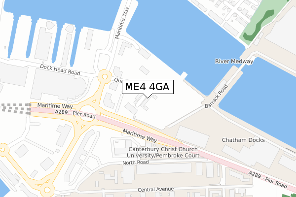
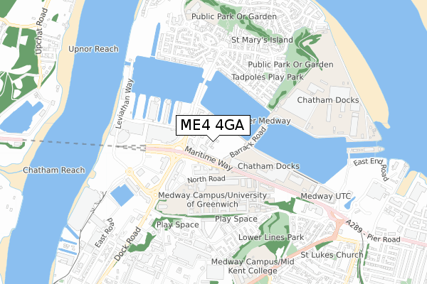
ME4 4GA is located in the St Mary's Island electoral ward, within the unitary authority of Medway and the English Parliamentary constituency of Rochester and Strood. The Sub Integrated Care Board (ICB) Location is NHS Kent and Medway ICB - 91Q and the police force is Kent. This postcode has been in use since January 2019.


GetTheData
Source: OS Open Zoomstack (Ordnance Survey)
Licence: Open Government Licence (requires attribution)
Attribution: Contains OS data © Crown copyright and database right 2024
Source: Open Postcode Geo
Licence: Open Government Licence (requires attribution)
Attribution: Contains OS data © Crown copyright and database right 2024; Contains Royal Mail data © Royal Mail copyright and database right 2024; Source: Office for National Statistics licensed under the Open Government Licence v.3.0
| Easting | 576723 |
| Northing | 169844 |
| Latitude | 51.400097 |
| Longitude | 0.539173 |
GetTheData
Source: Open Postcode Geo
Licence: Open Government Licence
| Country | England |
| Postcode District | ME4 |
| ➜ ME4 open data dashboard ➜ See where ME4 is on a map ➜ Where is Gillingham? | |
GetTheData
Source: Land Registry Price Paid Data
Licence: Open Government Licence
| Ward | St Mary's Island |
| Constituency | Rochester And Strood |
GetTheData
Source: ONS Postcode Database
Licence: Open Government Licence
17, STARBOARD CRESCENT, CHATHAM, ME4 4GA 2021 23 JUN £354,950 |
GetTheData
Source: HM Land Registry Price Paid Data
Licence: Contains HM Land Registry data © Crown copyright and database right 2024. This data is licensed under the Open Government Licence v3.0.
| June 2023 | Anti-social behaviour | On or near Park/Open Space | 398m |
| June 2022 | Violence and sexual offences | On or near Quayside | 131m |
| June 2022 | Vehicle crime | On or near Quayside | 131m |
| ➜ Get more crime data in our Crime section | |||
GetTheData
Source: data.police.uk
Licence: Open Government Licence
| Ship And Trades (Maritime Way) | Chatham Maritime | 213m |
| Ship And Trades (Maritime Way) | Chatham Maritime | 267m |
| Central Avenue | Chatham | 282m |
| Dockside Outlet (Dockhead Road) | Chatham Maritime | 309m |
| Pembroke (Central Avenue) | Chatham | 331m |
| Gillingham (Kent) Station | 1.7km |
| Chatham Station | 2.5km |
| Rochester Station | 2.6km |
GetTheData
Source: NaPTAN
Licence: Open Government Licence
| Percentage of properties with Next Generation Access | 0.0% |
| Percentage of properties with Superfast Broadband | 0.0% |
| Percentage of properties with Ultrafast Broadband | 0.0% |
| Percentage of properties with Full Fibre Broadband | 0.0% |
Superfast Broadband is between 30Mbps and 300Mbps
Ultrafast Broadband is > 300Mbps
| Percentage of properties unable to receive 2Mbps | 0.0% |
| Percentage of properties unable to receive 5Mbps | 0.0% |
| Percentage of properties unable to receive 10Mbps | 0.0% |
| Percentage of properties unable to receive 30Mbps | 100.0% |
GetTheData
Source: Ofcom
Licence: Ofcom Terms of Use (requires attribution)
GetTheData
Source: ONS Postcode Database
Licence: Open Government Licence


➜ Get more ratings from the Food Standards Agency
GetTheData
Source: Food Standards Agency
Licence: FSA terms & conditions
| Last Collection | |||
|---|---|---|---|
| Location | Mon-Fri | Sat | Distance |
| University Of Greenwich | 17:30 | 08:15 | 337m |
| Pembroke Gate | 17:30 | 11:30 | 382m |
| Dockhead Road | 17:30 | 11:00 | 407m |
GetTheData
Source: Dracos
Licence: Creative Commons Attribution-ShareAlike
| Facility | Distance |
|---|---|
| Medway Sports Hall Central Avenue, Chatham Sports Hall, Health and Fitness Gym, Outdoor Tennis Courts | 319m |
| Trugym (Chatham) Dock Head Road, Chatham Maritime, Chatham Health and Fitness Gym, Studio | 360m |
| Puregym (Chatham) Leviathan Way, Chatham Maritime, Chatham Health and Fitness Gym, Studio | 475m |
GetTheData
Source: Active Places
Licence: Open Government Licence
| School | Phase of Education | Distance |
|---|---|---|
| Waterfront UTC South Side Three Road, Chatham, ME4 4FQ | Secondary | 713m |
| MidKent College Medway Road, Gillingham, ME7 1FN | 16 plus | 744m |
| St Mary's Island Church of England (Aided) Primary School Island Way West, St Mary's Island, Chatham, ME4 3ST | Primary | 846m |
GetTheData
Source: Edubase
Licence: Open Government Licence
| Risk of ME4 4GA flooding from rivers and sea | Low |
| ➜ ME4 4GA flood map | |
GetTheData
Source: Open Flood Risk by Postcode
Licence: Open Government Licence
The below table lists the International Territorial Level (ITL) codes (formerly Nomenclature of Territorial Units for Statistics (NUTS) codes) and Local Administrative Units (LAU) codes for ME4 4GA:
| ITL 1 Code | Name |
|---|---|
| TLJ | South East (England) |
| ITL 2 Code | Name |
| TLJ4 | Kent |
| ITL 3 Code | Name |
| TLJ41 | Medway |
| LAU 1 Code | Name |
| E06000035 | Medway |
GetTheData
Source: ONS Postcode Directory
Licence: Open Government Licence
The below table lists the Census Output Area (OA), Lower Layer Super Output Area (LSOA), and Middle Layer Super Output Area (MSOA) for ME4 4GA:
| Code | Name | |
|---|---|---|
| OA | E00081433 | |
| LSOA | E01032798 | Medway 007E |
| MSOA | E02003320 | Medway 007 |
GetTheData
Source: ONS Postcode Directory
Licence: Open Government Licence
| ME4 3ER | Maritime Way | 329m |
| ME4 4ZL | Dock Head Road | 360m |
| ME4 4ZN | Dock Head Road | 360m |
| ME4 4ZS | Dock Head Road | 360m |
| ME4 4ZH | Chatham Quays | 385m |
| ME4 3HB | Watersmeet | 389m |
| ME4 4RN | Walter Burke Way | 391m |
| ME4 3HD | Watersmeet | 391m |
| ME4 4BF | Central Avenue | 412m |
| ME4 3SB | Sandling Way | 414m |
GetTheData
Source: Open Postcode Geo; Land Registry Price Paid Data
Licence: Open Government Licence