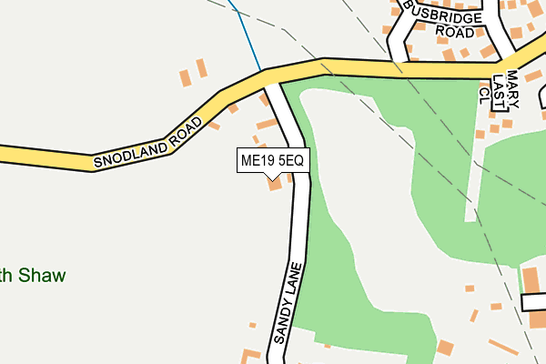
ME19 5EQ is located in the Birling, Leybourne & Ryarsh electoral ward, within the local authority district of Tonbridge and Malling and the English Parliamentary constituency of Tonbridge and Malling. The Sub Integrated Care Board (ICB) Location is NHS Kent and Medway ICB - 91Q and the police force is Kent. This postcode has been in use since January 1995.


GetTheData
Source: OS OpenMap – Local (Ordnance Survey)
Source: OS VectorMap District (Ordnance Survey)
Licence: Open Government Licence (requires attribution)
| Easting | 569200 |
| Northing | 161071 |
| Latitude | 51.323577 |
| Longitude | 0.426931 |
GetTheData
Source: Open Postcode Geo
Licence: Open Government Licence
| Country | England |
| Postcode District | ME19 |
➜ See where ME19 is on a map ➜ Where is Snodland? | |
GetTheData
Source: Land Registry Price Paid Data
Licence: Open Government Licence
Elevation or altitude of ME19 5EQ as distance above sea level:
| Metres | Feet | |
|---|---|---|
| Elevation | 20m | 66ft |
Elevation is measured from the approximate centre of the postcode, to the nearest point on an OS contour line from OS Terrain 50, which has contour spacing of ten vertical metres.
➜ How high above sea level am I? Find the elevation of your current position using your device's GPS.
GetTheData
Source: Open Postcode Elevation
Licence: Open Government Licence
| Ward | Birling, Leybourne & Ryarsh |
| Constituency | Tonbridge And Malling |
GetTheData
Source: ONS Postcode Database
Licence: Open Government Licence
| Gorham Close (Dryland Road) | Snodland | 600m |
| Gorham Close (Dryland Road) | Snodland | 627m |
| St Katherine's School (St Katherines Lane) | Snodland | 658m |
| Midsummer Road (St Benedict Road) | Snodland | 668m |
| St Katherine's School (St Katherine's Lane) | Snodland | 669m |
| Snodland Station | 1.7km |
| New Hythe Station | 2.3km |
| Halling Station | 3.5km |
GetTheData
Source: NaPTAN
Licence: Open Government Licence
GetTheData
Source: ONS Postcode Database
Licence: Open Government Licence


➜ Get more ratings from the Food Standards Agency
GetTheData
Source: Food Standards Agency
Licence: FSA terms & conditions
| Last Collection | |||
|---|---|---|---|
| Location | Mon-Fri | Sat | Distance |
| The Groves | 17:15 | 09:00 | 349m |
| Birling Village | 16:30 | 09:00 | 572m |
| Birling | 17:15 | 09:00 | 644m |
GetTheData
Source: Dracos
Licence: Creative Commons Attribution-ShareAlike
The below table lists the International Territorial Level (ITL) codes (formerly Nomenclature of Territorial Units for Statistics (NUTS) codes) and Local Administrative Units (LAU) codes for ME19 5EQ:
| ITL 1 Code | Name |
|---|---|
| TLJ | South East (England) |
| ITL 2 Code | Name |
| TLJ4 | Kent |
| ITL 3 Code | Name |
| TLJ46 | West Kent |
| LAU 1 Code | Name |
| E07000115 | Tonbridge and Malling |
GetTheData
Source: ONS Postcode Directory
Licence: Open Government Licence
The below table lists the Census Output Area (OA), Lower Layer Super Output Area (LSOA), and Middle Layer Super Output Area (MSOA) for ME19 5EQ:
| Code | Name | |
|---|---|---|
| OA | E00125570 | |
| LSOA | E01032829 | Tonbridge and Malling 014F |
| MSOA | E02006833 | Tonbridge and Malling 014 |
GetTheData
Source: ONS Postcode Directory
Licence: Open Government Licence
| ME6 5LH | Sandy Lane | 214m |
| ME6 5NS | Busbridge Road | 263m |
| ME6 5LU | St Benedict Road | 274m |
| ME6 5GA | Hamilton Close | 318m |
| ME6 5PY | Lucas Road | 326m |
| ME6 5LZ | Morhen Close | 331m |
| ME6 5QL | Edgeler Court | 331m |
| ME6 5LS | Hollow Lane | 345m |
| ME6 5PZ | Lucas Road | 389m |
| ME6 5LP | Hollow Lane | 396m |
GetTheData
Source: Open Postcode Geo; Land Registry Price Paid Data
Licence: Open Government Licence