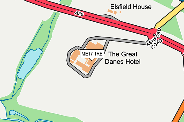
ME17 1RE is located in the Leeds electoral ward, within the local authority district of Maidstone and the English Parliamentary constituency of Faversham and Mid Kent. The Sub Integrated Care Board (ICB) Location is NHS Kent and Medway ICB - 91Q and the police force is Kent. This postcode has been in use since January 1980.


GetTheData
Source: OS OpenMap – Local (Ordnance Survey)
Source: OS VectorMap District (Ordnance Survey)
Licence: Open Government Licence (requires attribution)
| Easting | 582705 |
| Northing | 154245 |
| Latitude | 51.258089 |
| Longitude | 0.617052 |
GetTheData
Source: Open Postcode Geo
Licence: Open Government Licence
| Country | England |
| Postcode District | ME17 |
➜ See where ME17 is on a map | |
GetTheData
Source: Land Registry Price Paid Data
Licence: Open Government Licence
Elevation or altitude of ME17 1RE as distance above sea level:
| Metres | Feet | |
|---|---|---|
| Elevation | 50m | 164ft |
Elevation is measured from the approximate centre of the postcode, to the nearest point on an OS contour line from OS Terrain 50, which has contour spacing of ten vertical metres.
➜ How high above sea level am I? Find the elevation of your current position using your device's GPS.
GetTheData
Source: Open Postcode Elevation
Licence: Open Government Licence
| Ward | Leeds |
| Constituency | Faversham And Mid Kent |
GetTheData
Source: ONS Postcode Database
Licence: Open Government Licence
| Great Danes Hotel (Ashford Road) | Hollingbourne | 246m |
| Great Danes Hotel (Ashford Road) | Hollingbourne | 271m |
| Castle (Penfold Hill) | Leeds | 353m |
| Castle (Penfold Hill) | Leeds | 364m |
| Castle Grounds (Leeds Castle Grounds) | Leeds | 693m |
| Hollingbourne Station | 1.1km |
| Bearsted Station | 3.4km |
| Harrietsham Station | 4.1km |
GetTheData
Source: NaPTAN
Licence: Open Government Licence
GetTheData
Source: ONS Postcode Database
Licence: Open Government Licence


➜ Get more ratings from the Food Standards Agency
GetTheData
Source: Food Standards Agency
Licence: FSA terms & conditions
| Last Collection | |||
|---|---|---|---|
| Location | Mon-Fri | Sat | Distance |
| Hollingbourne Post Office | 17:30 | 12:15 | 648m |
| Roadchef | 18:00 | 09:00 | 1,022m |
| Lower Street | 16:15 | 09:00 | 1,100m |
GetTheData
Source: Dracos
Licence: Creative Commons Attribution-ShareAlike
The below table lists the International Territorial Level (ITL) codes (formerly Nomenclature of Territorial Units for Statistics (NUTS) codes) and Local Administrative Units (LAU) codes for ME17 1RE:
| ITL 1 Code | Name |
|---|---|
| TLJ | South East (England) |
| ITL 2 Code | Name |
| TLJ4 | Kent |
| ITL 3 Code | Name |
| TLJ45 | Mid Kent |
| LAU 1 Code | Name |
| E07000110 | Maidstone |
GetTheData
Source: ONS Postcode Directory
Licence: Open Government Licence
The below table lists the Census Output Area (OA), Lower Layer Super Output Area (LSOA), and Middle Layer Super Output Area (MSOA) for ME17 1RE:
| Code | Name | |
|---|---|---|
| OA | E00123743 | |
| LSOA | E01024375 | Maidstone 015C |
| MSOA | E02005082 | Maidstone 015 |
GetTheData
Source: ONS Postcode Directory
Licence: Open Government Licence
| ME17 1PA | Ashford Road | 173m |
| ME17 1PB | Elnothington Cottages | 334m |
| ME17 1TP | Eyhorne Street | 566m |
| ME17 1UU | Musket Lane | 624m |
| ME17 1PF | Ashford Road | 659m |
| ME17 1UX | Athelstan Green | 695m |
| ME17 1TT | Eyhorne Street | 733m |
| ME17 1TR | Eyhorne Street | 734m |
| ME17 1RJ | Lower Street | 797m |
| ME17 1XD | Old Mill Cottages | 816m |
GetTheData
Source: Open Postcode Geo; Land Registry Price Paid Data
Licence: Open Government Licence