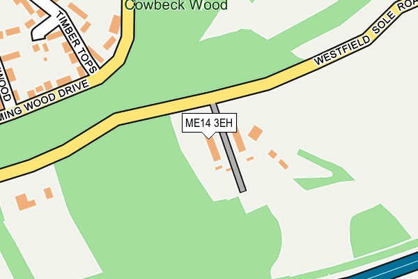
ME14 3EH lies on Westfield Sole Road in Boxley, Maidstone. ME14 3EH is located in the Boxley electoral ward, within the local authority district of Maidstone and the English Parliamentary constituency of Faversham and Mid Kent. The Sub Integrated Care Board (ICB) Location is NHS Kent and Medway ICB - 91Q and the police force is Kent. This postcode has been in use since January 1980.


GetTheData
Source: OS OpenMap – Local (Ordnance Survey)
Source: OS VectorMap District (Ordnance Survey)
Licence: Open Government Licence (requires attribution)
| Easting | 578038 |
| Northing | 161755 |
| Latitude | 51.327026 |
| Longitude | 0.554009 |
GetTheData
Source: Open Postcode Geo
Licence: Open Government Licence
| Street | Westfield Sole Road |
| Locality | Boxley |
| Town/City | Maidstone |
| Country | England |
| Postcode District | ME14 |
➜ See where ME14 is on a map ➜ Where is Chatham? | |
GetTheData
Source: Land Registry Price Paid Data
Licence: Open Government Licence
Elevation or altitude of ME14 3EH as distance above sea level:
| Metres | Feet | |
|---|---|---|
| Elevation | 160m | 525ft |
Elevation is measured from the approximate centre of the postcode, to the nearest point on an OS contour line from OS Terrain 50, which has contour spacing of ten vertical metres.
➜ How high above sea level am I? Find the elevation of your current position using your device's GPS.
GetTheData
Source: Open Postcode Elevation
Licence: Open Government Licence
| Ward | Boxley |
| Constituency | Faversham And Mid Kent |
GetTheData
Source: ONS Postcode Database
Licence: Open Government Licence
BRIGHTSIDES, WESTFIELD SOLE ROAD, BOXLEY, MAIDSTONE, ME14 3EH 2004 30 JAN £420,000 |
CHARLES DICKENS LODGE, WESTFIELD SOLE ROAD, BOXLEY, MAIDSTONE, ME14 3EH 2003 21 JUL £410,000 |
GetTheData
Source: HM Land Registry Price Paid Data
Licence: Contains HM Land Registry data © Crown copyright and database right 2025. This data is licensed under the Open Government Licence v3.0.
| Timber Tops (Gleaming Wood Drive) | Walderslade | 199m |
| Birch Drive (Gleaming Wood Drive) | Walderslade | 334m |
| Birch Drive (Gleaming Wood Drive) | Walderslade | 353m |
| Autumn Glade (Badger Road) | Walderslade | 428m |
| Golden Wood Close (Badger Road) | Walderslade | 541m |
| Rainham (Kent) Station | 5.9km |
GetTheData
Source: NaPTAN
Licence: Open Government Licence
| Percentage of properties with Next Generation Access | 100.0% |
| Percentage of properties with Superfast Broadband | 100.0% |
| Percentage of properties with Ultrafast Broadband | 0.0% |
| Percentage of properties with Full Fibre Broadband | 0.0% |
Superfast Broadband is between 30Mbps and 300Mbps
Ultrafast Broadband is > 300Mbps
| Median download speed | 36.9Mbps |
| Average download speed | 36.5Mbps |
| Maximum download speed | 62.28Mbps |
| Median upload speed | 7.1Mbps |
| Average upload speed | 8.9Mbps |
| Maximum upload speed | 20.00Mbps |
| Percentage of properties unable to receive 2Mbps | 0.0% |
| Percentage of properties unable to receive 5Mbps | 0.0% |
| Percentage of properties unable to receive 10Mbps | 0.0% |
| Percentage of properties unable to receive 30Mbps | 0.0% |
GetTheData
Source: Ofcom
Licence: Ofcom Terms of Use (requires attribution)
GetTheData
Source: ONS Postcode Database
Licence: Open Government Licence


➜ Get more ratings from the Food Standards Agency
GetTheData
Source: Food Standards Agency
Licence: FSA terms & conditions
| Last Collection | |||
|---|---|---|---|
| Location | Mon-Fri | Sat | Distance |
| Lidsing | 16:15 | 09:00 | 621m |
| Clandon Road | 16:00 | 10:45 | 724m |
| Revenge Road | 18:30 | 735m | |
GetTheData
Source: Dracos
Licence: Creative Commons Attribution-ShareAlike
The below table lists the International Territorial Level (ITL) codes (formerly Nomenclature of Territorial Units for Statistics (NUTS) codes) and Local Administrative Units (LAU) codes for ME14 3EH:
| ITL 1 Code | Name |
|---|---|
| TLJ | South East (England) |
| ITL 2 Code | Name |
| TLJ4 | Kent |
| ITL 3 Code | Name |
| TLJ45 | Mid Kent |
| LAU 1 Code | Name |
| E07000110 | Maidstone |
GetTheData
Source: ONS Postcode Directory
Licence: Open Government Licence
The below table lists the Census Output Area (OA), Lower Layer Super Output Area (LSOA), and Middle Layer Super Output Area (MSOA) for ME14 3EH:
| Code | Name | |
|---|---|---|
| OA | E00123540 | |
| LSOA | E01024333 | Maidstone 001A |
| MSOA | E02005068 | Maidstone 001 |
GetTheData
Source: ONS Postcode Directory
Licence: Open Government Licence
| ME5 8XX | Gleaming Wood Drive | 208m |
| ME5 8XY | Gleaming Wood Drive | 242m |
| ME5 8XF | Timbertops | 248m |
| ME5 8XU | Pinewood Drive | 318m |
| ME5 8XQ | Timbertops | 330m |
| ME5 8XT | Gleaming Wood Drive | 339m |
| ME5 8YU | Birch Drive | 352m |
| ME5 8XS | Badger Road | 374m |
| ME5 8XP | Autumn Glade | 398m |
| ME5 8XW | Dogwood Close | 407m |
GetTheData
Source: Open Postcode Geo; Land Registry Price Paid Data
Licence: Open Government Licence