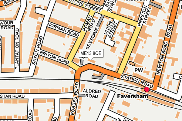
ME13 8QE is located in the St Ann's electoral ward, within the local authority district of Swale and the English Parliamentary constituency of Faversham and Mid Kent. The Sub Integrated Care Board (ICB) Location is NHS Kent and Medway ICB - 91Q and the police force is Kent. This postcode has been in use since January 1980.


GetTheData
Source: OS OpenMap – Local (Ordnance Survey)
Source: OS VectorMap District (Ordnance Survey)
Licence: Open Government Licence (requires attribution)
| Easting | 601406 |
| Northing | 161015 |
| Latitude | 51.312596 |
| Longitude | 0.888562 |
GetTheData
Source: Open Postcode Geo
Licence: Open Government Licence
| Country | England |
| Postcode District | ME13 |
➜ See where ME13 is on a map ➜ Where is Faversham? | |
GetTheData
Source: Land Registry Price Paid Data
Licence: Open Government Licence
Elevation or altitude of ME13 8QE as distance above sea level:
| Metres | Feet | |
|---|---|---|
| Elevation | 10m | 33ft |
Elevation is measured from the approximate centre of the postcode, to the nearest point on an OS contour line from OS Terrain 50, which has contour spacing of ten vertical metres.
➜ How high above sea level am I? Find the elevation of your current position using your device's GPS.
GetTheData
Source: Open Postcode Elevation
Licence: Open Government Licence
| Ward | St Ann's |
| Constituency | Faversham And Mid Kent |
GetTheData
Source: ONS Postcode Database
Licence: Open Government Licence
| Railway Station (Forbes Road) | Faversham | 56m |
| Preston Street (Stone Street) | Faversham | 167m |
| Railway Station (Station Road) | Faversham | 169m |
| Railway Station (Preston Lane) | Faversham | 183m |
| Saxon Road (Stone Street) | Faversham | 253m |
| Faversham Station | 0.2km |
| Selling Station | 5.4km |
GetTheData
Source: NaPTAN
Licence: Open Government Licence
GetTheData
Source: ONS Postcode Database
Licence: Open Government Licence


➜ Get more ratings from the Food Standards Agency
GetTheData
Source: Food Standards Agency
Licence: FSA terms & conditions
| Last Collection | |||
|---|---|---|---|
| Location | Mon-Fri | Sat | Distance |
| Railway Station | 17:30 | 10:30 | 185m |
| Saxon Road | 17:30 | 12:00 | 205m |
| Athelstan Road | 17:30 | 12:00 | 251m |
GetTheData
Source: Dracos
Licence: Creative Commons Attribution-ShareAlike
The below table lists the International Territorial Level (ITL) codes (formerly Nomenclature of Territorial Units for Statistics (NUTS) codes) and Local Administrative Units (LAU) codes for ME13 8QE:
| ITL 1 Code | Name |
|---|---|
| TLJ | South East (England) |
| ITL 2 Code | Name |
| TLJ4 | Kent |
| ITL 3 Code | Name |
| TLJ43 | Kent Thames Gateway |
| LAU 1 Code | Name |
| E07000113 | Swale |
GetTheData
Source: ONS Postcode Directory
Licence: Open Government Licence
The below table lists the Census Output Area (OA), Lower Layer Super Output Area (LSOA), and Middle Layer Super Output Area (MSOA) for ME13 8QE:
| Code | Name | |
|---|---|---|
| OA | E00124627 | |
| LSOA | E01024553 | Swale 015C |
| MSOA | E02005129 | Swale 015 |
GetTheData
Source: ONS Postcode Directory
Licence: Open Government Licence
| ME13 8PL | Victoria Place | 75m |
| ME13 8PZ | Roman Road | 77m |
| ME13 8PP | Dorset Place | 96m |
| ME13 8PJ | Union Street | 117m |
| ME13 8QH | Briton Road | 118m |
| ME13 8PQ | Limes Place | 118m |
| ME13 8PG | Preston Street | 142m |
| ME13 8PX | Norman Road | 153m |
| ME13 8PE | Preston Street | 155m |
| ME13 8QG | Forbes Road | 156m |
GetTheData
Source: Open Postcode Geo; Land Registry Price Paid Data
Licence: Open Government Licence