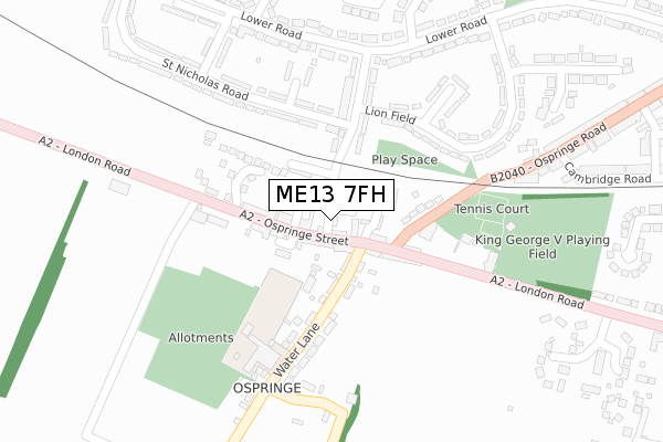
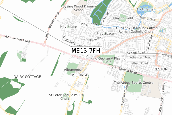
ME13 7FH is located in the Watling electoral ward, within the local authority district of Swale and the English Parliamentary constituency of Faversham and Mid Kent. The Sub Integrated Care Board (ICB) Location is NHS Kent and Medway ICB - 91Q and the police force is Kent. This postcode has been in use since August 2017.


GetTheData
Source: OS Open Zoomstack (Ordnance Survey)
Licence: Open Government Licence (requires attribution)
Attribution: Contains OS data © Crown copyright and database right 2024
Source: Open Postcode Geo
Licence: Open Government Licence (requires attribution)
Attribution: Contains OS data © Crown copyright and database right 2024; Contains Royal Mail data © Royal Mail copyright and database right 2024; Source: Office for National Statistics licensed under the Open Government Licence v.3.0
| Easting | 600325 |
| Northing | 160895 |
| Latitude | 51.311899 |
| Longitude | 0.873005 |
GetTheData
Source: Open Postcode Geo
Licence: Open Government Licence
| Country | England |
| Postcode District | ME13 |
| ➜ ME13 open data dashboard ➜ See where ME13 is on a map ➜ Where is Faversham? | |
GetTheData
Source: Land Registry Price Paid Data
Licence: Open Government Licence
| Ward | Watling |
| Constituency | Faversham And Mid Kent |
GetTheData
Source: ONS Postcode Database
Licence: Open Government Licence
| January 2024 | Other crime | On or near Parking Area | 143m |
| November 2023 | Public order | On or near Wheler Court | 431m |
| October 2023 | Robbery | On or near Wheler Court | 431m |
| ➜ Get more crime data in our Crime section | |||
GetTheData
Source: data.police.uk
Licence: Open Government Licence
| The Street (Ospringe Street) | Ospringe | 129m |
| The Street (Ospringe Street) | Ospringe | 134m |
| Wallers Road (Lower Road) | Faversham | 268m |
| Wallers Road (Lower Road) | Faversham | 270m |
| Willow Avenue (Lower Road) | Faversham | 332m |
| Faversham Station | 1.3km |
| Teynham Station | 5.2km |
| Selling Station | 6.1km |
GetTheData
Source: NaPTAN
Licence: Open Government Licence
| Percentage of properties with Next Generation Access | 100.0% |
| Percentage of properties with Superfast Broadband | 100.0% |
| Percentage of properties with Ultrafast Broadband | 0.0% |
| Percentage of properties with Full Fibre Broadband | 0.0% |
Superfast Broadband is between 30Mbps and 300Mbps
Ultrafast Broadband is > 300Mbps
| Percentage of properties unable to receive 2Mbps | 0.0% |
| Percentage of properties unable to receive 5Mbps | 0.0% |
| Percentage of properties unable to receive 10Mbps | 0.0% |
| Percentage of properties unable to receive 30Mbps | 0.0% |
GetTheData
Source: Ofcom
Licence: Ofcom Terms of Use (requires attribution)
GetTheData
Source: ONS Postcode Database
Licence: Open Government Licence


➜ Get more ratings from the Food Standards Agency
GetTheData
Source: Food Standards Agency
Licence: FSA terms & conditions
| Last Collection | |||
|---|---|---|---|
| Location | Mon-Fri | Sat | Distance |
| Ospringe Post Office | 17:15 | 12:00 | 39m |
| Lower Road | 17:15 | 10:30 | 322m |
| Hazebrock Road | 17:30 | 10:45 | 509m |
GetTheData
Source: Dracos
Licence: Creative Commons Attribution-ShareAlike
| Facility | Distance |
|---|---|
| King Georges Playing Field (Faversham) The Mount, London Road, Faversham Grass Pitches, Artificial Grass Pitch | 325m |
| Bysing Wood Primary School Lower Road, Faversham Grass Pitches | 745m |
| Davington Priory Cricket Club Greenway, Faversham Grass Pitches | 841m |
GetTheData
Source: Active Places
Licence: Open Government Licence
| School | Phase of Education | Distance |
|---|---|---|
| Ospringe Church of England Primary School Water Lane, Ospringe, Faversham, ME13 8TX | Primary | 229m |
| Bysing Wood Primary School Lower Road, Faversham, ME13 7NU | Primary | 745m |
| Ethelbert Road Primary School Ethelbert Road, Faversham, ME13 8SQ | Primary | 755m |
GetTheData
Source: Edubase
Licence: Open Government Licence
| Risk of ME13 7FH flooding from rivers and sea | Medium |
| ➜ ME13 7FH flood map | |
GetTheData
Source: Open Flood Risk by Postcode
Licence: Open Government Licence
The below table lists the International Territorial Level (ITL) codes (formerly Nomenclature of Territorial Units for Statistics (NUTS) codes) and Local Administrative Units (LAU) codes for ME13 7FH:
| ITL 1 Code | Name |
|---|---|
| TLJ | South East (England) |
| ITL 2 Code | Name |
| TLJ4 | Kent |
| ITL 3 Code | Name |
| TLJ43 | Kent Thames Gateway |
| LAU 1 Code | Name |
| E07000113 | Swale |
GetTheData
Source: ONS Postcode Directory
Licence: Open Government Licence
The below table lists the Census Output Area (OA), Lower Layer Super Output Area (LSOA), and Middle Layer Super Output Area (MSOA) for ME13 7FH:
| Code | Name | |
|---|---|---|
| OA | E00124981 | |
| LSOA | E01024627 | Swale 014F |
| MSOA | E02005128 | Swale 014 |
GetTheData
Source: ONS Postcode Directory
Licence: Open Government Licence
| ME13 7NP | Grove Place | 45m |
| ME13 7PH | Grove Place | 54m |
| ME13 8TL | Ospringe Street | 62m |
| ME13 8TW | Ospringe Street | 74m |
| ME13 8TN | Ospringe Street | 79m |
| ME13 8TS | Water Lane | 82m |
| ME13 8TR | William Hall Terrace | 84m |
| ME13 7PJ | Lindfield Cottages | 89m |
| ME13 8TJ | Ospringe Street | 102m |
| ME13 7PW | Wallers Road | 133m |
GetTheData
Source: Open Postcode Geo; Land Registry Price Paid Data
Licence: Open Government Licence