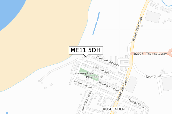
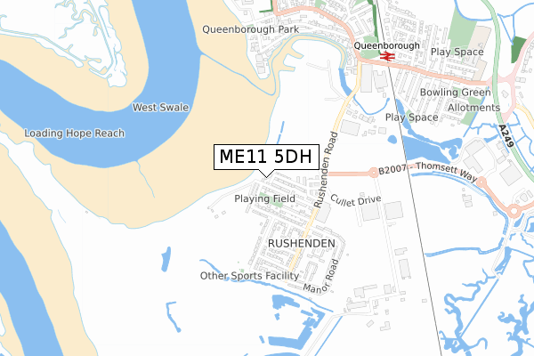
ME11 5DH is located in the Queenborough and Halfway electoral ward, within the local authority district of Swale and the English Parliamentary constituency of Sittingbourne and Sheppey. The Sub Integrated Care Board (ICB) Location is NHS Kent and Medway ICB - 91Q and the police force is Kent. This postcode has been in use since March 2019.


GetTheData
Source: OS Open Zoomstack (Ordnance Survey)
Licence: Open Government Licence (requires attribution)
Attribution: Contains OS data © Crown copyright and database right 2024
Source: Open Postcode Geo
Licence: Open Government Licence (requires attribution)
Attribution: Contains OS data © Crown copyright and database right 2024; Contains Royal Mail data © Royal Mail copyright and database right 2024; Source: Office for National Statistics licensed under the Open Government Licence v.3.0
| Easting | 590746 |
| Northing | 171548 |
| Latitude | 51.410867 |
| Longitude | 0.741442 |
GetTheData
Source: Open Postcode Geo
Licence: Open Government Licence
| Country | England |
| Postcode District | ME11 |
| ➜ ME11 open data dashboard ➜ See where ME11 is on a map ➜ Where is Queenborough? | |
GetTheData
Source: Land Registry Price Paid Data
Licence: Open Government Licence
| Ward | Queenborough And Halfway |
| Constituency | Sittingbourne And Sheppey |
GetTheData
Source: ONS Postcode Database
Licence: Open Government Licence
2021 10 SEP £310,000 |
2019 22 MAR £265,000 |
3, FRANCES ROW, QUEENBOROUGH, ME11 5DH 2019 22 MAR £267,500 |
1, FRANCES ROW, QUEENBOROUGH, ME11 5DH 2019 22 MAR £269,500 |
GetTheData
Source: HM Land Registry Price Paid Data
Licence: Contains HM Land Registry data © Crown copyright and database right 2024. This data is licensed under the Open Government Licence v3.0.
| June 2022 | Criminal damage and arson | On or near Sports/Recreation Area | 108m |
| June 2022 | Vehicle crime | On or near First Avenue | 118m |
| June 2022 | Other theft | On or near Swale Avenue | 203m |
| ➜ Get more crime data in our Crime section | |||
GetTheData
Source: data.police.uk
Licence: Open Government Licence
| First Avenue (Rushenden Road) | Rushenden | 273m |
| Cullet Drive (Rushenden Road) | Rushenden | 275m |
| First Avenue (Rushenden Road) | Rushenden | 282m |
| Rolling Mill (Rushenden Road) | Queenborough | 373m |
| Hillside Avenue | Rushenden | 402m |
| Queenborough Station | 0.8km |
| Swale Station | 2.4km |
| Sheerness-on-Sea Station | 3.6km |
GetTheData
Source: NaPTAN
Licence: Open Government Licence
| Percentage of properties with Next Generation Access | 100.0% |
| Percentage of properties with Superfast Broadband | 100.0% |
| Percentage of properties with Ultrafast Broadband | 100.0% |
| Percentage of properties with Full Fibre Broadband | 100.0% |
Superfast Broadband is between 30Mbps and 300Mbps
Ultrafast Broadband is > 300Mbps
| Percentage of properties unable to receive 2Mbps | 0.0% |
| Percentage of properties unable to receive 5Mbps | 0.0% |
| Percentage of properties unable to receive 10Mbps | 0.0% |
| Percentage of properties unable to receive 30Mbps | 0.0% |
GetTheData
Source: Ofcom
Licence: Ofcom Terms of Use (requires attribution)
GetTheData
Source: ONS Postcode Database
Licence: Open Government Licence


➜ Get more ratings from the Food Standards Agency
GetTheData
Source: Food Standards Agency
Licence: FSA terms & conditions
| Last Collection | |||
|---|---|---|---|
| Location | Mon-Fri | Sat | Distance |
| Rushenden | 17:00 | 08:00 | 358m |
| Queenborough | 18:30 | 11:30 | 835m |
| Railway Terrace | 17:00 | 11:30 | 838m |
GetTheData
Source: Dracos
Licence: Creative Commons Attribution-ShareAlike
| Facility | Distance |
|---|---|
| Snap Fitness (Neats Court) Thomsett Way, Thomsett Way, Queenborough Health and Fitness Gym | 1km |
| King George V Playing Field (Queenborough) Castlemere Avenue, Queenborough Grass Pitches | 1.1km |
| Holm Park Queenborough Road, Minster On Sea, Sheerness Grass Pitches | 2.1km |
GetTheData
Source: Active Places
Licence: Open Government Licence
| School | Phase of Education | Distance |
|---|---|---|
| Queenborough School and Nursery Edward Road, Queenborough, ME11 5DF | Primary | 1.1km |
| West Minster Primary School St George's Avenue, Sheerness, ME12 1ET | Primary | 2.4km |
| Halfway Houses Primary School Danley Road, Minster-on-Sea, Sheerness, ME12 3AP | Primary | 3km |
GetTheData
Source: Edubase
Licence: Open Government Licence
| Risk of ME11 5DH flooding from rivers and sea | Low |
| ➜ ME11 5DH flood map | |
GetTheData
Source: Open Flood Risk by Postcode
Licence: Open Government Licence
The below table lists the International Territorial Level (ITL) codes (formerly Nomenclature of Territorial Units for Statistics (NUTS) codes) and Local Administrative Units (LAU) codes for ME11 5DH:
| ITL 1 Code | Name |
|---|---|
| TLJ | South East (England) |
| ITL 2 Code | Name |
| TLJ4 | Kent |
| ITL 3 Code | Name |
| TLJ43 | Kent Thames Gateway |
| LAU 1 Code | Name |
| E07000113 | Swale |
GetTheData
Source: ONS Postcode Directory
Licence: Open Government Licence
The below table lists the Census Output Area (OA), Lower Layer Super Output Area (LSOA), and Middle Layer Super Output Area (MSOA) for ME11 5DH:
| Code | Name | |
|---|---|---|
| OA | E00124839 | |
| LSOA | E01024597 | Swale 005C |
| MSOA | E02005119 | Swale 005 |
GetTheData
Source: ONS Postcode Directory
Licence: Open Government Licence
| ME11 5JQ | First Avenue | 48m |
| ME11 5JL | Seaview Villas | 52m |
| ME11 5JN | Alsager Avenue | 78m |
| ME11 5JX | Swale Avenue | 145m |
| ME11 5JF | First Avenue | 146m |
| ME11 5LB | Well Road | 154m |
| ME11 5JT | Second Avenue | 205m |
| ME11 5LE | Hillside Avenue | 222m |
| ME11 5JU | Swale Avenue | 250m |
| ME11 5JE | Rushenden Road | 272m |
GetTheData
Source: Open Postcode Geo; Land Registry Price Paid Data
Licence: Open Government Licence