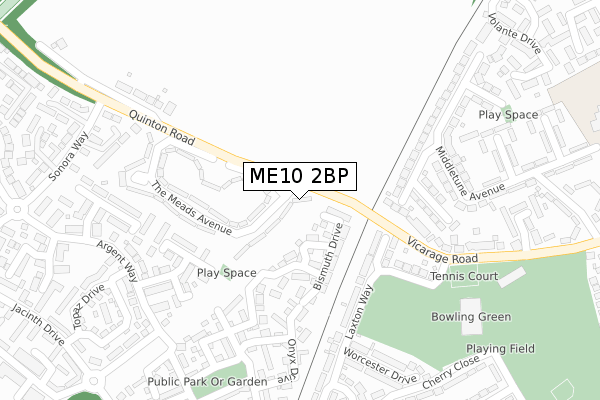
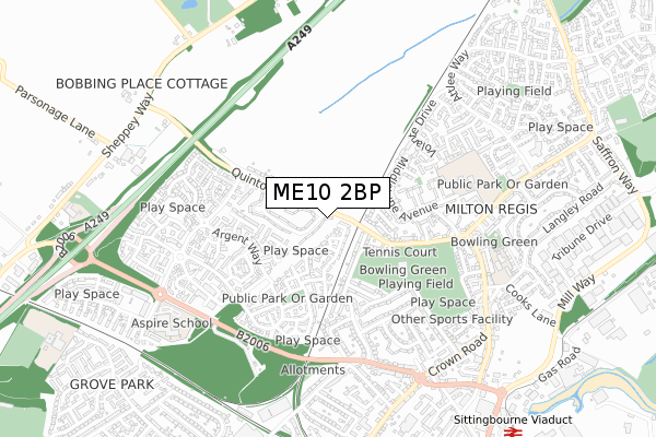
ME10 2BP lies on Quinton Road in Sittingbourne. ME10 2BP is located in the The Meads electoral ward, within the local authority district of Swale and the English Parliamentary constituency of Sittingbourne and Sheppey. The Sub Integrated Care Board (ICB) Location is NHS Kent and Medway ICB - 91Q and the police force is Kent. This postcode has been in use since January 1980.


GetTheData
Source: OS Open Zoomstack (Ordnance Survey)
Licence: Open Government Licence (requires attribution)
Attribution: Contains OS data © Crown copyright and database right 2025
Source: Open Postcode Geo
Licence: Open Government Licence (requires attribution)
Attribution: Contains OS data © Crown copyright and database right 2025; Contains Royal Mail data © Royal Mail copyright and database right 2025; Source: Office for National Statistics licensed under the Open Government Licence v.3.0
| Easting | 589770 |
| Northing | 165036 |
| Latitude | 51.352705 |
| Longitude | 0.723949 |
GetTheData
Source: Open Postcode Geo
Licence: Open Government Licence
| Street | Quinton Road |
| Town/City | Sittingbourne |
| Country | England |
| Postcode District | ME10 |
➜ See where ME10 is on a map ➜ Where is Sittingbourne? | |
GetTheData
Source: Land Registry Price Paid Data
Licence: Open Government Licence
Elevation or altitude of ME10 2BP as distance above sea level:
| Metres | Feet | |
|---|---|---|
| Elevation | 10m | 33ft |
Elevation is measured from the approximate centre of the postcode, to the nearest point on an OS contour line from OS Terrain 50, which has contour spacing of ten vertical metres.
➜ How high above sea level am I? Find the elevation of your current position using your device's GPS.
GetTheData
Source: Open Postcode Elevation
Licence: Open Government Licence
| Ward | The Meads |
| Constituency | Sittingbourne And Sheppey |
GetTheData
Source: ONS Postcode Database
Licence: Open Government Licence
| Quinton Road Phone Box (Quinton Road) | Sonora Fields | 39m |
| Quinton Road Phone Box (Quinton Road) | Sonora Fields | 45m |
| Laxton Way (Vicarage Road) | Milton Regis | 233m |
| Laxton Way (Vicarage Road) | Milton Regis | 277m |
| Quinton Stores (Quinton Road) | Sonora Fields | 283m |
| Kemsley Station | 1.3km |
| Sittingbourne Station | 1.4km |
| Newington Station | 3.9km |
GetTheData
Source: NaPTAN
Licence: Open Government Licence
| Percentage of properties with Next Generation Access | 100.0% |
| Percentage of properties with Superfast Broadband | 100.0% |
| Percentage of properties with Ultrafast Broadband | 100.0% |
| Percentage of properties with Full Fibre Broadband | 0.0% |
Superfast Broadband is between 30Mbps and 300Mbps
Ultrafast Broadband is > 300Mbps
| Percentage of properties unable to receive 2Mbps | 0.0% |
| Percentage of properties unable to receive 5Mbps | 0.0% |
| Percentage of properties unable to receive 10Mbps | 0.0% |
| Percentage of properties unable to receive 30Mbps | 0.0% |
GetTheData
Source: Ofcom
Licence: Ofcom Terms of Use (requires attribution)
GetTheData
Source: ONS Postcode Database
Licence: Open Government Licence


➜ Get more ratings from the Food Standards Agency
GetTheData
Source: Food Standards Agency
Licence: FSA terms & conditions
| Last Collection | |||
|---|---|---|---|
| Location | Mon-Fri | Sat | Distance |
| Staplehurst Road | 17:30 | 09:00 | 202m |
| Quinton Road | 17:15 | 11:45 | 261m |
| Windmill Road | 17:30 | 11:45 | 438m |
GetTheData
Source: Dracos
Licence: Creative Commons Attribution-ShareAlike
The below table lists the International Territorial Level (ITL) codes (formerly Nomenclature of Territorial Units for Statistics (NUTS) codes) and Local Administrative Units (LAU) codes for ME10 2BP:
| ITL 1 Code | Name |
|---|---|
| TLJ | South East (England) |
| ITL 2 Code | Name |
| TLJ4 | Kent |
| ITL 3 Code | Name |
| TLJ43 | Kent Thames Gateway |
| LAU 1 Code | Name |
| E07000113 | Swale |
GetTheData
Source: ONS Postcode Directory
Licence: Open Government Licence
The below table lists the Census Output Area (OA), Lower Layer Super Output Area (LSOA), and Middle Layer Super Output Area (MSOA) for ME10 2BP:
| Code | Name | |
|---|---|---|
| OA | E00166895 | |
| LSOA | E01024567 | Swale 009C |
| MSOA | E02005123 | Swale 009 |
GetTheData
Source: ONS Postcode Directory
Licence: Open Government Licence
| ME10 5LD | Trona Court | 84m |
| ME10 5JU | Bismuth Drive | 90m |
| ME10 5JT | Bismuth Drive | 135m |
| ME10 2QJ | Pippin Close | 147m |
| ME10 2JG | Roberts Close | 193m |
| ME10 2DB | Quinton Road | 201m |
| ME10 2BT | Meads Avenue | 213m |
| ME10 5JY | Raite Green | 216m |
| ME10 2QL | Laxton Way | 219m |
| ME10 2QH | Laxton Way | 223m |
GetTheData
Source: Open Postcode Geo; Land Registry Price Paid Data
Licence: Open Government Licence