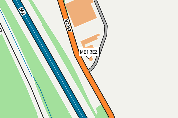
ME1 3EZ is located in the Aylesford North & North Downs electoral ward, within the local authority district of Tonbridge and Malling and the English Parliamentary constituency of Chatham and Aylesford. The Sub Integrated Care Board (ICB) Location is NHS Kent and Medway ICB - 91Q and the police force is Kent. This postcode has been in use since November 2008.


GetTheData
Source: OS OpenMap – Local (Ordnance Survey)
Source: OS VectorMap District (Ordnance Survey)
Licence: Open Government Licence (requires attribution)
| Easting | 574281 |
| Northing | 164189 |
| Latitude | 51.350053 |
| Longitude | 0.501303 |
GetTheData
Source: Open Postcode Geo
Licence: Open Government Licence
| Country | England |
| Postcode District | ME1 |
➜ See where ME1 is on a map ➜ Where is Rochester? | |
GetTheData
Source: Land Registry Price Paid Data
Licence: Open Government Licence
Elevation or altitude of ME1 3EZ as distance above sea level:
| Metres | Feet | |
|---|---|---|
| Elevation | 120m | 394ft |
Elevation is measured from the approximate centre of the postcode, to the nearest point on an OS contour line from OS Terrain 50, which has contour spacing of ten vertical metres.
➜ How high above sea level am I? Find the elevation of your current position using your device's GPS.
GetTheData
Source: Open Postcode Elevation
Licence: Open Government Licence
| Ward | Aylesford North & North Downs |
| Constituency | Chatham And Aylesford |
GetTheData
Source: ONS Postcode Database
Licence: Open Government Licence
| Rochester Airport Industrial Estate (Laker Road) | Warren Wood | 402m |
| Rochester Airport Industrial Estate (Laker Road) | Warren Wood | 423m |
| Watson Avenue (Maidstone Road) | Davis Estate | 483m |
| Medway Gurdwara (Lankester Parker Road) | Warren Wood | 519m |
| Watson Avenue (Maidstone Road) | Davis Estate | 524m |
| Chatham Station | 3.6km |
| Cuxton Station | 3.8km |
| Halling Station | 3.9km |
GetTheData
Source: NaPTAN
Licence: Open Government Licence
GetTheData
Source: ONS Postcode Database
Licence: Open Government Licence


➜ Get more ratings from the Food Standards Agency
GetTheData
Source: Food Standards Agency
Licence: FSA terms & conditions
| Last Collection | |||
|---|---|---|---|
| Location | Mon-Fri | Sat | Distance |
| Laker Road | 17:00 | 09:00 | 421m |
| Davis Estate Post Office | 17:30 | 11:30 | 602m |
| King George Road | 17:30 | 11:30 | 1,106m |
GetTheData
Source: Dracos
Licence: Creative Commons Attribution-ShareAlike
The below table lists the International Territorial Level (ITL) codes (formerly Nomenclature of Territorial Units for Statistics (NUTS) codes) and Local Administrative Units (LAU) codes for ME1 3EZ:
| ITL 1 Code | Name |
|---|---|
| TLJ | South East (England) |
| ITL 2 Code | Name |
| TLJ4 | Kent |
| ITL 3 Code | Name |
| TLJ46 | West Kent |
| LAU 1 Code | Name |
| E07000115 | Tonbridge and Malling |
GetTheData
Source: ONS Postcode Directory
Licence: Open Government Licence
The below table lists the Census Output Area (OA), Lower Layer Super Output Area (LSOA), and Middle Layer Super Output Area (MSOA) for ME1 3EZ:
| Code | Name | |
|---|---|---|
| OA | E00167605 | |
| LSOA | E01024727 | Tonbridge and Malling 001E |
| MSOA | E02005149 | Tonbridge and Malling 001 |
GetTheData
Source: ONS Postcode Directory
Licence: Open Government Licence
| ME1 3QX | Rochester Airport Industrial Estate | 447m |
| ME5 9UN | Highview Drive | 512m |
| ME5 9SH | Watson Avenue | 574m |
| ME5 9SE | Maidstone Road | 585m |
| ME5 9UR | Shirley Avenue | 586m |
| ME5 9UT | Binland Grove | 588m |
| ME5 9UU | Binland Grove | 601m |
| ME5 9UP | Shirley Avenue | 613m |
| ME5 9UJ | Highview Drive | 631m |
| ME5 9SB | Rochester Road | 632m |
GetTheData
Source: Open Postcode Geo; Land Registry Price Paid Data
Licence: Open Government Licence