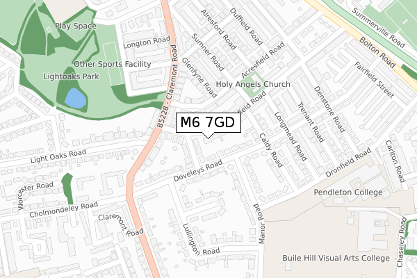
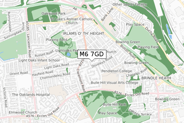
M6 7GD lies on Moorfield Road in Salford. M6 7GD is located in the Claremont electoral ward, within the metropolitan district of Salford and the English Parliamentary constituency of Salford and Eccles. The Sub Integrated Care Board (ICB) Location is NHS Greater Manchester ICB - 01G and the police force is Greater Manchester. This postcode has been in use since January 1980.


GetTheData
Source: OS Open Zoomstack (Ordnance Survey)
Licence: Open Government Licence (requires attribution)
Attribution: Contains OS data © Crown copyright and database right 2025
Source: Open Postcode Geo
Licence: Open Government Licence (requires attribution)
Attribution: Contains OS data © Crown copyright and database right 2025; Contains Royal Mail data © Royal Mail copyright and database right 2025; Source: Office for National Statistics licensed under the Open Government Licence v.3.0
| Easting | 379618 |
| Northing | 399952 |
| Latitude | 53.495871 |
| Longitude | -2.308700 |
GetTheData
Source: Open Postcode Geo
Licence: Open Government Licence
| Street | Moorfield Road |
| Town/City | Salford |
| Country | England |
| Postcode District | M6 |
➜ See where M6 is on a map ➜ Where is Salford? | |
GetTheData
Source: Land Registry Price Paid Data
Licence: Open Government Licence
Elevation or altitude of M6 7GD as distance above sea level:
| Metres | Feet | |
|---|---|---|
| Elevation | 70m | 230ft |
Elevation is measured from the approximate centre of the postcode, to the nearest point on an OS contour line from OS Terrain 50, which has contour spacing of ten vertical metres.
➜ How high above sea level am I? Find the elevation of your current position using your device's GPS.
GetTheData
Source: Open Postcode Elevation
Licence: Open Government Licence
| Ward | Claremont |
| Constituency | Salford And Eccles |
GetTheData
Source: ONS Postcode Database
Licence: Open Government Licence
| Doveleys Rd (Nebd) (Doveleys Road) | Irlams O' Th' Height | 67m |
| Claremont Rd (Sbnd) (Claremont Rd) | Irlams O' Th' Height | 191m |
| Claremont Rd (Nbnd) (Claremont Rd) | Irlams O' Th' Height | 208m |
| Claremont Rd/Cholmondley Rd (Claremont Rd) | Irlams O' Th' Height | 253m |
| Claremont Rd/Eccles Old Rd (Claremont Rd) | Pendleton | 360m |
| Weaste (Manchester Metrolink) (Eccles New Road) | Weaste | 1,488m |
| Ladywell (Manchester Metrolink) (Eccles New Road) | Ladywell | 1,869m |
| Eccles Station | 2.1km |
| Salford Crescent Station | 2.4km |
| Swinton (Manchester) Station | 2.8km |
GetTheData
Source: NaPTAN
Licence: Open Government Licence
| Percentage of properties with Next Generation Access | 100.0% |
| Percentage of properties with Superfast Broadband | 100.0% |
| Percentage of properties with Ultrafast Broadband | 100.0% |
| Percentage of properties with Full Fibre Broadband | 0.0% |
Superfast Broadband is between 30Mbps and 300Mbps
Ultrafast Broadband is > 300Mbps
| Median download speed | 70.0Mbps |
| Average download speed | 97.9Mbps |
| Maximum download speed | 350.00Mbps |
| Median upload speed | 4.4Mbps |
| Average upload speed | 6.4Mbps |
| Maximum upload speed | 19.53Mbps |
| Percentage of properties unable to receive 2Mbps | 0.0% |
| Percentage of properties unable to receive 5Mbps | 0.0% |
| Percentage of properties unable to receive 10Mbps | 0.0% |
| Percentage of properties unable to receive 30Mbps | 0.0% |
GetTheData
Source: Ofcom
Licence: Ofcom Terms of Use (requires attribution)
Estimated total energy consumption in M6 7GD by fuel type, 2015.
| Consumption (kWh) | 409,827 |
|---|---|
| Meter count | 19 |
| Mean (kWh/meter) | 21,570 |
| Median (kWh/meter) | 21,075 |
| Consumption (kWh) | 76,565 |
|---|---|
| Meter count | 17 |
| Mean (kWh/meter) | 4,504 |
| Median (kWh/meter) | 4,233 |
GetTheData
Source: Postcode level gas estimates: 2015 (experimental)
Source: Postcode level electricity estimates: 2015 (experimental)
Licence: Open Government Licence
GetTheData
Source: ONS Postcode Database
Licence: Open Government Licence


➜ Get more ratings from the Food Standards Agency
GetTheData
Source: Food Standards Agency
Licence: FSA terms & conditions
| Last Collection | |||
|---|---|---|---|
| Location | Mon-Fri | Sat | Distance |
| Cromwell Bridge P.o. | 17:30 | 12:00 | 980m |
| Stott Lane / Eccles New Road | 17:30 | 11:45 | 1,142m |
| Gilda Brook P.o. | 17:30 | 12:00 | 1,320m |
GetTheData
Source: Dracos
Licence: Creative Commons Attribution-ShareAlike
The below table lists the International Territorial Level (ITL) codes (formerly Nomenclature of Territorial Units for Statistics (NUTS) codes) and Local Administrative Units (LAU) codes for M6 7GD:
| ITL 1 Code | Name |
|---|---|
| TLD | North West (England) |
| ITL 2 Code | Name |
| TLD3 | Greater Manchester |
| ITL 3 Code | Name |
| TLD34 | Greater Manchester South West |
| LAU 1 Code | Name |
| E08000006 | Salford |
GetTheData
Source: ONS Postcode Directory
Licence: Open Government Licence
The below table lists the Census Output Area (OA), Lower Layer Super Output Area (LSOA), and Middle Layer Super Output Area (MSOA) for M6 7GD:
| Code | Name | |
|---|---|---|
| OA | E00028498 | |
| LSOA | E01005623 | Salford 018B |
| MSOA | E02001174 | Salford 018 |
GetTheData
Source: ONS Postcode Directory
Licence: Open Government Licence
| M6 8QW | Doveleys Road | 52m |
| M6 7QE | Woodfield Road | 63m |
| M6 8GN | Doveleys Road | 85m |
| M6 7QD | Moorfield Road | 95m |
| M6 7GE | Acresfield Road | 123m |
| M6 7QF | Claremont Road | 132m |
| M6 8NL | Claremont Road | 133m |
| M6 7EX | Caldy Road | 136m |
| M6 7GF | Glenfyne Road | 157m |
| M6 7QH | Sumner Road | 167m |
GetTheData
Source: Open Postcode Geo; Land Registry Price Paid Data
Licence: Open Government Licence