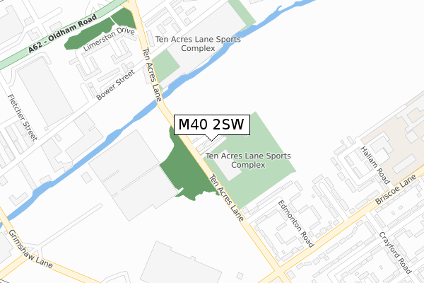
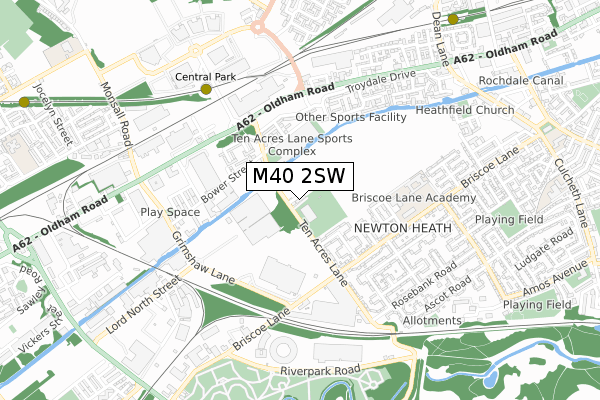
M40 2SW lies on Makkah Close in Manchester. M40 2SW is located in the Miles Platting & Newton Heath electoral ward, within the metropolitan district of Manchester and the English Parliamentary constituency of Manchester Central. The Sub Integrated Care Board (ICB) Location is NHS Greater Manchester ICB - 14L and the police force is Greater Manchester. This postcode has been in use since May 1994.


GetTheData
Source: OS Open Zoomstack (Ordnance Survey)
Licence: Open Government Licence (requires attribution)
Attribution: Contains OS data © Crown copyright and database right 2025
Source: Open Postcode Geo
Licence: Open Government Licence (requires attribution)
Attribution: Contains OS data © Crown copyright and database right 2025; Contains Royal Mail data © Royal Mail copyright and database right 2025; Source: Office for National Statistics licensed under the Open Government Licence v.3.0
| Easting | 387278 |
| Northing | 400098 |
| Latitude | 53.497426 |
| Longitude | -2.193243 |
GetTheData
Source: Open Postcode Geo
Licence: Open Government Licence
| Street | Makkah Close |
| Town/City | Manchester |
| Country | England |
| Postcode District | M40 |
➜ See where M40 is on a map ➜ Where is Manchester? | |
GetTheData
Source: Land Registry Price Paid Data
Licence: Open Government Licence
Elevation or altitude of M40 2SW as distance above sea level:
| Metres | Feet | |
|---|---|---|
| Elevation | 80m | 262ft |
Elevation is measured from the approximate centre of the postcode, to the nearest point on an OS contour line from OS Terrain 50, which has contour spacing of ten vertical metres.
➜ How high above sea level am I? Find the elevation of your current position using your device's GPS.
GetTheData
Source: Open Postcode Elevation
Licence: Open Government Licence
| Ward | Miles Platting & Newton Heath |
| Constituency | Manchester Central |
GetTheData
Source: ONS Postcode Database
Licence: Open Government Licence
1, MAKKAH CLOSE, MANCHESTER, M40 2SW 2023 27 JAN £180,000 |
GetTheData
Source: HM Land Registry Price Paid Data
Licence: Contains HM Land Registry data © Crown copyright and database right 2025. This data is licensed under the Open Government Licence v3.0.
| Bower Street (Bower St) | Newton Heath | 251m |
| Eldridge Drive (Eldridge Dr) | Newton Heath | 282m |
| Briscoe Ln/Ten Acres Ln (Briscoe Ln) | Newton Heath | 338m |
| Briscoe Ln/Crayford Rd (Briscoe Ln) | Newton Heath | 372m |
| Briscoe Ln/Ten Acres Ln (Briscoe Ln) | Newton Heath | 375m |
| Central Park (Manchester Metrolink) (The Gateway) | Newton Heath | 607m |
| Newton Heath & Moston (Manchester Metrolink) (Dean Lane) | Newton Heath | 937m |
| Monsall (Manchester Metrolink) (Ruislip Avenue) | Monsall | 1,226m |
| Etihad Campus (Manchester Metrolink) (Joe Mercer Way) | Sportcity | 1,446m |
| Ashburys Station | 2.9km |
| Ardwick Station | 3.2km |
| Moston Station | 3.2km |
GetTheData
Source: NaPTAN
Licence: Open Government Licence
| Percentage of properties with Next Generation Access | 0.0% |
| Percentage of properties with Superfast Broadband | 0.0% |
| Percentage of properties with Ultrafast Broadband | 0.0% |
| Percentage of properties with Full Fibre Broadband | 0.0% |
Superfast Broadband is between 30Mbps and 300Mbps
Ultrafast Broadband is > 300Mbps
| Median download speed | 5.2Mbps |
| Average download speed | 4.8Mbps |
| Maximum download speed | 6.29Mbps |
| Median upload speed | 1.0Mbps |
| Average upload speed | 1.0Mbps |
| Maximum upload speed | 1.14Mbps |
| Percentage of properties unable to receive 2Mbps | 0.0% |
| Percentage of properties unable to receive 5Mbps | 0.0% |
| Percentage of properties unable to receive 10Mbps | 100.0% |
| Percentage of properties unable to receive 30Mbps | 100.0% |
GetTheData
Source: Ofcom
Licence: Ofcom Terms of Use (requires attribution)
Estimated total energy consumption in M40 2SW by fuel type, 2015.
| Consumption (kWh) | 129,963 |
|---|---|
| Meter count | 10 |
| Mean (kWh/meter) | 12,996 |
| Median (kWh/meter) | 12,616 |
| Consumption (kWh) | 35,410 |
|---|---|
| Meter count | 10 |
| Mean (kWh/meter) | 3,541 |
| Median (kWh/meter) | 2,539 |
GetTheData
Source: Postcode level gas estimates: 2015 (experimental)
Source: Postcode level electricity estimates: 2015 (experimental)
Licence: Open Government Licence
GetTheData
Source: ONS Postcode Database
Licence: Open Government Licence


➜ Get more ratings from the Food Standards Agency
GetTheData
Source: Food Standards Agency
Licence: FSA terms & conditions
| Last Collection | |||
|---|---|---|---|
| Location | Mon-Fri | Sat | Distance |
| New Moston | 17:30 | 12:00 | 578m |
| Scotland Hall Road | 17:30 | 12:00 | 964m |
| 95 Stuart Street | 17:30 | 12:00 | 1,262m |
GetTheData
Source: Dracos
Licence: Creative Commons Attribution-ShareAlike
The below table lists the International Territorial Level (ITL) codes (formerly Nomenclature of Territorial Units for Statistics (NUTS) codes) and Local Administrative Units (LAU) codes for M40 2SW:
| ITL 1 Code | Name |
|---|---|
| TLD | North West (England) |
| ITL 2 Code | Name |
| TLD3 | Greater Manchester |
| ITL 3 Code | Name |
| TLD33 | Manchester |
| LAU 1 Code | Name |
| E08000003 | Manchester |
GetTheData
Source: ONS Postcode Directory
Licence: Open Government Licence
The below table lists the Census Output Area (OA), Lower Layer Super Output Area (LSOA), and Middle Layer Super Output Area (MSOA) for M40 2SW:
| Code | Name | |
|---|---|---|
| OA | E00026645 | |
| LSOA | E01005257 | Manchester 011B |
| MSOA | E02001055 | Manchester 011 |
GetTheData
Source: ONS Postcode Directory
Licence: Open Government Licence
| M40 2SP | Ten Acres Lane | 45m |
| M40 2SG | Staplehurst Road | 186m |
| M40 2DN | Ten Acres Lane | 222m |
| M40 2SR | Edmonton Road | 251m |
| M40 2SQ | Ten Acres Lane | 277m |
| M40 2SU | Halliday Road | 293m |
| M40 2SJ | Dorking Avenue | 295m |
| M40 2DP | Milstead Walk | 310m |
| M40 2SS | Briscoe Lane | 332m |
| M40 2DU | Penhall Walk | 336m |
GetTheData
Source: Open Postcode Geo; Land Registry Price Paid Data
Licence: Open Government Licence