M27 0BT maps, stats, and open data
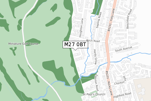
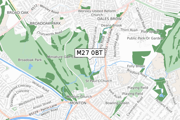
M27 0BT lies on Houghton Lane in Swinton, Manchester. M27 0BT is located in the Worsley & Westwood Park electoral ward, within the metropolitan district of Salford and the English Parliamentary constituency of Worsley and Eccles South. The Sub Integrated Care Board (ICB) Location is NHS Greater Manchester ICB - 01G and the police force is Greater Manchester. This postcode has been in use since May 1994.
M27 0BT maps


Licence: Open Government Licence (requires attribution)
Attribution: Contains OS data © Crown copyright and database right 2025
Source: Open Postcode Geo
Licence: Open Government Licence (requires attribution)
Attribution: Contains OS data © Crown copyright and database right 2025; Contains Royal Mail data © Royal Mail copyright and database right 2025; Source: Office for National Statistics licensed under the Open Government Licence v.3.0
M27 0BT geodata
| Easting | 376653 |
| Northing | 400127 |
| Latitude | 53.497320 |
| Longitude | -2.353406 |
Where is M27 0BT?
| Street | Houghton Lane |
| Locality | Swinton |
| Town/City | Manchester |
| Country | England |
| Postcode District | M27 |
M27 0BT Elevation
Elevation or altitude of M27 0BT as distance above sea level:
| Metres | Feet | |
|---|---|---|
| Elevation | 30m | 98ft |
Elevation is measured from the approximate centre of the postcode, to the nearest point on an OS contour line from OS Terrain 50, which has contour spacing of ten vertical metres.
➜ How high above sea level am I? Find the elevation of your current position using your device's GPS.
Politics
| Ward | Worsley & Westwood Park |
|---|---|
| Constituency | Worsley And Eccles South |
House Prices
Sales of detached houses in M27 0BT
106, HOUGHTON LANE, SWINTON, MANCHESTER, M27 0BT 2007 16 FEB £250,000 |
Licence: Contains HM Land Registry data © Crown copyright and database right 2025. This data is licensed under the Open Government Licence v3.0.
Transport
Nearest bus stops to M27 0BT
| Folly Ln/Birch Rd (Folly Ln) | Dales Brow | 216m |
| Folly Ln/Rocky Ln (Folly Ln) | Dales Brow | 243m |
| Folly Ln/Leigh Ave (Folly Ln) | Dales Brow | 417m |
| Folly Ln/Leigh Ave (Folly Ln) | Dales Brow | 430m |
| Rocky Ln/Park Dr (Rocky Ln) | Monton | 445m |
Nearest railway stations to M27 0BT
| Patricroft Station | 1.4km |
| Eccles Station | 1.8km |
| Moorside Station | 2.1km |
Broadband
Broadband access in M27 0BT (2020 data)
| Percentage of properties with Next Generation Access | 100.0% |
| Percentage of properties with Superfast Broadband | 100.0% |
| Percentage of properties with Ultrafast Broadband | 100.0% |
| Percentage of properties with Full Fibre Broadband | 100.0% |
Superfast Broadband is between 30Mbps and 300Mbps
Ultrafast Broadband is > 300Mbps
Broadband speed in M27 0BT (2019 data)
Download
| Median download speed | 35.6Mbps |
| Average download speed | 78.1Mbps |
| Maximum download speed | 350.00Mbps |
Upload
| Median upload speed | 2.8Mbps |
| Average upload speed | 3.7Mbps |
| Maximum upload speed | 7.44Mbps |
Broadband limitations in M27 0BT (2020 data)
| Percentage of properties unable to receive 2Mbps | 0.0% |
| Percentage of properties unable to receive 5Mbps | 0.0% |
| Percentage of properties unable to receive 10Mbps | 0.0% |
| Percentage of properties unable to receive 30Mbps | 0.0% |
M27 0BT gas and electricity consumption
Estimated total energy consumption in M27 0BT by fuel type, 2015.
Gas
| Consumption (kWh) | 217,753 |
|---|---|
| Meter count | 13 |
| Mean (kWh/meter) | 16,750 |
| Median (kWh/meter) | 17,271 |
Electricity
| Consumption (kWh) | 50,121 |
|---|---|
| Meter count | 13 |
| Mean (kWh/meter) | 3,855 |
| Median (kWh/meter) | 4,063 |
- Consumption: The estimated total energy consumption, in kWh, across all meters in M27 0BT, for 2015.
- Meter count: The total number of meters in M27 0BT.
- Mean: The mean average consumption per meter, in kWh.
- Median: The median average consumption per meter, in kWh.
Source: Postcode level electricity estimates: 2015 (experimental)
Licence: Open Government Licence
Deprivation
17.8% of English postcodes are less deprived than M27 0BT:Food Standards Agency
Three nearest food hygiene ratings to M27 0BT (metres)


➜ Get more ratings from the Food Standards Agency
Nearest post box to M27 0BT
| Last Collection | |||
|---|---|---|---|
| Location | Mon-Fri | Sat | Distance |
| Cnr Park Road Rockey Lane | 17:30 | 12:00 | 316m |
| Monton P.o. | 17:30 | 12:00 | 776m |
| 7 Stafford Road | 17:30 | 12:00 | 1,066m |
M27 0BT ITL and M27 0BT LAU
The below table lists the International Territorial Level (ITL) codes (formerly Nomenclature of Territorial Units for Statistics (NUTS) codes) and Local Administrative Units (LAU) codes for M27 0BT:
| ITL 1 Code | Name |
|---|---|
| TLD | North West (England) |
| ITL 2 Code | Name |
| TLD3 | Greater Manchester |
| ITL 3 Code | Name |
| TLD34 | Greater Manchester South West |
| LAU 1 Code | Name |
| E08000006 | Salford |
M27 0BT census areas
The below table lists the Census Output Area (OA), Lower Layer Super Output Area (LSOA), and Middle Layer Super Output Area (MSOA) for M27 0BT:
| Code | Name | |
|---|---|---|
| OA | E00028864 | |
| LSOA | E01005695 | Salford 014A |
| MSOA | E02001170 | Salford 014 |
Nearest postcodes to M27 0BT
| M27 0BU | Houghton Lane | 56m |
| M27 0BX | Birch Road | 65m |
| M27 0DA | Hardy Grove | 126m |
| M27 0BP | Kirby Avenue | 150m |
| M27 0DG | Willow Street | 185m |
| M27 0BN | Houghton Lane | 187m |
| M27 0BR | Houghton Lane | 192m |
| M27 0DB | Folly Lane | 192m |
| M27 0BS | Lonsdale Avenue | 195m |
| M27 0BY | Sapling Road | 204m |