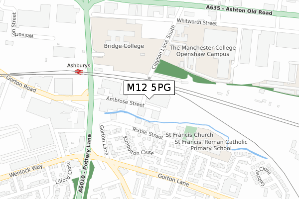
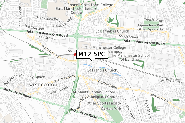
M12 5PG is located in the Gorton & Abbey Hey electoral ward, within the metropolitan district of Manchester and the English Parliamentary constituency of Manchester, Gorton. The Sub Integrated Care Board (ICB) Location is NHS Greater Manchester ICB - 14L and the police force is Greater Manchester. This postcode has been in use since June 2019.


GetTheData
Source: OS Open Zoomstack (Ordnance Survey)
Licence: Open Government Licence (requires attribution)
Attribution: Contains OS data © Crown copyright and database right 2024
Source: Open Postcode Geo
Licence: Open Government Licence (requires attribution)
Attribution: Contains OS data © Crown copyright and database right 2024; Contains Royal Mail data © Royal Mail copyright and database right 2024; Source: Office for National Statistics licensed under the Open Government Licence v.3.0
| Easting | 387403 |
| Northing | 397162 |
| Latitude | 53.471055 |
| Longitude | -2.191238 |
GetTheData
Source: Open Postcode Geo
Licence: Open Government Licence
| Country | England |
| Postcode District | M12 |
| ➜ M12 open data dashboard ➜ See where M12 is on a map ➜ Where is Manchester? | |
GetTheData
Source: Land Registry Price Paid Data
Licence: Open Government Licence
| Ward | Gorton & Abbey Hey |
| Constituency | Manchester, Gorton |
GetTheData
Source: ONS Postcode Database
Licence: Open Government Licence
| Pottery Ln/Gorton Rd (Pottery Ln) | Ashburys | 184m |
| Pottery Ln/Ashburys Stn (Pottery Ln) | Ashburys | 217m |
| Gorton Ln/Gardner St (Gorton Ln) | West Gorton | 262m |
| Wenlock Way/Pottery Ln (Wenlock Way) | West Gorton | 307m |
| Belle Vue St/Gorton Ln (Belle Vue St) | West Gorton | 308m |
| Velopark (Manchester Metrolink) (Ashton New Road) | Sportcity | 1,254m |
| Clayton Hall (Manchester Metrolink) (Ashton New Road) | Clayton | 1,439m |
| Holt Town (Manchester Metrolink) (Holt Town) | Holt Town | 1,940m |
| Ashburys Station | 0.2km |
| Belle Vue Station | 1.2km |
| Ardwick Station | 1.5km |
GetTheData
Source: NaPTAN
Licence: Open Government Licence
GetTheData
Source: ONS Postcode Database
Licence: Open Government Licence


➜ Get more ratings from the Food Standards Agency
GetTheData
Source: Food Standards Agency
Licence: FSA terms & conditions
| Last Collection | |||
|---|---|---|---|
| Location | Mon-Fri | Sat | Distance |
| Gorton Brook | 17:30 | 12:00 | 274m |
| Openshaw P.o. | 17:30 | 12:00 | 483m |
| Birch Street | 17:30 | 12:00 | 554m |
GetTheData
Source: Dracos
Licence: Creative Commons Attribution-ShareAlike
| Facility | Distance |
|---|---|
| Bridge College Whitworth Street, Openshaw, Manchester Sports Hall | 237m |
| The Manchester College (Openshaw Campus) Ashton Old Road, Openshaw, Manchester Health and Fitness Gym, Sports Hall | 268m |
| East Manchester Leisure Centre Grey Mare Lane, Manchester Health and Fitness Gym, Swimming Pool, Studio | 693m |
GetTheData
Source: Active Places
Licence: Open Government Licence
| School | Phase of Education | Distance |
|---|---|---|
| LTE Group Whitworth House, Whitworth St, Openshaw, Manchester, M11 2WH | 16 plus | 256m |
| St Francis RC Primary School Ellenbrook Close, Gorton, Manchester, M12 5LZ | Primary | 256m |
| St Francis RC Primary School Ellenbrook Close, Gorton, Manchester, M12 5LZ | Primary | 272m |
GetTheData
Source: Edubase
Licence: Open Government Licence
| Risk of M12 5PG flooding from rivers and sea | Low |
| ➜ M12 5PG flood map | |
GetTheData
Source: Open Flood Risk by Postcode
Licence: Open Government Licence
The below table lists the International Territorial Level (ITL) codes (formerly Nomenclature of Territorial Units for Statistics (NUTS) codes) and Local Administrative Units (LAU) codes for M12 5PG:
| ITL 1 Code | Name |
|---|---|
| TLD | North West (England) |
| ITL 2 Code | Name |
| TLD3 | Greater Manchester |
| ITL 3 Code | Name |
| TLD33 | Manchester |
| LAU 1 Code | Name |
| E08000003 | Manchester |
GetTheData
Source: ONS Postcode Directory
Licence: Open Government Licence
The below table lists the Census Output Area (OA), Lower Layer Super Output Area (LSOA), and Middle Layer Super Output Area (MSOA) for M12 5PG:
| Code | Name | |
|---|---|---|
| OA | E00026301 | |
| LSOA | E01005186 | Manchester 020B |
| MSOA | E02001064 | Manchester 020 |
GetTheData
Source: ONS Postcode Directory
Licence: Open Government Licence
| M12 5DJ | Textile Street | 128m |
| M12 5PT | Neenton Square | 146m |
| M12 5PN | Didley Square | 160m |
| M12 5PD | Kimbolton Close | 163m |
| M12 5PU | Westbrook Square | 186m |
| M12 5DF | Gorton Lane | 203m |
| M12 5PE | Kimbolton Close | 207m |
| M12 5PF | Romsley Close | 208m |
| M12 5PH | Gardner Street | 242m |
| M12 5SA | Cormorant Walk | 274m |
GetTheData
Source: Open Postcode Geo; Land Registry Price Paid Data
Licence: Open Government Licence