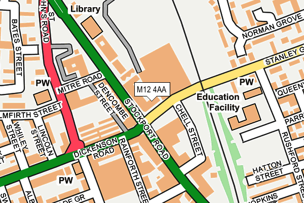
M12 4AA is located in the Longsight electoral ward, within the metropolitan district of Manchester and the English Parliamentary constituency of Manchester, Gorton. The Sub Integrated Care Board (ICB) Location is NHS Greater Manchester ICB - 14L and the police force is Greater Manchester. This postcode has been in use since June 2000.


GetTheData
Source: OS OpenMap – Local (Ordnance Survey)
Source: OS VectorMap District (Ordnance Survey)
Licence: Open Government Licence (requires attribution)
| Easting | 386872 |
| Northing | 395532 |
| Latitude | 53.456391 |
| Longitude | -2.199169 |
GetTheData
Source: Open Postcode Geo
Licence: Open Government Licence
| Country | England |
| Postcode District | M12 |
➜ See where M12 is on a map ➜ Where is Manchester? | |
GetTheData
Source: Land Registry Price Paid Data
Licence: Open Government Licence
Elevation or altitude of M12 4AA as distance above sea level:
| Metres | Feet | |
|---|---|---|
| Elevation | 50m | 164ft |
Elevation is measured from the approximate centre of the postcode, to the nearest point on an OS contour line from OS Terrain 50, which has contour spacing of ten vertical metres.
➜ How high above sea level am I? Find the elevation of your current position using your device's GPS.
GetTheData
Source: Open Postcode Elevation
Licence: Open Government Licence
| Ward | Longsight |
| Constituency | Manchester, Gorton |
GetTheData
Source: ONS Postcode Database
Licence: Open Government Licence
| Stanley Grove | Longsight | 63m |
| Stanley Gr/Asda (Stanley Gr) | Longsight | 69m |
| Stanley Gr/Asda (Stanley Gr) | Longsight | 96m |
| Dickenson Rd/Longsight Market (Dickenson Rd) | Longsight | 125m |
| Dickenson Rd/Longsight Market (Dickenson Rd) | Longsight | 146m |
| Belle Vue Station | 1.4km |
| Levenshulme Station | 1.4km |
| Ashburys Station | 1.7km |
GetTheData
Source: NaPTAN
Licence: Open Government Licence
GetTheData
Source: ONS Postcode Database
Licence: Open Government Licence


➜ Get more ratings from the Food Standards Agency
GetTheData
Source: Food Standards Agency
Licence: FSA terms & conditions
| Last Collection | |||
|---|---|---|---|
| Location | Mon-Fri | Sat | Distance |
| Asda | 17:30 | 12:00 | 154m |
| Slade Lane P.o. | 17:30 | 12:00 | 207m |
| North Road P.o. | 17:30 | 12:00 | 370m |
GetTheData
Source: Dracos
Licence: Creative Commons Attribution-ShareAlike
The below table lists the International Territorial Level (ITL) codes (formerly Nomenclature of Territorial Units for Statistics (NUTS) codes) and Local Administrative Units (LAU) codes for M12 4AA:
| ITL 1 Code | Name |
|---|---|
| TLD | North West (England) |
| ITL 2 Code | Name |
| TLD3 | Greater Manchester |
| ITL 3 Code | Name |
| TLD33 | Manchester |
| LAU 1 Code | Name |
| E08000003 | Manchester |
GetTheData
Source: ONS Postcode Directory
Licence: Open Government Licence
The below table lists the Census Output Area (OA), Lower Layer Super Output Area (LSOA), and Middle Layer Super Output Area (MSOA) for M12 4AA:
| Code | Name | |
|---|---|---|
| OA | E00026503 | |
| LSOA | E01005234 | Manchester 027E |
| MSOA | E02001071 | Manchester 027 |
GetTheData
Source: ONS Postcode Directory
Licence: Open Government Licence
| M13 0RG | Stockport Road | 35m |
| M13 0RQ | Stockport Road | 70m |
| M13 0WG | Dickenson Road | 85m |
| M13 0RX | Stockport Road | 94m |
| M13 0RP | Rainforth Street | 95m |
| M12 4JJ | Stockport Road | 116m |
| M13 0SF | Stamford Road | 122m |
| M13 0SH | Stockport Road | 157m |
| M13 0SE | Stamford Road | 161m |
| M12 4NZ | Hatton Street | 202m |
GetTheData
Source: Open Postcode Geo; Land Registry Price Paid Data
Licence: Open Government Licence