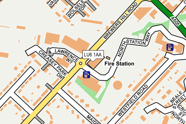
LU6 1AA is located in the Dunstable North electoral ward, within the unitary authority of Central Bedfordshire and the English Parliamentary constituency of South West Bedfordshire. The Sub Integrated Care Board (ICB) Location is NHS Bedfordshire, Luton and Milton Keynes ICB - M1J4Y and the police force is Bedfordshire. This postcode has been in use since January 1980.


GetTheData
Source: OS OpenMap – Local (Ordnance Survey)
Source: OS VectorMap District (Ordnance Survey)
Licence: Open Government Licence (requires attribution)
| Easting | 501058 |
| Northing | 222679 |
| Latitude | 51.893518 |
| Longitude | -0.532804 |
GetTheData
Source: Open Postcode Geo
Licence: Open Government Licence
| Country | England |
| Postcode District | LU6 |
➜ See where LU6 is on a map ➜ Where is Dunstable? | |
GetTheData
Source: Land Registry Price Paid Data
Licence: Open Government Licence
Elevation or altitude of LU6 1AA as distance above sea level:
| Metres | Feet | |
|---|---|---|
| Elevation | 140m | 459ft |
Elevation is measured from the approximate centre of the postcode, to the nearest point on an OS contour line from OS Terrain 50, which has contour spacing of ten vertical metres.
➜ How high above sea level am I? Find the elevation of your current position using your device's GPS.
GetTheData
Source: Open Postcode Elevation
Licence: Open Government Licence
| Ward | Dunstable North |
| Constituency | South West Bedfordshire |
GetTheData
Source: ONS Postcode Database
Licence: Open Government Licence
| Northfields (Houghton Road) | Dunstable | 163m |
| Watling Court (High Street North) | Dunstable | 189m |
| District Council Offices (High Street North) | Dunstable | 192m |
| Watling Court (High Street North) | Dunstable | 193m |
| Northfields (Houghton Road) | Dunstable | 247m |
GetTheData
Source: NaPTAN
Licence: Open Government Licence
GetTheData
Source: ONS Postcode Database
Licence: Open Government Licence


➜ Get more ratings from the Food Standards Agency
GetTheData
Source: Food Standards Agency
Licence: FSA terms & conditions
| Last Collection | |||
|---|---|---|---|
| Location | Mon-Fri | Sat | Distance |
| High Street North | 16:15 | 12:00 | 196m |
| Chiltern Road | 17:00 | 11:30 | 379m |
| Frenchs Avenue | 16:30 | 11:30 | 459m |
GetTheData
Source: Dracos
Licence: Creative Commons Attribution-ShareAlike
The below table lists the International Territorial Level (ITL) codes (formerly Nomenclature of Territorial Units for Statistics (NUTS) codes) and Local Administrative Units (LAU) codes for LU6 1AA:
| ITL 1 Code | Name |
|---|---|
| TLH | East |
| ITL 2 Code | Name |
| TLH2 | Bedfordshire and Hertfordshire |
| ITL 3 Code | Name |
| TLH25 | Central Bedfordshire |
| LAU 1 Code | Name |
| E06000056 | Central Bedfordshire |
GetTheData
Source: ONS Postcode Directory
Licence: Open Government Licence
The below table lists the Census Output Area (OA), Lower Layer Super Output Area (LSOA), and Middle Layer Super Output Area (MSOA) for LU6 1AA:
| Code | Name | |
|---|---|---|
| OA | E00088828 | |
| LSOA | E01017599 | Central Bedfordshire 028F |
| MSOA | E02003646 | Central Bedfordshire 028 |
GetTheData
Source: ONS Postcode Directory
Licence: Open Government Licence
| LU6 1AU | High Street North | 99m |
| LU6 1DA | Houghton Parade | 112m |
| LU6 1DD | Houghton Road | 115m |
| LU6 1DB | High Street North | 142m |
| LU6 1FF | Leyland Road | 156m |
| LU5 5AA | Houghton Road | 173m |
| LU6 1FH | Wolseley Drive | 174m |
| LU6 1FL | Healey Road | 204m |
| LU5 5AG | Capron Road | 205m |
| LU6 1BF | Vauxhall Way | 222m |
GetTheData
Source: Open Postcode Geo; Land Registry Price Paid Data
Licence: Open Government Licence