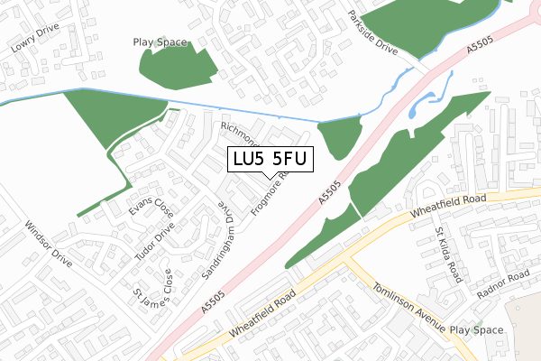
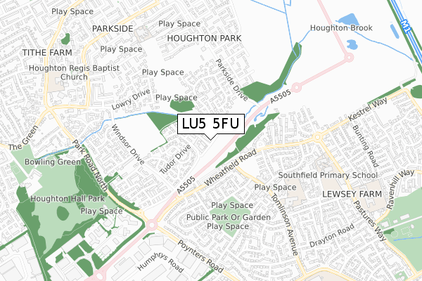
LU5 5FU is located in the Houghton Regis West electoral ward, within the unitary authority of Central Bedfordshire and the English Parliamentary constituency of South West Bedfordshire. The Sub Integrated Care Board (ICB) Location is NHS Bedfordshire, Luton and Milton Keynes ICB - M1J4Y and the police force is Bedfordshire. This postcode has been in use since July 2018.


GetTheData
Source: OS Open Zoomstack (Ordnance Survey)
Licence: Open Government Licence (requires attribution)
Attribution: Contains OS data © Crown copyright and database right 2024
Source: Open Postcode Geo
Licence: Open Government Licence (requires attribution)
Attribution: Contains OS data © Crown copyright and database right 2024; Contains Royal Mail data © Royal Mail copyright and database right 2024; Source: Office for National Statistics licensed under the Open Government Licence v.3.0
| Easting | 502655 |
| Northing | 223569 |
| Latitude | 51.901226 |
| Longitude | -0.509340 |
GetTheData
Source: Open Postcode Geo
Licence: Open Government Licence
| Country | England |
| Postcode District | LU5 |
| ➜ LU5 open data dashboard ➜ See where LU5 is on a map ➜ Where is Houghton Regis? | |
GetTheData
Source: Land Registry Price Paid Data
Licence: Open Government Licence
| Ward | Houghton Regis West |
| Constituency | South West Bedfordshire |
GetTheData
Source: ONS Postcode Database
Licence: Open Government Licence
| October 2022 | Burglary | On or near Porz Avenue | 390m |
| June 2022 | Anti-social behaviour | On or near Park Road North | 224m |
| June 2022 | Violence and sexual offences | On or near Tennyson Avenue | 232m |
| ➜ Get more crime data in our Crime section | |||
GetTheData
Source: data.police.uk
Licence: Open Government Licence
| Milton Way (Sandringham Drive) | Houghton Regis | 322m |
| Wheatfield Road | Lewsey Farm | 336m |
| Tennyson Avenue (Windsor Drive) | Houghton Regis | 343m |
| Tennyson Avenue (Windsor Drive) | Houghton Regis | 349m |
| Wheatfield Road | Lewsey Farm | 366m |
| Leagrave Station | 3.5km |
GetTheData
Source: NaPTAN
Licence: Open Government Licence
GetTheData
Source: ONS Postcode Database
Licence: Open Government Licence


➜ Get more ratings from the Food Standards Agency
GetTheData
Source: Food Standards Agency
Licence: FSA terms & conditions
| Last Collection | |||
|---|---|---|---|
| Location | Mon-Fri | Sat | Distance |
| Windsor Drive | 16:00 | 12:00 | 345m |
| Brookfield Avenue | 17:30 | 11:45 | 440m |
| Lovett Way | 18:30 | 557m | |
GetTheData
Source: Dracos
Licence: Creative Commons Attribution-ShareAlike
| Facility | Distance |
|---|---|
| Moore Crescent Recreation Ground Moore Crescent, Houghton Regis, Dunstable Grass Pitches | 270m |
| The Vale Academy Wilbury Drive, Dunstable Sports Hall, Grass Pitches | 839m |
| Parkside Drive Recreation Ground Parkside Drive, Houghton Regis, Dunstable Grass Pitches | 938m |
GetTheData
Source: Active Places
Licence: Open Government Licence
| School | Phase of Education | Distance |
|---|---|---|
| St Vincent's Catholic Primary School Hammersmith Gardens, Houghton Regis, Dunstable, LU5 5RG | Primary | 761m |
| The Vale Academy Wilbury Drive, Dunstable, LU5 4QP | Primary | 838m |
| Willow Nursery School Goldstone Crescent, Dunstable, LU5 4QU | Nursery | 920m |
GetTheData
Source: Edubase
Licence: Open Government Licence
| Risk of LU5 5FU flooding from rivers and sea | Very Low |
| ➜ LU5 5FU flood map | |
GetTheData
Source: Open Flood Risk by Postcode
Licence: Open Government Licence
The below table lists the International Territorial Level (ITL) codes (formerly Nomenclature of Territorial Units for Statistics (NUTS) codes) and Local Administrative Units (LAU) codes for LU5 5FU:
| ITL 1 Code | Name |
|---|---|
| TLH | East |
| ITL 2 Code | Name |
| TLH2 | Bedfordshire and Hertfordshire |
| ITL 3 Code | Name |
| TLH25 | Central Bedfordshire |
| LAU 1 Code | Name |
| E06000056 | Central Bedfordshire |
GetTheData
Source: ONS Postcode Directory
Licence: Open Government Licence
The below table lists the Census Output Area (OA), Lower Layer Super Output Area (LSOA), and Middle Layer Super Output Area (MSOA) for LU5 5FU:
| Code | Name | |
|---|---|---|
| OA | E00088737 | |
| LSOA | E01017581 | Central Bedfordshire 026D |
| MSOA | E02003644 | Central Bedfordshire 026 |
GetTheData
Source: ONS Postcode Directory
Licence: Open Government Licence
| LU5 5UG | Tennyson Avenue | 186m |
| LU5 5UD | Milton Walk | 200m |
| LU5 5UF | Milton Way | 206m |
| LU5 5UQ | Tennyson Avenue | 234m |
| LU5 5HY | Halleys Way | 256m |
| LU5 5HZ | Halleys Way | 318m |
| LU5 5UE | Milton Way | 328m |
| LU5 5GZ | Moore Crescent | 376m |
| LU5 5QY | Longbrooke | 380m |
| LU5 5QX | Longbrooke | 388m |
GetTheData
Source: Open Postcode Geo; Land Registry Price Paid Data
Licence: Open Government Licence