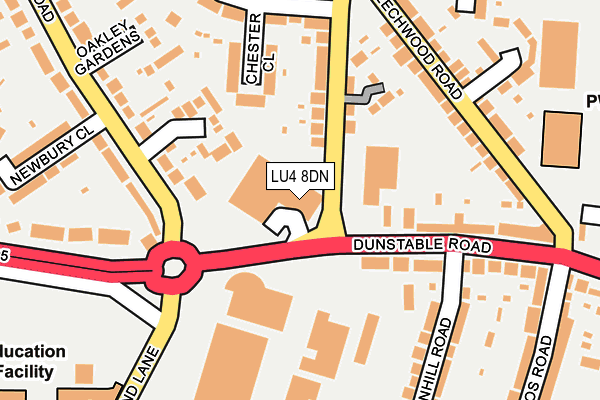
LU4 8DN is located in the Challney electoral ward, within the unitary authority of Luton and the English Parliamentary constituency of Luton North. The Sub Integrated Care Board (ICB) Location is NHS Bedfordshire, Luton and Milton Keynes ICB - M1J4Y and the police force is Bedfordshire. This postcode has been in use since January 1980.


GetTheData
Source: OS OpenMap – Local (Ordnance Survey)
Source: OS VectorMap District (Ordnance Survey)
Licence: Open Government Licence (requires attribution)
| Easting | 506553 |
| Northing | 222681 |
| Latitude | 51.892514 |
| Longitude | -0.452981 |
GetTheData
Source: Open Postcode Geo
Licence: Open Government Licence
| Country | England |
| Postcode District | LU4 |
➜ See where LU4 is on a map ➜ Where is Luton? | |
GetTheData
Source: Land Registry Price Paid Data
Licence: Open Government Licence
Elevation or altitude of LU4 8DN as distance above sea level:
| Metres | Feet | |
|---|---|---|
| Elevation | 130m | 427ft |
Elevation is measured from the approximate centre of the postcode, to the nearest point on an OS contour line from OS Terrain 50, which has contour spacing of ten vertical metres.
➜ How high above sea level am I? Find the elevation of your current position using your device's GPS.
GetTheData
Source: Open Postcode Elevation
Licence: Open Government Licence
| Ward | Challney |
| Constituency | Luton North |
GetTheData
Source: ONS Postcode Database
Licence: Open Government Licence
| Thornhill Road (Dunstable Road) | Challney | 134m |
| Newbury Close (Oakley Road) | Challney | 188m |
| Newbury Close (Oakley Road) | Challney | 202m |
| Beechwood Roundabout (Beechwood Road) | Maidenhall | 212m |
| Beechwood Roundabout (Beechwood Road) | Maidenhall | 219m |
| Leagrave Station | 1.5km |
| Luton Station | 2.9km |
| Luton Airport Parkway Station | 4.5km |
GetTheData
Source: NaPTAN
Licence: Open Government Licence
GetTheData
Source: ONS Postcode Database
Licence: Open Government Licence


➜ Get more ratings from the Food Standards Agency
GetTheData
Source: Food Standards Agency
Licence: FSA terms & conditions
| Last Collection | |||
|---|---|---|---|
| Location | Mon-Fri | Sat | Distance |
| Post Office Waller Avenue | 17:30 | 12:15 | 257m |
| Chandos Road | 17:30 | 12:00 | 285m |
| Humberstone Road | 17:30 | 12:30 | 461m |
GetTheData
Source: Dracos
Licence: Creative Commons Attribution-ShareAlike
The below table lists the International Territorial Level (ITL) codes (formerly Nomenclature of Territorial Units for Statistics (NUTS) codes) and Local Administrative Units (LAU) codes for LU4 8DN:
| ITL 1 Code | Name |
|---|---|
| TLH | East |
| ITL 2 Code | Name |
| TLH2 | Bedfordshire and Hertfordshire |
| ITL 3 Code | Name |
| TLH21 | Luton |
| LAU 1 Code | Name |
| E06000032 | Luton |
GetTheData
Source: ONS Postcode Directory
Licence: Open Government Licence
The below table lists the Census Output Area (OA), Lower Layer Super Output Area (LSOA), and Middle Layer Super Output Area (MSOA) for LU4 8DN:
| Code | Name | |
|---|---|---|
| OA | E00079473 | |
| LSOA | E01015711 | Luton 011A |
| MSOA | E02003268 | Luton 011 |
GetTheData
Source: ONS Postcode Directory
Licence: Open Government Licence
| LU4 8DG | Dunstable Road | 116m |
| LU4 9PW | Fulbourne Close | 117m |
| LU4 9SJ | Chester Close | 151m |
| LU4 9RP | Waller Avenue | 151m |
| LU4 8DL | Dunstable Road | 168m |
| LU4 8RR | Beechwood Road | 175m |
| LU4 8RP | Beechwood Road | 203m |
| LU4 8DE | Dunstable Road | 218m |
| LU4 8EY | Thornhill Road | 223m |
| LU4 9DH | Oakley Gardens | 226m |
GetTheData
Source: Open Postcode Geo; Land Registry Price Paid Data
Licence: Open Government Licence