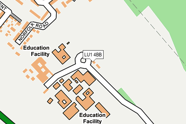
LU1 4BB is located in the Caddington electoral ward, within the unitary authority of Central Bedfordshire and the English Parliamentary constituency of Luton South. The Sub Integrated Care Board (ICB) Location is NHS Bedfordshire, Luton and Milton Keynes ICB - M1J4Y and the police force is Bedfordshire. This postcode has been in use since March 1983.


GetTheData
Source: OS OpenMap – Local (Ordnance Survey)
Source: OS VectorMap District (Ordnance Survey)
Licence: Open Government Licence (requires attribution)
| Easting | 503693 |
| Northing | 220530 |
| Latitude | 51.873721 |
| Longitude | -0.495171 |
GetTheData
Source: Open Postcode Geo
Licence: Open Government Licence
| Country | England |
| Postcode District | LU1 |
➜ See where LU1 is on a map ➜ Where is Dunstable? | |
GetTheData
Source: Land Registry Price Paid Data
Licence: Open Government Licence
Elevation or altitude of LU1 4BB as distance above sea level:
| Metres | Feet | |
|---|---|---|
| Elevation | 160m | 525ft |
Elevation is measured from the approximate centre of the postcode, to the nearest point on an OS contour line from OS Terrain 50, which has contour spacing of ten vertical metres.
➜ How high above sea level am I? Find the elevation of your current position using your device's GPS.
GetTheData
Source: Open Postcode Elevation
Licence: Open Government Licence
| Ward | Caddington |
| Constituency | Luton South |
GetTheData
Source: ONS Postcode Database
Licence: Open Government Licence
| Southern Campus Schools (Dunstable Road Schools Access) | Caddington | 97m |
| Southwood Road | Downside | 321m |
| Lincoln Close (Southwood Road) | Downside | 331m |
| Lincoln Close (Southwood Road) | Downside | 353m |
| Morcom Road (Southwood Road) | Downside | 488m |
| Leagrave Station | 4.3km |
GetTheData
Source: NaPTAN
Licence: Open Government Licence
GetTheData
Source: ONS Postcode Database
Licence: Open Government Licence


➜ Get more ratings from the Food Standards Agency
GetTheData
Source: Food Standards Agency
Licence: FSA terms & conditions
| Last Collection | |||
|---|---|---|---|
| Location | Mon-Fri | Sat | Distance |
| Southwood Road | 17:30 | 11:45 | 540m |
| Stipers Hill | 17:30 | 11:45 | 699m |
| Lowther Road | 17:45 | 11:30 | 805m |
GetTheData
Source: Dracos
Licence: Creative Commons Attribution-ShareAlike
The below table lists the International Territorial Level (ITL) codes (formerly Nomenclature of Territorial Units for Statistics (NUTS) codes) and Local Administrative Units (LAU) codes for LU1 4BB:
| ITL 1 Code | Name |
|---|---|
| TLH | East |
| ITL 2 Code | Name |
| TLH2 | Bedfordshire and Hertfordshire |
| ITL 3 Code | Name |
| TLH25 | Central Bedfordshire |
| LAU 1 Code | Name |
| E06000056 | Central Bedfordshire |
GetTheData
Source: ONS Postcode Directory
Licence: Open Government Licence
The below table lists the Census Output Area (OA), Lower Layer Super Output Area (LSOA), and Middle Layer Super Output Area (MSOA) for LU1 4BB:
| Code | Name | |
|---|---|---|
| OA | E00088652 | |
| LSOA | E01017562 | Central Bedfordshire 033B |
| MSOA | E02003651 | Central Bedfordshire 033 |
GetTheData
Source: ONS Postcode Directory
Licence: Open Government Licence
| LU5 4ES | Suffolk Road | 211m |
| LU5 4ER | Norfolk Road | 224m |
| LU5 4EN | Southwood Road | 291m |
| LU6 3FJ | Fossett Grove | 319m |
| LU5 4EP | Lincoln Close | 341m |
| LU5 4EL | Southwood Road | 349m |
| LU6 3FP | Renner Croft | 371m |
| LU5 4EW | Southwood Road | 373m |
| LU6 3FL | Goodhart Crescent | 381m |
| LU5 4EE | Southwood Road | 468m |
GetTheData
Source: Open Postcode Geo; Land Registry Price Paid Data
Licence: Open Government Licence