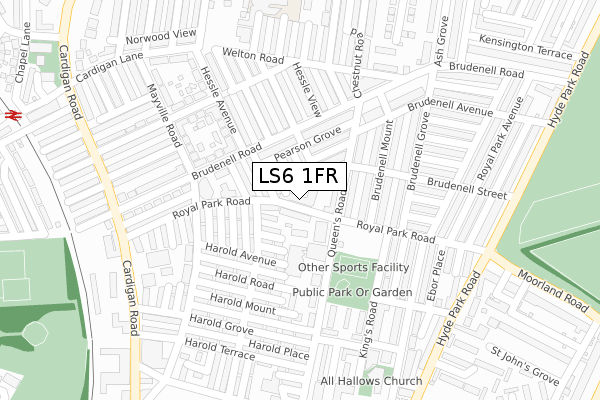
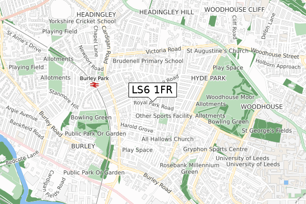
LS6 1FR is located in the Headingley & Hyde Park electoral ward, within the metropolitan district of Leeds and the English Parliamentary constituency of Leeds North West. The Sub Integrated Care Board (ICB) Location is NHS West Yorkshire ICB - 15F and the police force is West Yorkshire. This postcode has been in use since October 2019.


GetTheData
Source: OS Open Zoomstack (Ordnance Survey)
Licence: Open Government Licence (requires attribution)
Attribution: Contains OS data © Crown copyright and database right 2024
Source: Open Postcode Geo
Licence: Open Government Licence (requires attribution)
Attribution: Contains OS data © Crown copyright and database right 2024; Contains Royal Mail data © Royal Mail copyright and database right 2024; Source: Office for National Statistics licensed under the Open Government Licence v.3.0
| Easting | 428363 |
| Northing | 435034 |
| Latitude | 53.810842 |
| Longitude | -1.570752 |
GetTheData
Source: Open Postcode Geo
Licence: Open Government Licence
| Country | England |
| Postcode District | LS6 |
| ➜ LS6 open data dashboard ➜ See where LS6 is on a map ➜ Where is Leeds? | |
GetTheData
Source: Land Registry Price Paid Data
Licence: Open Government Licence
| Ward | Headingley & Hyde Park |
| Constituency | Leeds North West |
GetTheData
Source: ONS Postcode Database
Licence: Open Government Licence
| January 2024 | Violence and sexual offences | On or near Hill Top Street | 364m |
| January 2024 | Violence and sexual offences | On or near Hill Top Street | 364m |
| January 2024 | Violence and sexual offences | On or near Hill Top Street | 364m |
| ➜ Get more crime data in our Crime section | |||
GetTheData
Source: data.police.uk
Licence: Open Government Licence
| Queens Rd Royal Park Road (Queen's Road) | Hyde Park | 71m |
| Royal Park Road Brundenell Mount (Royal Park Road) | Hyde Park | 118m |
| Brudenell Road Mayville Rd (Brudenell Road) | Hyde Park | 159m |
| Brudenell Road Queens Rd (Brudenell Road) | Hyde Park | 169m |
| Queens Rd Brudenell Road (Queen's Road) | Hyde Park | 178m |
| Burley Park Station | 0.5km |
| Headingley Station | 1.7km |
| Leeds Station | 2.3km |
GetTheData
Source: NaPTAN
Licence: Open Government Licence
GetTheData
Source: ONS Postcode Database
Licence: Open Government Licence


➜ Get more ratings from the Food Standards Agency
GetTheData
Source: Food Standards Agency
Licence: FSA terms & conditions
| Last Collection | |||
|---|---|---|---|
| Location | Mon-Fri | Sat | Distance |
| Brudenell Road P.o. | 17:30 | 12:00 | 152m |
| Queens Road | 17:30 | 11:15 | 253m |
| Ashvilles | 17:30 | 11:30 | 336m |
GetTheData
Source: Dracos
Licence: Creative Commons Attribution-ShareAlike
| Facility | Distance |
|---|---|
| University Of Leeds (The Gryphon Sports Centre) Woodsley Road, Leeds Sports Hall, Squash Courts | 654m |
| Leeds Girls' High School (Closed) Headingley Lane, Leeds Sports Hall, Swimming Pool, Grass Pitches | 656m |
| Woodhouse Moor Park Woodhouse Lane, Woodhouse, Leeds Grass Pitches, Outdoor Tennis Courts | 709m |
GetTheData
Source: Active Places
Licence: Open Government Licence
| School | Phase of Education | Distance |
|---|---|---|
| Brudenell Primary School School View, Leeds, LS6 1EN | Primary | 335m |
| Burley St Matthias Church of England Voluntary Controlled Primary School Burley Road, Leeds, LS4 2HY | Primary | 762m |
| Spring Bank Primary School Spring Bank Primary School, Spring Road, Headingley, Spring Road, Leeds, LS6 1AD | Primary | 763m |
GetTheData
Source: Edubase
Licence: Open Government Licence
The below table lists the International Territorial Level (ITL) codes (formerly Nomenclature of Territorial Units for Statistics (NUTS) codes) and Local Administrative Units (LAU) codes for LS6 1FR:
| ITL 1 Code | Name |
|---|---|
| TLE | Yorkshire and The Humber |
| ITL 2 Code | Name |
| TLE4 | West Yorkshire |
| ITL 3 Code | Name |
| TLE42 | Leeds |
| LAU 1 Code | Name |
| E08000035 | Leeds |
GetTheData
Source: ONS Postcode Directory
Licence: Open Government Licence
The below table lists the Census Output Area (OA), Lower Layer Super Output Area (LSOA), and Middle Layer Super Output Area (MSOA) for LS6 1FR:
| Code | Name | |
|---|---|---|
| OA | E00057662 | |
| LSOA | E01011445 | Leeds 054A |
| MSOA | E02002383 | Leeds 054 |
GetTheData
Source: ONS Postcode Directory
Licence: Open Government Licence
| LS6 1JG | William Street | 43m |
| LS6 1JF | Elizabeth Street | 49m |
| LS6 1JE | John Street | 51m |
| LS6 1JN | Thornville Row | 53m |
| LS6 1JA | Pearson Avenue | 65m |
| LS6 1JQ | Meadow View | 69m |
| LS6 1HY | Queens Road | 72m |
| LS6 1JW | Thornville Place | 81m |
| LS6 1HZ | Pearson Terrace | 85m |
| LS6 1JL | Thornville Street | 86m |
GetTheData
Source: Open Postcode Geo; Land Registry Price Paid Data
Licence: Open Government Licence