Leeds Girls' High School (Closed)
Leeds Girls' High School (Closed) is located in Leeds (LS6).
| Address | Headingley Lane, Leeds, LS6 1BN |
| Car Park | Yes |
| Car Park Capacity | 80 |
| Management Type | Not Known |
| Management Group | Not Known |
| Owner Type | Other Independent School |
| Owner Group | Education |
| Education Phase | Not applicable |
| Closure Date | 1st Sep 2008 |
| Closure Reason | Unclassified |
Facilities
| Closure Date | 1st Sep 2008 |
| Closure Reason | Unclassified |
| Accessibility | Sports Club / Community Association |
| Management Type | Not Known |
| Year Built | 1985 |
| Changing Rooms | Yes |
| Year Changing Rooms Refurbished | 2004 |
| Date Record Checked | 9th Dec 2008 |
| Opening Times | Detailed Timings |
Facility specifics
| Area | 1020m² |
| Floor Matting | Don't Know |
| Gymnastics Trampoline Use | Don't Know |
| Length | 34m |
| Moveable Balance Apparatus | Don't Know |
| Moveable Large Apparatus | Don't Know |
| Moveable Rebound Apparatus | Don't Know |
| Width | 30m |
| Moveable Trampolines | Don't Know |
| Small Apparatus | Don't Know |
| Swinging and Hanging Apparatus | Don't Know |
| Closure Date | 1st Sep 2008 |
| Closure Reason | Unclassified |
| Accessibility | Sports Club / Community Association |
| Management Type | Not Known |
| Year Built | 1985 |
| Changing Rooms | Yes |
| Date Record Checked | 9th Dec 2008 |
| Opening Times | Detailed Timings |
Facility specifics
| Access to Pool Hoist | No |
| Area | 225m² |
| Diving Boards | No |
| Length | 25m |
| Maximum Depth | 2m |
| Minimum Depth | 1m |
| Movable Floor | No |
| Width | 9m |
| Closure Date | 1st Sep 2008 |
| Closure Reason | Unclassified |
| Accessibility | Sports Club / Community Association |
| Management Type | Not Known |
| Year Built | 1800 |
| Changing Rooms | Yes |
| Date Record Checked | 9th Dec 2008 |
| Opening Times | Detailed Timings |
Facility specifics
| Closure Date | 1st Sep 2008 |
| Closure Reason | Unclassified |
| Accessibility | Sports Club / Community Association |
| Management Type | Not Known |
| Year Built | 1800 |
| Changing Rooms | Yes |
| Date Record Checked | 9th Dec 2008 |
| Opening Times | Detailed Timings |
Facility specifics
Where is Leeds Girls' High School (Closed)?
| Sub Building Name | |
| Building Name | |
| Building Number | 0 |
| Dependent Thoroughfare | |
| Thoroughfare Name | Headingley Lane |
| Double Dependent Locality | |
| Dependent Locality | |
| PostTown | Leeds |
| Postcode | LS6 1BN |
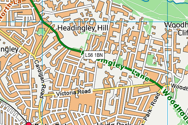
Leeds Girls' High School (Closed) on a map

Leeds Girls' High School (Closed) geodata
| Easting | 428632 |
| Northing | 435632 |
| Latitude | 53.816186 |
| Longitude | -1.566608 |
| Local Authority Name | Leeds |
| Local Authority Code | E08000035 |
| Parliamentary Constituency Name | Leeds Central |
| Parliamentary Constituency Code | E14000777 |
| Region Name | Yorkshire and the Humber |
| Region Code | E15000003 |
| Ward Name | Headingley & Hyde Park |
| Ward Code | E05011397 |
| Output Area Code | E00057645 |
About this data
This data is open data sourced from Active Places Power and licenced under the Active Places Open Data Licence.
| Created On | 14th Dec 2014 |
| Audited On | 26th Jan 2015 |
| Checked On | 9th Dec 2008 |
