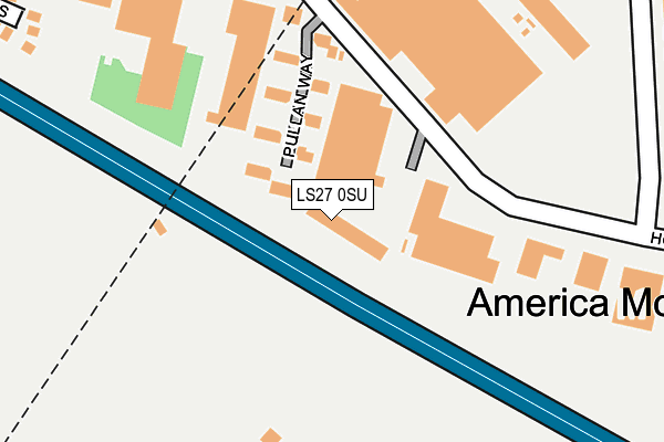
LS27 0SU is located in the Morley South electoral ward, within the metropolitan district of Leeds and the English Parliamentary constituency of Morley and Outwood. The Sub Integrated Care Board (ICB) Location is NHS West Yorkshire ICB - 15F and the police force is West Yorkshire. This postcode has been in use since June 2002.


GetTheData
Source: OS OpenMap – Local (Ordnance Survey)
Source: OS VectorMap District (Ordnance Survey)
Licence: Open Government Licence (requires attribution)
| Easting | 425888 |
| Northing | 426315 |
| Latitude | 53.732606 |
| Longitude | -1.609065 |
GetTheData
Source: Open Postcode Geo
Licence: Open Government Licence
| Country | England |
| Postcode District | LS27 |
➜ See where LS27 is on a map ➜ Where is Morley? | |
GetTheData
Source: Land Registry Price Paid Data
Licence: Open Government Licence
Elevation or altitude of LS27 0SU as distance above sea level:
| Metres | Feet | |
|---|---|---|
| Elevation | 160m | 525ft |
Elevation is measured from the approximate centre of the postcode, to the nearest point on an OS contour line from OS Terrain 50, which has contour spacing of ten vertical metres.
➜ How high above sea level am I? Find the elevation of your current position using your device's GPS.
GetTheData
Source: Open Postcode Elevation
Licence: Open Government Licence
| Ward | Morley South |
| Constituency | Morley And Outwood |
GetTheData
Source: ONS Postcode Database
Licence: Open Government Licence
| Cooperative Road | Morley | 435m |
| Scotchman Lane | Morley | 437m |
| Scotchman Ln The Gardens (Scotchman Lane) | Morley | 444m |
| Scotchman Lane | Morley | 451m |
| Scotchman Lane | Morley | 463m |
| Morley Station | 2.3km |
| Batley Station | 2.7km |
| Cottingley Station | 4.2km |
GetTheData
Source: NaPTAN
Licence: Open Government Licence
GetTheData
Source: ONS Postcode Database
Licence: Open Government Licence


➜ Get more ratings from the Food Standards Agency
GetTheData
Source: Food Standards Agency
Licence: FSA terms & conditions
| Last Collection | |||
|---|---|---|---|
| Location | Mon-Fri | Sat | Distance |
| Howley Park | 603m | ||
| Top High Street | 17:30 | 11:45 | 693m |
| Fountain Street/ Worral Street | 19:00 | 11:45 | 928m |
GetTheData
Source: Dracos
Licence: Creative Commons Attribution-ShareAlike
The below table lists the International Territorial Level (ITL) codes (formerly Nomenclature of Territorial Units for Statistics (NUTS) codes) and Local Administrative Units (LAU) codes for LS27 0SU:
| ITL 1 Code | Name |
|---|---|
| TLE | Yorkshire and The Humber |
| ITL 2 Code | Name |
| TLE4 | West Yorkshire |
| ITL 3 Code | Name |
| TLE42 | Leeds |
| LAU 1 Code | Name |
| E08000035 | Leeds |
GetTheData
Source: ONS Postcode Directory
Licence: Open Government Licence
The below table lists the Census Output Area (OA), Lower Layer Super Output Area (LSOA), and Middle Layer Super Output Area (MSOA) for LS27 0SU:
| Code | Name | |
|---|---|---|
| OA | E00058209 | |
| LSOA | E01011546 | Leeds 106C |
| MSOA | E02002435 | Leeds 106 |
GetTheData
Source: ONS Postcode Directory
Licence: Open Government Licence
| LS27 0BN | Howley Park Road | 336m |
| LS27 0NS | The Gardens | 350m |
| LS27 0BH | Scotchman Close | 350m |
| LS27 0AZ | Howley Park Terrace | 420m |
| LS27 0AX | America Moor Lane | 430m |
| LS27 0AU | Britannia Road | 455m |
| LS27 0NT | Scotchman Lane | 464m |
| LS27 0BQ | Scotchman Lane | 477m |
| LS27 0AT | Britannia Square | 503m |
| LS27 0BJ | Scotchman Lane | 517m |
GetTheData
Source: Open Postcode Geo; Land Registry Price Paid Data
Licence: Open Government Licence