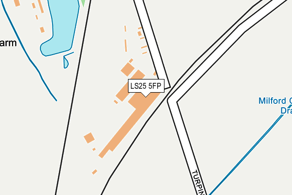
LS25 5FP is located in the Monk Fryston & South Milford electoral ward, within the unitary authority of North Yorkshire and the English Parliamentary constituency of Selby and Ainsty. The Sub Integrated Care Board (ICB) Location is NHS Humber and North Yorkshire ICB - 03Q and the police force is North Yorkshire. This postcode has been in use since December 2012.


GetTheData
Source: OS OpenMap – Local (Ordnance Survey)
Source: OS VectorMap District (Ordnance Survey)
Licence: Open Government Licence (requires attribution)
| Easting | 450574 |
| Northing | 431223 |
| Latitude | 53.774896 |
| Longitude | -1.234092 |
GetTheData
Source: Open Postcode Geo
Licence: Open Government Licence
| Country | England |
| Postcode District | LS25 |
➜ See where LS25 is on a map | |
GetTheData
Source: Land Registry Price Paid Data
Licence: Open Government Licence
Elevation or altitude of LS25 5FP as distance above sea level:
| Metres | Feet | |
|---|---|---|
| Elevation | 10m | 33ft |
Elevation is measured from the approximate centre of the postcode, to the nearest point on an OS contour line from OS Terrain 50, which has contour spacing of ten vertical metres.
➜ How high above sea level am I? Find the elevation of your current position using your device's GPS.
GetTheData
Source: Open Postcode Elevation
Licence: Open Government Licence
| Ward | Monk Fryston & South Milford |
| Constituency | Selby And Ainsty |
GetTheData
Source: ONS Postcode Database
Licence: Open Government Licence
| Beech Drive (Low Street) | South Milford | 944m |
| Beech Drive (Low Street) | South Milford | 956m |
| White Swan (Milford Road) | South Milford | 1,028m |
| Steincroft Road (Sand Lane) | South Milford | 1,040m |
| Steincroft Road (Sand Lane) | South Milford | 1,042m |
| South Milford Station | 1.4km |
| Sherburn-in-Elmet Station | 2.5km |
GetTheData
Source: NaPTAN
Licence: Open Government Licence
GetTheData
Source: ONS Postcode Database
Licence: Open Government Licence


➜ Get more ratings from the Food Standards Agency
GetTheData
Source: Food Standards Agency
Licence: FSA terms & conditions
| Last Collection | |||
|---|---|---|---|
| Location | Mon-Fri | Sat | Distance |
| Common Lane/Mill Lane | 16:15 | 09:45 | 932m |
| South Milford P.o. | 17:30 | 11:00 | 1,207m |
| Monk Fryston P.o. | 16:15 | 11:00 | 1,532m |
GetTheData
Source: Dracos
Licence: Creative Commons Attribution-ShareAlike
The below table lists the International Territorial Level (ITL) codes (formerly Nomenclature of Territorial Units for Statistics (NUTS) codes) and Local Administrative Units (LAU) codes for LS25 5FP:
| ITL 1 Code | Name |
|---|---|
| TLE | Yorkshire and The Humber |
| ITL 2 Code | Name |
| TLE2 | North Yorkshire |
| ITL 3 Code | Name |
| TLE22 | North Yorkshire CC |
| LAU 1 Code | Name |
| E07000169 | Selby |
GetTheData
Source: ONS Postcode Directory
Licence: Open Government Licence
The below table lists the Census Output Area (OA), Lower Layer Super Output Area (LSOA), and Middle Layer Super Output Area (MSOA) for LS25 5FP:
| Code | Name | |
|---|---|---|
| OA | E00142142 | |
| LSOA | E01027898 | Selby 004A |
| MSOA | E02005812 | Selby 004 |
GetTheData
Source: ONS Postcode Directory
Licence: Open Government Licence
| LS25 5BY | Hampton Row | 472m |
| LS25 5FL | Black Lane | 599m |
| LS25 5FF | Croft Close | 620m |
| LS25 5FH | Southland Court | 624m |
| LS25 5FD | Fryston View | 650m |
| LS25 5DH | Ingthorne Lane | 657m |
| LS25 5DF | Brooklands | 663m |
| LS25 5FN | Swan Road | 674m |
| LS25 5FG | Thatch Close | 675m |
| LS25 5FB | Nursery Close | 687m |
GetTheData
Source: Open Postcode Geo; Land Registry Price Paid Data
Licence: Open Government Licence