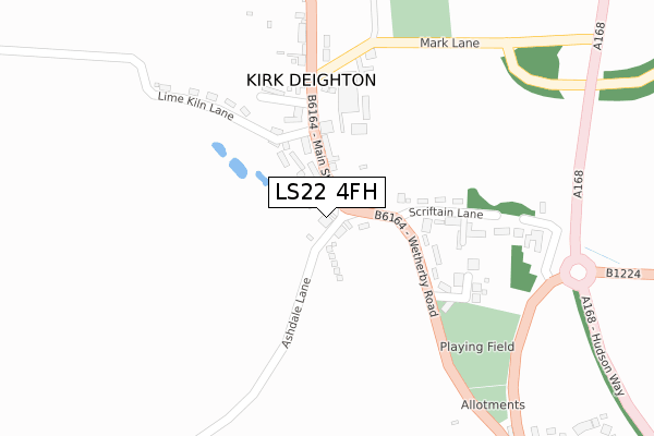
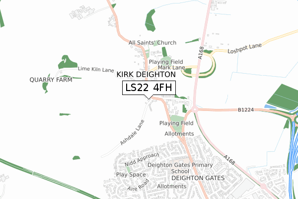
LS22 4FH lies on Ashdale Lane in Kirk Deighton, Wetherby. LS22 4FH is located in the Spofforth with Lower Wharfedale & Tockwith electoral ward, within the unitary authority of North Yorkshire and the English Parliamentary constituency of Selby and Ainsty. The Sub Integrated Care Board (ICB) Location is NHS Humber and North Yorkshire ICB - 42D and the police force is North Yorkshire. This postcode has been in use since January 1980.


GetTheData
Source: OS Open Zoomstack (Ordnance Survey)
Licence: Open Government Licence (requires attribution)
Attribution: Contains OS data © Crown copyright and database right 2025
Source: Open Postcode Geo
Licence: Open Government Licence (requires attribution)
Attribution: Contains OS data © Crown copyright and database right 2025; Contains Royal Mail data © Royal Mail copyright and database right 2025; Source: Office for National Statistics licensed under the Open Government Licence v.3.0
| Easting | 439899 |
| Northing | 450131 |
| Latitude | 53.945770 |
| Longitude | -1.393613 |
GetTheData
Source: Open Postcode Geo
Licence: Open Government Licence
| Street | Ashdale Lane |
| Locality | Kirk Deighton |
| Town/City | Wetherby |
| Country | England |
| Postcode District | LS22 |
➜ See where LS22 is on a map ➜ Where is Kirk Deighton? | |
GetTheData
Source: Land Registry Price Paid Data
Licence: Open Government Licence
Elevation or altitude of LS22 4FH as distance above sea level:
| Metres | Feet | |
|---|---|---|
| Elevation | 30m | 98ft |
Elevation is measured from the approximate centre of the postcode, to the nearest point on an OS contour line from OS Terrain 50, which has contour spacing of ten vertical metres.
➜ How high above sea level am I? Find the elevation of your current position using your device's GPS.
GetTheData
Source: Open Postcode Elevation
Licence: Open Government Licence
| Ward | Spofforth With Lower Wharfedale & Tockwith |
| Constituency | Selby And Ainsty |
GetTheData
Source: ONS Postcode Database
Licence: Open Government Licence
| Bay Horse (Main Street) | Kirk Deighton | 171m |
| Football Ground (Wetherby Road) | Kirk Deighton | 197m |
| Football Ground (Wetherby Road) | Kirk Deighton | 205m |
| Mark Lane (Lime Kiln Lane) | Kirk Deighton | 238m |
| Aire Road Loxley Grove (Aire Road) | Wetherby | 518m |
GetTheData
Source: NaPTAN
Licence: Open Government Licence
| Percentage of properties with Next Generation Access | 100.0% |
| Percentage of properties with Superfast Broadband | 100.0% |
| Percentage of properties with Ultrafast Broadband | 0.0% |
| Percentage of properties with Full Fibre Broadband | 0.0% |
Superfast Broadband is between 30Mbps and 300Mbps
Ultrafast Broadband is > 300Mbps
| Percentage of properties unable to receive 2Mbps | 0.0% |
| Percentage of properties unable to receive 5Mbps | 0.0% |
| Percentage of properties unable to receive 10Mbps | 0.0% |
| Percentage of properties unable to receive 30Mbps | 0.0% |
GetTheData
Source: Ofcom
Licence: Ofcom Terms of Use (requires attribution)
GetTheData
Source: ONS Postcode Database
Licence: Open Government Licence


➜ Get more ratings from the Food Standards Agency
GetTheData
Source: Food Standards Agency
Licence: FSA terms & conditions
| Last Collection | |||
|---|---|---|---|
| Location | Mon-Fri | Sat | Distance |
| Kirk Deighton | 16:15 | 09:45 | 166m |
| Deighton Bar P.o. | 17:30 | 12:15 | 536m |
| School House Terrace | 16:15 | 09:45 | 691m |
GetTheData
Source: Dracos
Licence: Creative Commons Attribution-ShareAlike
The below table lists the International Territorial Level (ITL) codes (formerly Nomenclature of Territorial Units for Statistics (NUTS) codes) and Local Administrative Units (LAU) codes for LS22 4FH:
| ITL 1 Code | Name |
|---|---|
| TLE | Yorkshire and The Humber |
| ITL 2 Code | Name |
| TLE2 | North Yorkshire |
| ITL 3 Code | Name |
| TLE22 | North Yorkshire CC |
| LAU 1 Code | Name |
| E07000165 | Harrogate |
GetTheData
Source: ONS Postcode Directory
Licence: Open Government Licence
The below table lists the Census Output Area (OA), Lower Layer Super Output Area (LSOA), and Middle Layer Super Output Area (MSOA) for LS22 4FH:
| Code | Name | |
|---|---|---|
| OA | E00141091 | |
| LSOA | E01027703 | Harrogate 016E |
| MSOA | E02005776 | Harrogate 016 |
GetTheData
Source: ONS Postcode Directory
Licence: Open Government Licence
| LS22 4DX | Wetherby Road | 58m |
| LS22 4DY | Garth End | 71m |
| LS22 4DZ | Main Street | 86m |
| LS22 4DS | Ashdale View | 184m |
| LS22 4DT | Scriftain Lane | 196m |
| LS22 4EE | St Marks Terrace | 211m |
| LS22 4EA | Lime Kiln Lane | 279m |
| LS22 4EB | Main Street | 314m |
| LS22 4EF | Mark Lane | 381m |
| LS22 7UF | Ure Grove | 421m |
GetTheData
Source: Open Postcode Geo; Land Registry Price Paid Data
Licence: Open Government Licence