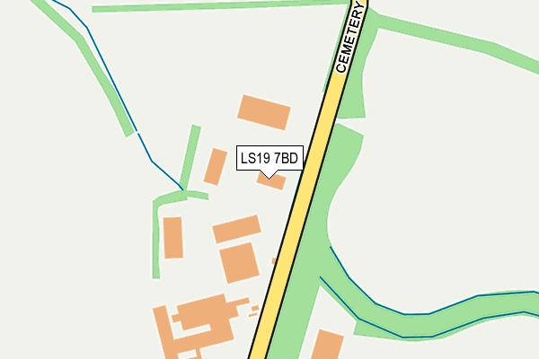
LS19 7BD is located in the Otley & Yeadon electoral ward, within the metropolitan district of Leeds and the English Parliamentary constituency of Leeds North West. The Sub Integrated Care Board (ICB) Location is NHS West Yorkshire ICB - 15F and the police force is West Yorkshire. This postcode has been in use since January 1980.


GetTheData
Source: OS OpenMap – Local (Ordnance Survey)
Source: OS VectorMap District (Ordnance Survey)
Licence: Open Government Licence (requires attribution)
| Easting | 421780 |
| Northing | 442630 |
| Latitude | 53.879413 |
| Longitude | -1.670183 |
GetTheData
Source: Open Postcode Geo
Licence: Open Government Licence
| Country | England |
| Postcode District | LS19 |
➜ See where LS19 is on a map ➜ Where is Yeadon? | |
GetTheData
Source: Land Registry Price Paid Data
Licence: Open Government Licence
Elevation or altitude of LS19 7BD as distance above sea level:
| Metres | Feet | |
|---|---|---|
| Elevation | 210m | 689ft |
Elevation is measured from the approximate centre of the postcode, to the nearest point on an OS contour line from OS Terrain 50, which has contour spacing of ten vertical metres.
➜ How high above sea level am I? Find the elevation of your current position using your device's GPS.
GetTheData
Source: Open Postcode Elevation
Licence: Open Government Licence
| Ward | Otley & Yeadon |
| Constituency | Leeds North West |
GetTheData
Source: ONS Postcode Database
Licence: Open Government Licence
| Warren House Lane | Yeadon | 680m |
| Harrogate Road | Leeds Bradford Airport | 690m |
| Warren House Lane | Yeadon | 702m |
| Harrogate Road | Leeds Bradford Airport | 703m |
| Harrogate Rd Airport Ind Est (Harrogate Road) | Leeds Bradford Airport | 754m |
| Guiseley Station | 3km |
| Horsforth Station | 4.4km |
| Menston Station | 4.5km |
GetTheData
Source: NaPTAN
Licence: Open Government Licence
GetTheData
Source: ONS Postcode Database
Licence: Open Government Licence


➜ Get more ratings from the Food Standards Agency
GetTheData
Source: Food Standards Agency
Licence: FSA terms & conditions
| Last Collection | |||
|---|---|---|---|
| Location | Mon-Fri | Sat | Distance |
| Phone Box East Carlton Village | 17:30 | 09:45 | 560m |
| Ellsmere Mount | 17:00 | 11:00 | 1,400m |
| Yeadon P.o. | 17:30 | 12:15 | 1,674m |
GetTheData
Source: Dracos
Licence: Creative Commons Attribution-ShareAlike
The below table lists the International Territorial Level (ITL) codes (formerly Nomenclature of Territorial Units for Statistics (NUTS) codes) and Local Administrative Units (LAU) codes for LS19 7BD:
| ITL 1 Code | Name |
|---|---|
| TLE | Yorkshire and The Humber |
| ITL 2 Code | Name |
| TLE4 | West Yorkshire |
| ITL 3 Code | Name |
| TLE42 | Leeds |
| LAU 1 Code | Name |
| E08000035 | Leeds |
GetTheData
Source: ONS Postcode Directory
Licence: Open Government Licence
The below table lists the Census Output Area (OA), Lower Layer Super Output Area (LSOA), and Middle Layer Super Output Area (MSOA) for LS19 7BD:
| Code | Name | |
|---|---|---|
| OA | E00058332 | |
| LSOA | E01032503 | Leeds 007E |
| MSOA | E02002336 | Leeds 007 |
GetTheData
Source: ONS Postcode Directory
Licence: Open Government Licence
| LS19 7BE | Carlton Lane | 372m |
| LS19 7BG | Carlton Lane | 576m |
| LS19 7BQ | Church Garth | 712m |
| LS20 9NW | Carlton Lane | 1045m |
| LS19 7XE | Haw Avenue | 1065m |
| LS19 7XD | Haw Avenue | 1108m |
| LS19 7XF | Haw View | 1158m |
| LS19 7UR | Cemetery Road | 1173m |
| LS19 7XA | Hawthorn Drive | 1181m |
| LS19 7UZ | Carlton Mount | 1200m |
GetTheData
Source: Open Postcode Geo; Land Registry Price Paid Data
Licence: Open Government Licence