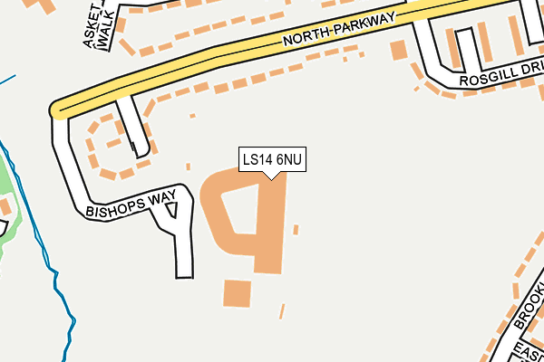
LS14 6NU is located in the Killingbeck & Seacroft electoral ward, within the metropolitan district of Leeds and the English Parliamentary constituency of Leeds East. The Sub Integrated Care Board (ICB) Location is NHS West Yorkshire ICB - 15F and the police force is West Yorkshire. This postcode has been in use since November 2006.


GetTheData
Source: OS OpenMap – Local (Ordnance Survey)
Source: OS VectorMap District (Ordnance Survey)
Licence: Open Government Licence (requires attribution)
| Easting | 434404 |
| Northing | 436058 |
| Latitude | 53.819683 |
| Longitude | -1.478901 |
GetTheData
Source: Open Postcode Geo
Licence: Open Government Licence
| Country | England |
| Postcode District | LS14 |
➜ See where LS14 is on a map ➜ Where is Leeds? | |
GetTheData
Source: Land Registry Price Paid Data
Licence: Open Government Licence
Elevation or altitude of LS14 6NU as distance above sea level:
| Metres | Feet | |
|---|---|---|
| Elevation | 60m | 197ft |
Elevation is measured from the approximate centre of the postcode, to the nearest point on an OS contour line from OS Terrain 50, which has contour spacing of ten vertical metres.
➜ How high above sea level am I? Find the elevation of your current position using your device's GPS.
GetTheData
Source: Open Postcode Elevation
Licence: Open Government Licence
| Ward | Killingbeck & Seacroft |
| Constituency | Leeds East |
GetTheData
Source: ONS Postcode Database
Licence: Open Government Licence
| Fearnville Place | Fearnville | 226m |
| Asket Crescent (Asket Avenue) | Seacroft | 259m |
| Asket Crescent (Asket Avenue) | Seacroft | 267m |
| Grange Park Road Foxwood Walk (Grange Park Road) | Fearnville | 331m |
| Asket Avenue Kentmere Approach (Asket Avenue) | Seacroft | 336m |
| Cross Gates Station | 2.4km |
| Leeds Station | 5.3km |
GetTheData
Source: NaPTAN
Licence: Open Government Licence
GetTheData
Source: ONS Postcode Database
Licence: Open Government Licence


➜ Get more ratings from the Food Standards Agency
GetTheData
Source: Food Standards Agency
Licence: FSA terms & conditions
| Last Collection | |||
|---|---|---|---|
| Location | Mon-Fri | Sat | Distance |
| Fearnville Drive/Terrace | 17:30 | 11:00 | 323m |
| Kentmere Approach | 17:30 | 11:30 | 384m |
| Southwaite Lane/Brooklands Ave | 17:30 | 12:30 | 441m |
GetTheData
Source: Dracos
Licence: Creative Commons Attribution-ShareAlike
The below table lists the International Territorial Level (ITL) codes (formerly Nomenclature of Territorial Units for Statistics (NUTS) codes) and Local Administrative Units (LAU) codes for LS14 6NU:
| ITL 1 Code | Name |
|---|---|
| TLE | Yorkshire and The Humber |
| ITL 2 Code | Name |
| TLE4 | West Yorkshire |
| ITL 3 Code | Name |
| TLE42 | Leeds |
| LAU 1 Code | Name |
| E08000035 | Leeds |
GetTheData
Source: ONS Postcode Directory
Licence: Open Government Licence
The below table lists the Census Output Area (OA), Lower Layer Super Output Area (LSOA), and Middle Layer Super Output Area (MSOA) for LS14 6NU:
| Code | Name | |
|---|---|---|
| OA | E00058799 | |
| LSOA | E01011662 | Leeds 040E |
| MSOA | E02002369 | Leeds 040 |
GetTheData
Source: ONS Postcode Directory
Licence: Open Government Licence
| LS14 6RG | Foundry Mill Gardens | 90m |
| LS8 3EE | Foxwood Farm Way | 158m |
| LS14 1JE | Asket Walk | 198m |
| LS8 3DX | Fearnville Place | 216m |
| LS14 6RF | North Parkway | 229m |
| LS8 3BW | Foxwood Close | 238m |
| LS8 3DY | Fearnville Place | 259m |
| LS14 6SB | Brooklands Drive | 281m |
| LS14 6SD | Foundry Mill Drive | 299m |
| LS8 3BJ | Grange Park Road | 301m |
GetTheData
Source: Open Postcode Geo; Land Registry Price Paid Data
Licence: Open Government Licence