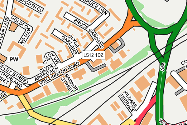
LS12 1DZ is located in the Armley electoral ward, within the metropolitan district of Leeds and the English Parliamentary constituency of Leeds West. The Sub Integrated Care Board (ICB) Location is NHS West Yorkshire ICB - 15F and the police force is West Yorkshire. This postcode has been in use since January 1980.


GetTheData
Source: OS OpenMap – Local (Ordnance Survey)
Source: OS VectorMap District (Ordnance Survey)
Licence: Open Government Licence (requires attribution)
| Easting | 428394 |
| Northing | 432886 |
| Latitude | 53.791519 |
| Longitude | -1.570475 |
GetTheData
Source: Open Postcode Geo
Licence: Open Government Licence
| Country | England |
| Postcode District | LS12 |
➜ See where LS12 is on a map ➜ Where is Leeds? | |
GetTheData
Source: Land Registry Price Paid Data
Licence: Open Government Licence
Elevation or altitude of LS12 1DZ as distance above sea level:
| Metres | Feet | |
|---|---|---|
| Elevation | 40m | 131ft |
Elevation is measured from the approximate centre of the postcode, to the nearest point on an OS contour line from OS Terrain 50, which has contour spacing of ten vertical metres.
➜ How high above sea level am I? Find the elevation of your current position using your device's GPS.
GetTheData
Source: Open Postcode Elevation
Licence: Open Government Licence
| Ward | Armley |
| Constituency | Leeds West |
GetTheData
Source: ONS Postcode Database
Licence: Open Government Licence
| Wellington Rd Clyde Approach (Wellington Road) | New Wortley | 32m |
| Wellington Rd Clyde Approach (Wellington Road) | New Wortley | 103m |
| Wellington Rd Clyde Gardens (Wellington Road) | New Wortley | 123m |
| Copley Hill Wortley (Wellington Road) | New Wortley | 169m |
| Domestic Rd Copley Hill (Gelderd Road) | Wortley | 269m |
| Leeds Station | 1.5km |
| Burley Park Station | 2.3km |
| Cottingley Station | 2.9km |
GetTheData
Source: NaPTAN
Licence: Open Government Licence
GetTheData
Source: ONS Postcode Database
Licence: Open Government Licence


➜ Get more ratings from the Food Standards Agency
GetTheData
Source: Food Standards Agency
Licence: FSA terms & conditions
| Last Collection | |||
|---|---|---|---|
| Location | Mon-Fri | Sat | Distance |
| Gelderd Road Bottom Of Copley Hi | 17:30 | 11:00 | 280m |
| Tong Road Post Office | 18:30 | 12:00 | 418m |
| Suttons Street | 18:30 | 11:00 | 500m |
GetTheData
Source: Dracos
Licence: Creative Commons Attribution-ShareAlike
The below table lists the International Territorial Level (ITL) codes (formerly Nomenclature of Territorial Units for Statistics (NUTS) codes) and Local Administrative Units (LAU) codes for LS12 1DZ:
| ITL 1 Code | Name |
|---|---|
| TLE | Yorkshire and The Humber |
| ITL 2 Code | Name |
| TLE4 | West Yorkshire |
| ITL 3 Code | Name |
| TLE42 | Leeds |
| LAU 1 Code | Name |
| E08000035 | Leeds |
GetTheData
Source: ONS Postcode Directory
Licence: Open Government Licence
The below table lists the Census Output Area (OA), Lower Layer Super Output Area (LSOA), and Middle Layer Super Output Area (MSOA) for LS12 1DZ:
| Code | Name | |
|---|---|---|
| OA | E00057310 | |
| LSOA | E01011363 | Leeds 071E |
| MSOA | E02002400 | Leeds 071 |
GetTheData
Source: ONS Postcode Directory
Licence: Open Government Licence
| LS12 1YA | Bruce Gardens | 98m |
| LS12 1XX | Bruce Lawn | 102m |
| LS12 1XH | Clyde Gardens | 111m |
| LS12 1XQ | Clyde Chase | 138m |
| LS12 1XY | Bruce Lawn | 163m |
| LS12 1XZ | Bruce Gardens | 165m |
| LS12 1XG | Clyde Walk | 184m |
| LS12 1YJ | Bruce Lawn | 187m |
| LS12 1DS | Copley Hill | 244m |
| LS12 6HD | Gelderd Road | 258m |
GetTheData
Source: Open Postcode Geo; Land Registry Price Paid Data
Licence: Open Government Licence