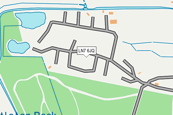
LN7 6JQ is located in the Wold View electoral ward, within the local authority district of West Lindsey and the English Parliamentary constituency of Gainsborough. The Sub Integrated Care Board (ICB) Location is NHS Lincolnshire ICB - 71E and the police force is Lincolnshire. This postcode has been in use since January 1980.


GetTheData
Source: OS OpenMap – Local (Ordnance Survey)
Source: OS VectorMap District (Ordnance Survey)
Licence: Open Government Licence (requires attribution)
| Easting | 508731 |
| Northing | 400967 |
| Latitude | 53.494202 |
| Longitude | -0.362499 |
GetTheData
Source: Open Postcode Geo
Licence: Open Government Licence
| Country | England |
| Postcode District | LN7 |
➜ See where LN7 is on a map | |
GetTheData
Source: Land Registry Price Paid Data
Licence: Open Government Licence
Elevation or altitude of LN7 6JQ as distance above sea level:
| Metres | Feet | |
|---|---|---|
| Elevation | 30m | 98ft |
Elevation is measured from the approximate centre of the postcode, to the nearest point on an OS contour line from OS Terrain 50, which has contour spacing of ten vertical metres.
➜ How high above sea level am I? Find the elevation of your current position using your device's GPS.
GetTheData
Source: Open Postcode Elevation
Licence: Open Government Licence
| Ward | Wold View |
| Constituency | Gainsborough |
GetTheData
Source: ONS Postcode Database
Licence: Open Government Licence
GetTheData
Source: ONS Postcode Database
Licence: Open Government Licence


➜ Get more ratings from the Food Standards Agency
GetTheData
Source: Food Standards Agency
Licence: FSA terms & conditions
| Last Collection | |||
|---|---|---|---|
| Location | Mon-Fri | Sat | Distance |
| Moortown Station | 16:30 | 08:15 | 1,560m |
| North Kelsey Moor | 16:15 | 08:30 | 1,888m |
| Draycott | 16:30 | 09:00 | 1,912m |
GetTheData
Source: Dracos
Licence: Creative Commons Attribution-ShareAlike
The below table lists the International Territorial Level (ITL) codes (formerly Nomenclature of Territorial Units for Statistics (NUTS) codes) and Local Administrative Units (LAU) codes for LN7 6JQ:
| ITL 1 Code | Name |
|---|---|
| TLF | East Midlands (England) |
| ITL 2 Code | Name |
| TLF3 | Lincolnshire |
| ITL 3 Code | Name |
| TLF30 | Lincolnshire CC |
| LAU 1 Code | Name |
| E07000142 | West Lindsey |
GetTheData
Source: ONS Postcode Directory
Licence: Open Government Licence
The below table lists the Census Output Area (OA), Lower Layer Super Output Area (LSOA), and Middle Layer Super Output Area (MSOA) for LN7 6JQ:
| Code | Name | |
|---|---|---|
| OA | E00134208 | |
| LSOA | E01026416 | West Lindsey 001D |
| MSOA | E02005492 | West Lindsey 001 |
GetTheData
Source: ONS Postcode Directory
Licence: Open Government Licence
| LN7 6HH | Caistor Road | 671m |
| LN7 6HY | Moortown Road | 698m |
| LN7 6HX | Moortown Road | 1266m |
| LN7 6GJ | Hadrian Way | 1507m |
| LN7 6GR | Lucius Walk | 1523m |
| LN7 6GY | Tiberius Walk | 1546m |
| LN7 6SF | North Kelsey Road | 1583m |
| LN7 6HG | Smithfield Road | 1600m |
| LN7 6GN | Galba Road | 1605m |
| LN7 6GH | Augustus Walk | 1613m |
GetTheData
Source: Open Postcode Geo; Land Registry Price Paid Data
Licence: Open Government Licence