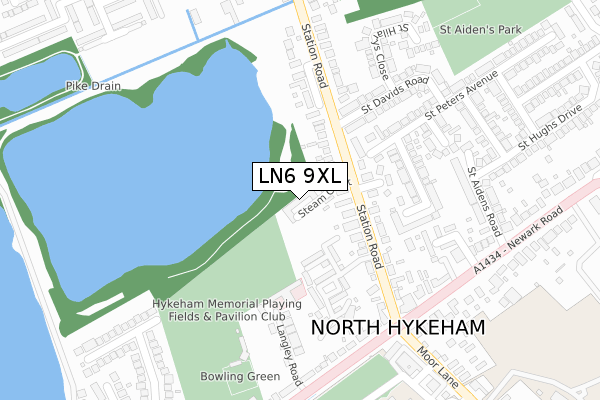
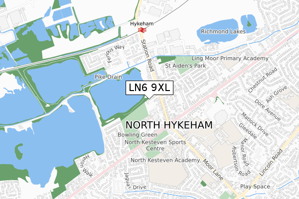
LN6 9XL is located in the Hykeham Memorial electoral ward, within the local authority district of North Kesteven and the English Parliamentary constituency of Sleaford and North Hykeham. The Sub Integrated Care Board (ICB) Location is NHS Lincolnshire ICB - 71E and the police force is Lincolnshire. This postcode has been in use since February 2018.


GetTheData
Source: OS Open Zoomstack (Ordnance Survey)
Licence: Open Government Licence (requires attribution)
Attribution: Contains OS data © Crown copyright and database right 2025
Source: Open Postcode Geo
Licence: Open Government Licence (requires attribution)
Attribution: Contains OS data © Crown copyright and database right 2025; Contains Royal Mail data © Royal Mail copyright and database right 2025; Source: Office for National Statistics licensed under the Open Government Licence v.3.0
| Easting | 493696 |
| Northing | 366775 |
| Latitude | 53.189844 |
| Longitude | -0.599151 |
GetTheData
Source: Open Postcode Geo
Licence: Open Government Licence
| Country | England |
| Postcode District | LN6 |
➜ See where LN6 is on a map ➜ Where is North Hykeham? | |
GetTheData
Source: Land Registry Price Paid Data
Licence: Open Government Licence
Elevation or altitude of LN6 9XL as distance above sea level:
| Metres | Feet | |
|---|---|---|
| Elevation | 10m | 33ft |
Elevation is measured from the approximate centre of the postcode, to the nearest point on an OS contour line from OS Terrain 50, which has contour spacing of ten vertical metres.
➜ How high above sea level am I? Find the elevation of your current position using your device's GPS.
GetTheData
Source: Open Postcode Elevation
Licence: Open Government Licence
| Ward | Hykeham Memorial |
| Constituency | Sleaford And North Hykeham |
GetTheData
Source: ONS Postcode Database
Licence: Open Government Licence
| Hamilton Road (Station Road) | North Hykeham | 92m |
| Hamilton Road (Station Road) | North Hykeham | 101m |
| Station Road (Newark Road) | North Hykeham | 278m |
| Station Road (Newark Road) | North Hykeham | 286m |
| Grace Avenue (Station Road) | North Hykeham | 334m |
| Hykeham Station | 0.6km |
| Lincoln Central Station | 5.7km |
GetTheData
Source: NaPTAN
Licence: Open Government Licence
| Percentage of properties with Next Generation Access | 100.0% |
| Percentage of properties with Superfast Broadband | 100.0% |
| Percentage of properties with Ultrafast Broadband | 0.0% |
| Percentage of properties with Full Fibre Broadband | 0.0% |
Superfast Broadband is between 30Mbps and 300Mbps
Ultrafast Broadband is > 300Mbps
| Median download speed | 39.8Mbps |
| Average download speed | 34.9Mbps |
| Maximum download speed | 60.15Mbps |
| Median upload speed | 9.8Mbps |
| Average upload speed | 7.6Mbps |
| Maximum upload speed | 19.60Mbps |
| Percentage of properties unable to receive 2Mbps | 0.0% |
| Percentage of properties unable to receive 5Mbps | 0.0% |
| Percentage of properties unable to receive 10Mbps | 0.0% |
| Percentage of properties unable to receive 30Mbps | 0.0% |
GetTheData
Source: Ofcom
Licence: Ofcom Terms of Use (requires attribution)
GetTheData
Source: ONS Postcode Database
Licence: Open Government Licence


➜ Get more ratings from the Food Standards Agency
GetTheData
Source: Food Standards Agency
Licence: FSA terms & conditions
| Last Collection | |||
|---|---|---|---|
| Location | Mon-Fri | Sat | Distance |
| Hykeham Moor P.o. | 17:15 | 12:15 | 287m |
| High Street | 16:45 | 11:00 | 443m |
| Macmillan Avenue | 17:00 | 11:15 | 523m |
GetTheData
Source: Dracos
Licence: Creative Commons Attribution-ShareAlike
The below table lists the International Territorial Level (ITL) codes (formerly Nomenclature of Territorial Units for Statistics (NUTS) codes) and Local Administrative Units (LAU) codes for LN6 9XL:
| ITL 1 Code | Name |
|---|---|
| TLF | East Midlands (England) |
| ITL 2 Code | Name |
| TLF3 | Lincolnshire |
| ITL 3 Code | Name |
| TLF30 | Lincolnshire CC |
| LAU 1 Code | Name |
| E07000139 | North Kesteven |
GetTheData
Source: ONS Postcode Directory
Licence: Open Government Licence
The below table lists the Census Output Area (OA), Lower Layer Super Output Area (LSOA), and Middle Layer Super Output Area (MSOA) for LN6 9XL:
| Code | Name | |
|---|---|---|
| OA | E00133119 | |
| LSOA | E01032992 | North Kesteven 014F |
| MSOA | E02006867 | North Kesteven 014 |
GetTheData
Source: ONS Postcode Directory
Licence: Open Government Licence
| LN6 9AQ | Station Road | 99m |
| LN6 9AH | Hamilton Road | 125m |
| LN6 8QA | St Francis Court | 187m |
| LN6 9FF | Leys Close | 194m |
| LN6 8QJ | St Peters Avenue | 205m |
| LN6 8QH | St Crispins Close | 213m |
| LN6 9RX | Langley Road | 220m |
| LN6 8QL | St Davids Road | 223m |
| LN6 8JR | Lindum Mews | 239m |
| LN6 9RU | Newark Road | 261m |
GetTheData
Source: Open Postcode Geo; Land Registry Price Paid Data
Licence: Open Government Licence