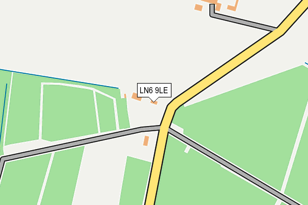
LN6 9LE is in Stapleford, Lincoln. LN6 9LE is located in the Bassingham Rural electoral ward, within the local authority district of North Kesteven and the English Parliamentary constituency of Sleaford and North Hykeham. The Sub Integrated Care Board (ICB) Location is NHS Lincolnshire ICB - 71E and the police force is Lincolnshire. This postcode has been in use since January 1980.


GetTheData
Source: OS OpenMap – Local (Ordnance Survey)
Source: OS VectorMap District (Ordnance Survey)
Licence: Open Government Licence (requires attribution)
| Easting | 486279 |
| Northing | 357381 |
| Latitude | 53.106654 |
| Longitude | -0.712654 |
GetTheData
Source: Open Postcode Geo
Licence: Open Government Licence
| Locality | Stapleford |
| Town/City | Lincoln |
| Country | England |
| Postcode District | LN6 |
➜ See where LN6 is on a map | |
GetTheData
Source: Land Registry Price Paid Data
Licence: Open Government Licence
Elevation or altitude of LN6 9LE as distance above sea level:
| Metres | Feet | |
|---|---|---|
| Elevation | 20m | 66ft |
Elevation is measured from the approximate centre of the postcode, to the nearest point on an OS contour line from OS Terrain 50, which has contour spacing of ten vertical metres.
➜ How high above sea level am I? Find the elevation of your current position using your device's GPS.
GetTheData
Source: Open Postcode Elevation
Licence: Open Government Licence
| Ward | Bassingham Rural |
| Constituency | Sleaford And North Hykeham |
GetTheData
Source: ONS Postcode Database
Licence: Open Government Licence
| Collingham Station | 4.9km |
GetTheData
Source: NaPTAN
Licence: Open Government Licence
| Percentage of properties with Next Generation Access | 100.0% |
| Percentage of properties with Superfast Broadband | 0.0% |
| Percentage of properties with Ultrafast Broadband | 0.0% |
| Percentage of properties with Full Fibre Broadband | 0.0% |
Superfast Broadband is between 30Mbps and 300Mbps
Ultrafast Broadband is > 300Mbps
| Percentage of properties unable to receive 2Mbps | 100.0% |
| Percentage of properties unable to receive 5Mbps | 100.0% |
| Percentage of properties unable to receive 10Mbps | 100.0% |
| Percentage of properties unable to receive 30Mbps | 100.0% |
GetTheData
Source: Ofcom
Licence: Ofcom Terms of Use (requires attribution)
GetTheData
Source: ONS Postcode Database
Licence: Open Government Licence
| Last Collection | |||
|---|---|---|---|
| Location | Mon-Fri | Sat | Distance |
| Brough | 16:15 | 11:00 | 2,762m |
| Village Hall | 16:00 | 11:30 | 4,012m |
| Langford | 17:00 | 10:30 | 4,154m |
GetTheData
Source: Dracos
Licence: Creative Commons Attribution-ShareAlike
The below table lists the International Territorial Level (ITL) codes (formerly Nomenclature of Territorial Units for Statistics (NUTS) codes) and Local Administrative Units (LAU) codes for LN6 9LE:
| ITL 1 Code | Name |
|---|---|
| TLF | East Midlands (England) |
| ITL 2 Code | Name |
| TLF3 | Lincolnshire |
| ITL 3 Code | Name |
| TLF30 | Lincolnshire CC |
| LAU 1 Code | Name |
| E07000139 | North Kesteven |
GetTheData
Source: ONS Postcode Directory
Licence: Open Government Licence
The below table lists the Census Output Area (OA), Lower Layer Super Output Area (LSOA), and Middle Layer Super Output Area (MSOA) for LN6 9LE:
| Code | Name | |
|---|---|---|
| OA | E00132992 | |
| LSOA | E01026192 | North Kesteven 006A |
| MSOA | E02005458 | North Kesteven 006 |
GetTheData
Source: ONS Postcode Directory
Licence: Open Government Licence
| NG24 2PD | Danethorpe Lane | 1117m |
| NG23 7QD | Stapleford Lane | 1385m |
| LN6 9LD | Newark Road | 1595m |
| NG24 2PE | Norwell Lane | 1597m |
| LN6 9LA | Brecks Lane | 1882m |
| LN6 9LB | High Street | 1900m |
| LN6 9LH | The Paddocks | 2007m |
| LN6 9YL | Hall Lodge Gardens | 2081m |
| LN6 9JN | Brills Hill | 2142m |
| LN6 9JY | Norton Road | 2183m |
GetTheData
Source: Open Postcode Geo; Land Registry Price Paid Data
Licence: Open Government Licence