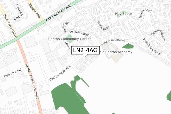
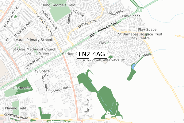
LN2 4AG lies on Carlton Boulevard in Lincoln. LN2 4AG is located in the Abbey electoral ward, within the local authority district of Lincoln and the English Parliamentary constituency of Lincoln. The Sub Integrated Care Board (ICB) Location is NHS Lincolnshire ICB - 71E and the police force is Lincolnshire. This postcode has been in use since November 2007.


GetTheData
Source: OS Open Zoomstack (Ordnance Survey)
Licence: Open Government Licence (requires attribution)
Attribution: Contains OS data © Crown copyright and database right 2025
Source: Open Postcode Geo
Licence: Open Government Licence (requires attribution)
Attribution: Contains OS data © Crown copyright and database right 2025; Contains Royal Mail data © Royal Mail copyright and database right 2025; Source: Office for National Statistics licensed under the Open Government Licence v.3.0
| Easting | 499891 |
| Northing | 372642 |
| Latitude | 53.241416 |
| Longitude | -0.504634 |
GetTheData
Source: Open Postcode Geo
Licence: Open Government Licence
| Street | Carlton Boulevard |
| Town/City | Lincoln |
| Country | England |
| Postcode District | LN2 |
➜ See where LN2 is on a map ➜ Where is Lincoln? | |
GetTheData
Source: Land Registry Price Paid Data
Licence: Open Government Licence
Elevation or altitude of LN2 4AG as distance above sea level:
| Metres | Feet | |
|---|---|---|
| Elevation | 40m | 131ft |
Elevation is measured from the approximate centre of the postcode, to the nearest point on an OS contour line from OS Terrain 50, which has contour spacing of ten vertical metres.
➜ How high above sea level am I? Find the elevation of your current position using your device's GPS.
GetTheData
Source: Open Postcode Elevation
Licence: Open Government Licence
| Ward | Abbey |
| Constituency | Lincoln |
GetTheData
Source: ONS Postcode Database
Licence: Open Government Licence
| Carlton Centre (Carlton Boulevard) | Lincoln | 119m |
| Carlton Centre (Carlton Boulevard) | Lincoln | 139m |
| Padley Road (Carlton Boulevard) | Lincoln | 147m |
| Padley Road (Carlton Boulevard) | Lincoln | 234m |
| Focus Diy (Wragby Road) | Glebe Park | 360m |
| Lincoln Central Station | 2.9km |
GetTheData
Source: NaPTAN
Licence: Open Government Licence
| Percentage of properties with Next Generation Access | 100.0% |
| Percentage of properties with Superfast Broadband | 100.0% |
| Percentage of properties with Ultrafast Broadband | 0.0% |
| Percentage of properties with Full Fibre Broadband | 0.0% |
Superfast Broadband is between 30Mbps and 300Mbps
Ultrafast Broadband is > 300Mbps
| Median download speed | 39.1Mbps |
| Average download speed | 36.2Mbps |
| Maximum download speed | 76.65Mbps |
| Median upload speed | 9.8Mbps |
| Average upload speed | 9.7Mbps |
| Maximum upload speed | 20.00Mbps |
| Percentage of properties unable to receive 2Mbps | 0.0% |
| Percentage of properties unable to receive 5Mbps | 0.0% |
| Percentage of properties unable to receive 10Mbps | 0.0% |
| Percentage of properties unable to receive 30Mbps | 0.0% |
GetTheData
Source: Ofcom
Licence: Ofcom Terms of Use (requires attribution)
GetTheData
Source: ONS Postcode Database
Licence: Open Government Licence


➜ Get more ratings from the Food Standards Agency
GetTheData
Source: Food Standards Agency
Licence: FSA terms & conditions
| Last Collection | |||
|---|---|---|---|
| Location | Mon-Fri | Sat | Distance |
| Wolsey Way | 17:30 | 12:15 | 537m |
| Greetwell Road | 17:30 | 11:15 | 1,288m |
| Lincoln Road | 17:30 | 12:45 | 1,468m |
GetTheData
Source: Dracos
Licence: Creative Commons Attribution-ShareAlike
The below table lists the International Territorial Level (ITL) codes (formerly Nomenclature of Territorial Units for Statistics (NUTS) codes) and Local Administrative Units (LAU) codes for LN2 4AG:
| ITL 1 Code | Name |
|---|---|
| TLF | East Midlands (England) |
| ITL 2 Code | Name |
| TLF3 | Lincolnshire |
| ITL 3 Code | Name |
| TLF30 | Lincolnshire CC |
| LAU 1 Code | Name |
| E07000138 | Lincoln |
GetTheData
Source: ONS Postcode Directory
Licence: Open Government Licence
The below table lists the Census Output Area (OA), Lower Layer Super Output Area (LSOA), and Middle Layer Super Output Area (MSOA) for LN2 4AG:
| Code | Name | |
|---|---|---|
| OA | E00173646 | |
| LSOA | E01026123 | Lincoln 004B |
| MSOA | E02005445 | Lincoln 004 |
GetTheData
Source: ONS Postcode Directory
Licence: Open Government Licence
| LN2 4FT | Pitcairn Avenue | 37m |
| LN2 4FQ | Pigot Way | 42m |
| LN2 4GQ | Warren Court | 43m |
| LN2 4BG | Gage Court | 54m |
| LN2 4UZ | Olsen Rise | 54m |
| LN2 4FZ | Reed Drive | 57m |
| LN2 4GP | Stark Way | 60m |
| LN2 4DU | Howe Court | 65m |
| LN2 4FW | Putnam Drive | 82m |
| LN2 4UT | Olsen Rise | 97m |
GetTheData
Source: Open Postcode Geo; Land Registry Price Paid Data
Licence: Open Government Licence