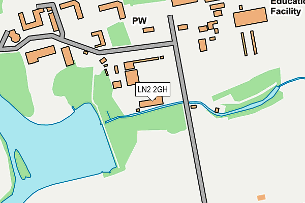
LN2 2GH is located in the Nettleham electoral ward, within the local authority district of West Lindsey and the English Parliamentary constituency of Gainsborough. The Sub Integrated Care Board (ICB) Location is NHS Lincolnshire ICB - 71E and the police force is Lincolnshire. This postcode has been in use since December 2000.


GetTheData
Source: OS OpenMap – Local (Ordnance Survey)
Source: OS VectorMap District (Ordnance Survey)
Licence: Open Government Licence (requires attribution)
| Easting | 498381 |
| Northing | 375520 |
| Latitude | 53.267581 |
| Longitude | -0.526365 |
GetTheData
Source: Open Postcode Geo
Licence: Open Government Licence
| Country | England |
| Postcode District | LN2 |
➜ See where LN2 is on a map | |
GetTheData
Source: Land Registry Price Paid Data
Licence: Open Government Licence
Elevation or altitude of LN2 2GH as distance above sea level:
| Metres | Feet | |
|---|---|---|
| Elevation | 40m | 131ft |
Elevation is measured from the approximate centre of the postcode, to the nearest point on an OS contour line from OS Terrain 50, which has contour spacing of ten vertical metres.
➜ How high above sea level am I? Find the elevation of your current position using your device's GPS.
GetTheData
Source: Open Postcode Elevation
Licence: Open Government Licence
| Ward | Nettleham |
| Constituency | Gainsborough |
GetTheData
Source: ONS Postcode Database
Licence: Open Government Licence
| College Of Agriculture (Lawress Hall) | Riseholme | 434m |
| Council Houses (Hall Lane) | Riseholme | 1,145m |
| Council Houses (Hall Lane) | Riseholme | 1,151m |
| Brown Cow Inn (Lincoln Road) | Nettleham | 1,394m |
| Brown Cow Inn (Lincoln Road) | Nettleham | 1,411m |
| Lincoln Central Station | 4.7km |
GetTheData
Source: NaPTAN
Licence: Open Government Licence
GetTheData
Source: ONS Postcode Database
Licence: Open Government Licence


➜ Get more ratings from the Food Standards Agency
GetTheData
Source: Food Standards Agency
Licence: FSA terms & conditions
| Last Collection | |||
|---|---|---|---|
| Location | Mon-Fri | Sat | Distance |
| Lincoln Road | 17:30 | 12:45 | 1,785m |
| Nettleham P.o. | 17:15 | 11:45 | 2,505m |
| Hillcroft | 16:30 | 11:30 | 2,657m |
GetTheData
Source: Dracos
Licence: Creative Commons Attribution-ShareAlike
The below table lists the International Territorial Level (ITL) codes (formerly Nomenclature of Territorial Units for Statistics (NUTS) codes) and Local Administrative Units (LAU) codes for LN2 2GH:
| ITL 1 Code | Name |
|---|---|
| TLF | East Midlands (England) |
| ITL 2 Code | Name |
| TLF3 | Lincolnshire |
| ITL 3 Code | Name |
| TLF30 | Lincolnshire CC |
| LAU 1 Code | Name |
| E07000142 | West Lindsey |
GetTheData
Source: ONS Postcode Directory
Licence: Open Government Licence
The below table lists the Census Output Area (OA), Lower Layer Super Output Area (LSOA), and Middle Layer Super Output Area (MSOA) for LN2 2GH:
| Code | Name | |
|---|---|---|
| OA | E00134107 | |
| LSOA | E01026394 | West Lindsey 010B |
| MSOA | E02005501 | West Lindsey 010 |
GetTheData
Source: ONS Postcode Directory
Licence: Open Government Licence
| LN2 2LE | Riseholme Lane | 295m |
| LN2 2LD | Riseholme Lane | 720m |
| LN2 2LQ | St Georges Lane | 1393m |
| LN2 2NE | Lincoln Road | 1439m |
| LN2 2NG | Lincoln Road | 1453m |
| LN2 4UH | Greenholme Close | 1500m |
| LN2 4UL | Winster Close | 1503m |
| LN2 4UQ | Oxen Park Close | 1509m |
| LN2 4UJ | Rusland Close | 1514m |
| LN2 4UN | Millbeck Drive | 1521m |
GetTheData
Source: Open Postcode Geo; Land Registry Price Paid Data
Licence: Open Government Licence