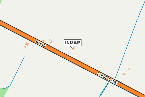
LN13 9JP lies on Long Lane in Mumby, Alford. LN13 9JP is located in the Willoughby with Sloothby electoral ward, within the local authority district of East Lindsey and the English Parliamentary constituency of Louth and Horncastle. The Sub Integrated Care Board (ICB) Location is NHS Lincolnshire ICB - 71E and the police force is Lincolnshire. This postcode has been in use since January 1980.


GetTheData
Source: OS OpenMap – Local (Ordnance Survey)
Source: OS VectorMap District (Ordnance Survey)
Licence: Open Government Licence (requires attribution)
| Easting | 550584 |
| Northing | 375196 |
| Latitude | 53.252414 |
| Longitude | 0.255650 |
GetTheData
Source: Open Postcode Geo
Licence: Open Government Licence
| Street | Long Lane |
| Locality | Mumby |
| Town/City | Alford |
| Country | England |
| Postcode District | LN13 |
➜ See where LN13 is on a map ➜ Where is Mumby? | |
GetTheData
Source: Land Registry Price Paid Data
Licence: Open Government Licence
Elevation or altitude of LN13 9JP as distance above sea level:
| Metres | Feet | |
|---|---|---|
| Elevation | 10m | 33ft |
Elevation is measured from the approximate centre of the postcode, to the nearest point on an OS contour line from OS Terrain 50, which has contour spacing of ten vertical metres.
➜ How high above sea level am I? Find the elevation of your current position using your device's GPS.
GetTheData
Source: Open Postcode Elevation
Licence: Open Government Licence
| Ward | Willoughby With Sloothby |
| Constituency | Louth And Horncastle |
GetTheData
Source: ONS Postcode Database
Licence: Open Government Licence
SWIMMERS, LONG LANE, MUMBY, ALFORD, LN13 9JP 2022 14 JAN £206,000 |
2016 12 OCT £285,000 |
2013 21 OCT £252,000 |
2004 4 AUG £230,000 |
SWIMMERS, LONG LANE, MUMBY, ALFORD, LN13 9JP 2004 4 FEB £150,000 |
SPRINGFIELD, LONG LANE, MUMBY, ALFORD, LN13 9JP 1999 11 OCT £86,250 |
THE LAURELS, LONG LANE, MUMBY, ALFORD, LN13 9JP 1997 4 NOV £80,000 |
SWIMMERS, LONG LANE, MUMBY, ALFORD, LN13 9JP 1995 21 AUG £54,000 |
GetTheData
Source: HM Land Registry Price Paid Data
Licence: Contains HM Land Registry data © Crown copyright and database right 2025. This data is licensed under the Open Government Licence v3.0.
| Anderby Turn (Rectory Road) | Anderby | 932m |
| Anderby Turn (Rectory Road) | Anderby | 942m |
| Thrumber Marsh Lane (Station Road) | Mumby | 1,045m |
| Manor Farm Cottage (Mumby Road) | Huttoft | 1,128m |
| Thrumber Marsh Lane (Station Road) | Mumby | 1,130m |
GetTheData
Source: NaPTAN
Licence: Open Government Licence
| Percentage of properties with Next Generation Access | 100.0% |
| Percentage of properties with Superfast Broadband | 25.0% |
| Percentage of properties with Ultrafast Broadband | 0.0% |
| Percentage of properties with Full Fibre Broadband | 0.0% |
Superfast Broadband is between 30Mbps and 300Mbps
Ultrafast Broadband is > 300Mbps
| Percentage of properties unable to receive 2Mbps | 12.5% |
| Percentage of properties unable to receive 5Mbps | 12.5% |
| Percentage of properties unable to receive 10Mbps | 12.5% |
| Percentage of properties unable to receive 30Mbps | 75.0% |
GetTheData
Source: Ofcom
Licence: Ofcom Terms of Use (requires attribution)
GetTheData
Source: ONS Postcode Database
Licence: Open Government Licence


➜ Get more ratings from the Food Standards Agency
GetTheData
Source: Food Standards Agency
Licence: FSA terms & conditions
| Last Collection | |||
|---|---|---|---|
| Location | Mon-Fri | Sat | Distance |
| Willoughby Post Office | 16:15 | 09:45 | 4,756m |
GetTheData
Source: Dracos
Licence: Creative Commons Attribution-ShareAlike
The below table lists the International Territorial Level (ITL) codes (formerly Nomenclature of Territorial Units for Statistics (NUTS) codes) and Local Administrative Units (LAU) codes for LN13 9JP:
| ITL 1 Code | Name |
|---|---|
| TLF | East Midlands (England) |
| ITL 2 Code | Name |
| TLF3 | Lincolnshire |
| ITL 3 Code | Name |
| TLF30 | Lincolnshire CC |
| LAU 1 Code | Name |
| E07000137 | East Lindsey |
GetTheData
Source: ONS Postcode Directory
Licence: Open Government Licence
The below table lists the Census Output Area (OA), Lower Layer Super Output Area (LSOA), and Middle Layer Super Output Area (MSOA) for LN13 9JP:
| Code | Name | |
|---|---|---|
| OA | E00132579 | |
| LSOA | E01026113 | East Lindsey 008D |
| MSOA | E02005431 | East Lindsey 008 |
GetTheData
Source: ONS Postcode Directory
Licence: Open Government Licence
| LN13 9JR | Huttoft Road | 635m |
| LN13 9JW | Huttoft Road | 912m |
| LN13 9JT | 1044m | |
| LN13 9SP | Parklands | 1111m |
| LN13 9TL | Thrumber Marsh Lane | 1196m |
| LN13 9JY | Washdyke Lane | 1271m |
| LN13 9JU | Occupation Lane | 1274m |
| LN13 9JZ | Coots Lane | 1279m |
| LN13 9RF | Mumby Road | 1281m |
| LN13 9RD | Church Lane | 1299m |
GetTheData
Source: Open Postcode Geo; Land Registry Price Paid Data
Licence: Open Government Licence