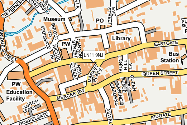
LN11 9NJ is located in the Priory & St James' electoral ward, within the local authority district of East Lindsey and the English Parliamentary constituency of Louth and Horncastle. The Sub Integrated Care Board (ICB) Location is NHS Lincolnshire ICB - 71E and the police force is Lincolnshire. This postcode has been in use since January 1980.


GetTheData
Source: OS OpenMap – Local (Ordnance Survey)
Source: OS VectorMap District (Ordnance Survey)
Licence: Open Government Licence (requires attribution)
| Easting | 532886 |
| Northing | 387422 |
| Latitude | 53.366990 |
| Longitude | -0.004322 |
GetTheData
Source: Open Postcode Geo
Licence: Open Government Licence
| Country | England |
| Postcode District | LN11 |
➜ See where LN11 is on a map ➜ Where is Louth? | |
GetTheData
Source: Land Registry Price Paid Data
Licence: Open Government Licence
Elevation or altitude of LN11 9NJ as distance above sea level:
| Metres | Feet | |
|---|---|---|
| Elevation | 30m | 98ft |
Elevation is measured from the approximate centre of the postcode, to the nearest point on an OS contour line from OS Terrain 50, which has contour spacing of ten vertical metres.
➜ How high above sea level am I? Find the elevation of your current position using your device's GPS.
GetTheData
Source: Open Postcode Elevation
Licence: Open Government Licence
| Ward | Priory & St James' |
| Constituency | Louth And Horncastle |
GetTheData
Source: ONS Postcode Database
Licence: Open Government Licence
| Market Place (Mercer Row) | Louth | 88m |
| Jasey's Bar (Eastgate) | Louth | 88m |
| Market Place (Mercer Row) | Louth | 98m |
| Bus Station (Church Street) | Louth | 301m |
| St Mary's Church (Upgate) | Louth | 335m |
GetTheData
Source: NaPTAN
Licence: Open Government Licence
GetTheData
Source: ONS Postcode Database
Licence: Open Government Licence


➜ Get more ratings from the Food Standards Agency
GetTheData
Source: Food Standards Agency
Licence: FSA terms & conditions
| Last Collection | |||
|---|---|---|---|
| Location | Mon-Fri | Sat | Distance |
| Pack Horse | 17:30 | 12:00 | 66m |
| Louth Market Place | 17:30 | 12:15 | 68m |
| Louth Delivery Office | 17:45 | 12:45 | 135m |
GetTheData
Source: Dracos
Licence: Creative Commons Attribution-ShareAlike
The below table lists the International Territorial Level (ITL) codes (formerly Nomenclature of Territorial Units for Statistics (NUTS) codes) and Local Administrative Units (LAU) codes for LN11 9NJ:
| ITL 1 Code | Name |
|---|---|
| TLF | East Midlands (England) |
| ITL 2 Code | Name |
| TLF3 | Lincolnshire |
| ITL 3 Code | Name |
| TLF30 | Lincolnshire CC |
| LAU 1 Code | Name |
| E07000137 | East Lindsey |
GetTheData
Source: ONS Postcode Directory
Licence: Open Government Licence
The below table lists the Census Output Area (OA), Lower Layer Super Output Area (LSOA), and Middle Layer Super Output Area (MSOA) for LN11 9NJ:
| Code | Name | |
|---|---|---|
| OA | E00132386 | |
| LSOA | E01026081 | East Lindsey 004A |
| MSOA | E02005427 | East Lindsey 004 |
GetTheData
Source: ONS Postcode Directory
Licence: Open Government Licence
| LN11 9NH | Eastgate | 23m |
| LN11 9NR | Market Place | 50m |
| LN11 9PD | Market Place | 54m |
| LN11 9PG | Eastgate | 56m |
| LN11 9NG | Eastgate | 59m |
| LN11 9PJ | Vickers Lane | 72m |
| LN11 9AU | Queen Street | 84m |
| LN11 9NL | Cannon Street | 89m |
| LN11 9PY | Cornmarket | 95m |
| LN11 9BG | Burnt Hill Lane | 96m |
GetTheData
Source: Open Postcode Geo; Land Registry Price Paid Data
Licence: Open Government Licence