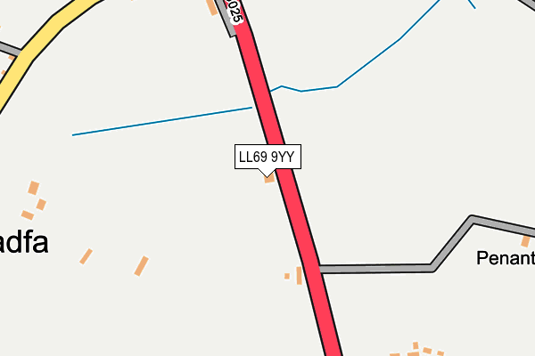
LL69 9YY is in Penysarn. LL69 9YY is located in the Twrcelyn electoral ward, within the unitary authority of Isle of Anglesey and the Welsh Parliamentary constituency of Ynys Môn. The Local Health Board is Betsi Cadwaladr University and the police force is North Wales. This postcode has been in use since January 1980.


GetTheData
Source: OS OpenMap – Local (Ordnance Survey)
Source: OS VectorMap District (Ordnance Survey)
Licence: Open Government Licence (requires attribution)
| Easting | 246166 |
| Northing | 389629 |
| Latitude | 53.381044 |
| Longitude | -4.314243 |
GetTheData
Source: Open Postcode Geo
Licence: Open Government Licence
| Town/City | Penysarn |
| Country | Wales |
| Postcode District | LL69 |
➜ See where LL69 is on a map ➜ Where is Gadfa? | |
GetTheData
Source: Land Registry Price Paid Data
Licence: Open Government Licence
Elevation or altitude of LL69 9YY as distance above sea level:
| Metres | Feet | |
|---|---|---|
| Elevation | 100m | 328ft |
Elevation is measured from the approximate centre of the postcode, to the nearest point on an OS contour line from OS Terrain 50, which has contour spacing of ten vertical metres.
➜ How high above sea level am I? Find the elevation of your current position using your device's GPS.
GetTheData
Source: Open Postcode Elevation
Licence: Open Government Licence
| Ward | Twrcelyn |
| Constituency | Ynys Môn |
GetTheData
Source: ONS Postcode Database
Licence: Open Government Licence
| Crossroads (A5025) | Gadfa | 325m |
| Crossroads (A5025) | Gadfa | 329m |
| Y Bedol (Chapel Street) | Penysarn | 627m |
| Y Bedol (Chapel Street) | Penysarn | 628m |
| Dinorben Terrace (Chapel Street) | Penysarn | 720m |
GetTheData
Source: NaPTAN
Licence: Open Government Licence
| Percentage of properties with Next Generation Access | 85.7% |
| Percentage of properties with Superfast Broadband | 85.7% |
| Percentage of properties with Ultrafast Broadband | 85.7% |
| Percentage of properties with Full Fibre Broadband | 85.7% |
Superfast Broadband is between 30Mbps and 300Mbps
Ultrafast Broadband is > 300Mbps
| Percentage of properties unable to receive 2Mbps | 0.0% |
| Percentage of properties unable to receive 5Mbps | 14.3% |
| Percentage of properties unable to receive 10Mbps | 14.3% |
| Percentage of properties unable to receive 30Mbps | 14.3% |
GetTheData
Source: Ofcom
Licence: Ofcom Terms of Use (requires attribution)
GetTheData
Source: ONS Postcode Database
Licence: Open Government Licence


➜ Get more ratings from the Food Standards Agency
GetTheData
Source: Food Standards Agency
Licence: FSA terms & conditions
| Last Collection | |||
|---|---|---|---|
| Location | Mon-Fri | Sat | Distance |
| Erw | 11:00 | 12:00 | 253m |
| Penysarn Post Office | 16:00 | 11:15 | 982m |
| Cerrigman | 16:17 | 12:00 | 1,847m |
GetTheData
Source: Dracos
Licence: Creative Commons Attribution-ShareAlike
The below table lists the International Territorial Level (ITL) codes (formerly Nomenclature of Territorial Units for Statistics (NUTS) codes) and Local Administrative Units (LAU) codes for LL69 9YY:
| ITL 1 Code | Name |
|---|---|
| TLL | Wales |
| ITL 2 Code | Name |
| TLL1 | West Wales and The Valleys |
| ITL 3 Code | Name |
| TLL11 | Isle of Anglesey |
| LAU 1 Code | Name |
| W06000001 | Isle of Anglesey |
GetTheData
Source: ONS Postcode Directory
Licence: Open Government Licence
The below table lists the Census Output Area (OA), Lower Layer Super Output Area (LSOA), and Middle Layer Super Output Area (MSOA) for LL69 9YY:
| Code | Name | |
|---|---|---|
| OA | W00000103 | |
| LSOA | W01000021 | Isle of Anglesey 002C |
| MSOA | W02000002 | Isle of Anglesey 002 |
GetTheData
Source: ONS Postcode Directory
Licence: Open Government Licence
| LL69 9AQ | 298m | |
| LL69 9UL | 417m | |
| LL69 9YU | 449m | |
| LL69 9BZ | Tyn Rhos Estate | 670m |
| LL69 9YS | 680m | |
| LL69 9YR | 681m | |
| LL69 9YW | Bryntirion | 740m |
| LL69 9YP | Chapel Street | 748m |
| LL69 9YE | 766m | |
| LL69 9BX | Penysarn Fawr Estate | 819m |
GetTheData
Source: Open Postcode Geo; Land Registry Price Paid Data
Licence: Open Government Licence