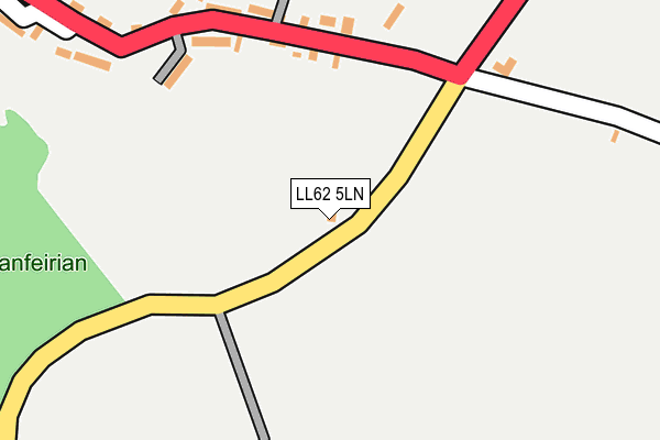
LL62 5LN is located in the Bro Aberffraw electoral ward, within the unitary authority of Isle of Anglesey and the Welsh Parliamentary constituency of Ynys Môn. The Local Health Board is Betsi Cadwaladr University and the police force is North Wales. This postcode has been in use since January 1980.


GetTheData
Source: OS OpenMap – Local (Ordnance Survey)
Source: OS VectorMap District (Ordnance Survey)
Licence: Open Government Licence (requires attribution)
| Easting | 239032 |
| Northing | 368726 |
| Latitude | 53.191194 |
| Longitude | -4.410798 |
GetTheData
Source: Open Postcode Geo
Licence: Open Government Licence
| Country | Wales |
| Postcode District | LL62 |
➜ See where LL62 is on a map ➜ Where is Hermon? | |
GetTheData
Source: Land Registry Price Paid Data
Licence: Open Government Licence
Elevation or altitude of LL62 5LN as distance above sea level:
| Metres | Feet | |
|---|---|---|
| Elevation | 60m | 197ft |
Elevation is measured from the approximate centre of the postcode, to the nearest point on an OS contour line from OS Terrain 50, which has contour spacing of ten vertical metres.
➜ How high above sea level am I? Find the elevation of your current position using your device's GPS.
GetTheData
Source: Open Postcode Elevation
Licence: Open Government Licence
| Ward | Bro Aberffraw |
| Constituency | Ynys Môn |
GetTheData
Source: ONS Postcode Database
Licence: Open Government Licence
| Alltfeirian (A4080) | Hermon Village | 161m |
| Alltfeirian (A4080) | Hermon Village | 166m |
| Argraig (A4080) | Hermon Village | 224m |
| Argraig (A4080) | Hermon Village | 230m |
| Treflys (A4080) | Hermon Village | 275m |
| Bodorgan Station | 1.5km |
| Ty Croes Station | 5.5km |
GetTheData
Source: NaPTAN
Licence: Open Government Licence
| Percentage of properties with Next Generation Access | 100.0% |
| Percentage of properties with Superfast Broadband | 0.0% |
| Percentage of properties with Ultrafast Broadband | 0.0% |
| Percentage of properties with Full Fibre Broadband | 0.0% |
Superfast Broadband is between 30Mbps and 300Mbps
Ultrafast Broadband is > 300Mbps
| Percentage of properties unable to receive 2Mbps | 0.0% |
| Percentage of properties unable to receive 5Mbps | 0.0% |
| Percentage of properties unable to receive 10Mbps | 33.3% |
| Percentage of properties unable to receive 30Mbps | 100.0% |
GetTheData
Source: Ofcom
Licence: Ofcom Terms of Use (requires attribution)
GetTheData
Source: ONS Postcode Database
Licence: Open Government Licence


➜ Get more ratings from the Food Standards Agency
GetTheData
Source: Food Standards Agency
Licence: FSA terms & conditions
| Last Collection | |||
|---|---|---|---|
| Location | Mon-Fri | Sat | Distance |
| Hermon | 09:00 | 07:30 | 207m |
| Malltraeth Post Office | 16:00 | 09:15 | 1,681m |
| Bethel Post Office | 16:00 | 10:45 | 1,784m |
GetTheData
Source: Dracos
Licence: Creative Commons Attribution-ShareAlike
The below table lists the International Territorial Level (ITL) codes (formerly Nomenclature of Territorial Units for Statistics (NUTS) codes) and Local Administrative Units (LAU) codes for LL62 5LN:
| ITL 1 Code | Name |
|---|---|
| TLL | Wales |
| ITL 2 Code | Name |
| TLL1 | West Wales and The Valleys |
| ITL 3 Code | Name |
| TLL11 | Isle of Anglesey |
| LAU 1 Code | Name |
| W06000001 | Isle of Anglesey |
GetTheData
Source: ONS Postcode Directory
Licence: Open Government Licence
The below table lists the Census Output Area (OA), Lower Layer Super Output Area (LSOA), and Middle Layer Super Output Area (MSOA) for LL62 5LN:
| Code | Name | |
|---|---|---|
| OA | W00000028 | |
| LSOA | W01000007 | Isle of Anglesey 009A |
| MSOA | W02000009 | Isle of Anglesey 009 |
GetTheData
Source: ONS Postcode Directory
Licence: Open Government Licence
| LL62 5LH | 197m | |
| LL62 5LF | Glascoed | 318m |
| LL62 5LE | 340m | |
| LL62 5LB | 727m | |
| LL62 5LA | 872m | |
| LL62 5HU | 985m | |
| LL62 5AE | 1027m | |
| LL62 5AB | 1084m | |
| LL62 5AF | 1151m | |
| LL62 5HP | 1156m |
GetTheData
Source: Open Postcode Geo; Land Registry Price Paid Data
Licence: Open Government Licence