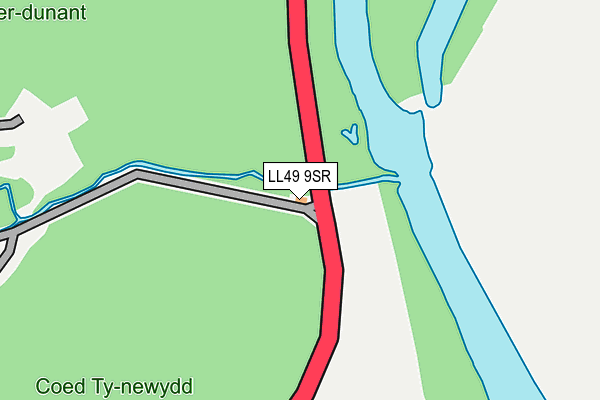
LL49 9SR is in Prenteg, Porthmadog. LL49 9SR is located in the Glaslyn electoral ward, within the unitary authority of Gwynedd and the Welsh Parliamentary constituency of Dwyfor Meirionnydd. The Local Health Board is Betsi Cadwaladr University and the police force is North Wales. This postcode has been in use since January 1980.


GetTheData
Source: OS OpenMap – Local (Ordnance Survey)
Source: OS VectorMap District (Ordnance Survey)
Licence: Open Government Licence (requires attribution)
| Easting | 258928 |
| Northing | 342919 |
| Latitude | 52.965038 |
| Longitude | -4.101914 |
GetTheData
Source: Open Postcode Geo
Licence: Open Government Licence
| Locality | Prenteg |
| Town/City | Porthmadog |
| Country | Wales |
| Postcode District | LL49 |
➜ See where LL49 is on a map | |
GetTheData
Source: Land Registry Price Paid Data
Licence: Open Government Licence
Elevation or altitude of LL49 9SR as distance above sea level:
| Metres | Feet | |
|---|---|---|
| Elevation | 10m | 33ft |
Elevation is measured from the approximate centre of the postcode, to the nearest point on an OS contour line from OS Terrain 50, which has contour spacing of ten vertical metres.
➜ How high above sea level am I? Find the elevation of your current position using your device's GPS.
GetTheData
Source: Open Postcode Elevation
Licence: Open Government Licence
| Ward | Glaslyn |
| Constituency | Dwyfor Meirionnydd |
GetTheData
Source: ONS Postcode Database
Licence: Open Government Licence
| Bryn Fynnon (A498) | Prenteg | 1,519m |
| Porthmadog Station | 4.4km |
| Minffordd Station | 4.5km |
| Minffordd Ffestiniog Railway Station | 4.5km |
GetTheData
Source: NaPTAN
Licence: Open Government Licence
| Percentage of properties with Next Generation Access | 50.0% |
| Percentage of properties with Superfast Broadband | 50.0% |
| Percentage of properties with Ultrafast Broadband | 50.0% |
| Percentage of properties with Full Fibre Broadband | 50.0% |
Superfast Broadband is between 30Mbps and 300Mbps
Ultrafast Broadband is > 300Mbps
| Percentage of properties unable to receive 2Mbps | 16.7% |
| Percentage of properties unable to receive 5Mbps | 50.0% |
| Percentage of properties unable to receive 10Mbps | 50.0% |
| Percentage of properties unable to receive 30Mbps | 50.0% |
GetTheData
Source: Ofcom
Licence: Ofcom Terms of Use (requires attribution)
Estimated total energy consumption in LL49 9SR by fuel type, 2015.
| Consumption (kWh) | 25,394 |
|---|---|
| Meter count | 6 |
| Mean (kWh/meter) | 4,232 |
| Median (kWh/meter) | 4,364 |
GetTheData
Source: Postcode level gas estimates: 2015 (experimental)
Source: Postcode level electricity estimates: 2015 (experimental)
Licence: Open Government Licence
GetTheData
Source: ONS Postcode Database
Licence: Open Government Licence

➜ Get more ratings from the Food Standards Agency
GetTheData
Source: Food Standards Agency
Licence: FSA terms & conditions
| Last Collection | |||
|---|---|---|---|
| Location | Mon-Fri | Sat | Distance |
| Prenteg | 16:00 | 10:00 | 1,524m |
| Nantmor | 10:30 | 09:45 | 3,344m |
| Tremadog Post Office | 16:15 | 11:00 | 3,943m |
GetTheData
Source: Dracos
Licence: Creative Commons Attribution-ShareAlike
The below table lists the International Territorial Level (ITL) codes (formerly Nomenclature of Territorial Units for Statistics (NUTS) codes) and Local Administrative Units (LAU) codes for LL49 9SR:
| ITL 1 Code | Name |
|---|---|
| TLL | Wales |
| ITL 2 Code | Name |
| TLL1 | West Wales and The Valleys |
| ITL 3 Code | Name |
| TLL12 | Gwynedd |
| LAU 1 Code | Name |
| W06000002 | Gwynedd |
GetTheData
Source: ONS Postcode Directory
Licence: Open Government Licence
The below table lists the Census Output Area (OA), Lower Layer Super Output Area (LSOA), and Middle Layer Super Output Area (MSOA) for LL49 9SR:
| Code | Name | |
|---|---|---|
| OA | W00000547 | |
| LSOA | W01000107 | Gwynedd 010E |
| MSOA | W02000019 | Gwynedd 010 |
GetTheData
Source: ONS Postcode Directory
Licence: Open Government Licence
| LL48 6BJ | 1346m | |
| LL49 9TA | Penrhiw Terrace | 1393m |
| LL49 9SY | Tandderwen Terrace | 1405m |
| LL49 9TB | Stepiau | 1416m |
| LL49 9TD | 1426m | |
| LL49 9SU | 1465m | |
| LL49 9ST | Bryn Eglwys | 1519m |
| LL49 9SS | London Terrace | 1566m |
| LL49 9SW | Tan Y Bryn Terrace | 1576m |
| LL49 9TE | 1770m |
GetTheData
Source: Open Postcode Geo; Land Registry Price Paid Data
Licence: Open Government Licence