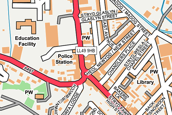
LL49 9HB is located in the Dwyrain Porthmadog electoral ward, within the unitary authority of Gwynedd and the Welsh Parliamentary constituency of Dwyfor Meirionnydd. The Local Health Board is Betsi Cadwaladr University and the police force is North Wales. This postcode has been in use since January 1980.


GetTheData
Source: OS OpenMap – Local (Ordnance Survey)
Source: OS VectorMap District (Ordnance Survey)
Licence: Open Government Licence (requires attribution)
| Easting | 256694 |
| Northing | 338910 |
| Latitude | 52.928417 |
| Longitude | -4.133371 |
GetTheData
Source: Open Postcode Geo
Licence: Open Government Licence
| Country | Wales |
| Postcode District | LL49 |
➜ See where LL49 is on a map ➜ Where is Porthmadog? | |
GetTheData
Source: Land Registry Price Paid Data
Licence: Open Government Licence
Elevation or altitude of LL49 9HB as distance above sea level:
| Metres | Feet | |
|---|---|---|
| Elevation | 10m | 33ft |
Elevation is measured from the approximate centre of the postcode, to the nearest point on an OS contour line from OS Terrain 50, which has contour spacing of ten vertical metres.
➜ How high above sea level am I? Find the elevation of your current position using your device's GPS.
GetTheData
Source: Open Postcode Elevation
Licence: Open Government Licence
| Ward | Dwyrain Porthmadog |
| Constituency | Dwyfor Meirionnydd |
GetTheData
Source: ONS Postcode Database
Licence: Open Government Licence
| Sportsman (High Street) | Porthmadog | 15m |
| Tesco (High Street) | Porthmadog | 84m |
| Rhes Cambrian (High Street) | Porthmadog | 171m |
| Aldi (Penamser Road) | Porthmadog | 250m |
| Madog Street | Porthmadog | 250m |
| Porthmadog Station | 0.3km |
| Porthmadog Harbour Ffestiniog Railway Station | 0.7km |
| Minffordd Station | 3.3km |
GetTheData
Source: NaPTAN
Licence: Open Government Licence
GetTheData
Source: ONS Postcode Database
Licence: Open Government Licence


➜ Get more ratings from the Food Standards Agency
GetTheData
Source: Food Standards Agency
Licence: FSA terms & conditions
| Last Collection | |||
|---|---|---|---|
| Location | Mon-Fri | Sat | Distance |
| High Street | 17:00 | 11:30 | 30m |
| Porthmadog Post Office | 17:30 | 12:15 | 291m |
| Ynys Towyn | 15:30 | 11:39 | 601m |
GetTheData
Source: Dracos
Licence: Creative Commons Attribution-ShareAlike
The below table lists the International Territorial Level (ITL) codes (formerly Nomenclature of Territorial Units for Statistics (NUTS) codes) and Local Administrative Units (LAU) codes for LL49 9HB:
| ITL 1 Code | Name |
|---|---|
| TLL | Wales |
| ITL 2 Code | Name |
| TLL1 | West Wales and The Valleys |
| ITL 3 Code | Name |
| TLL12 | Gwynedd |
| LAU 1 Code | Name |
| W06000002 | Gwynedd |
GetTheData
Source: ONS Postcode Directory
Licence: Open Government Licence
The below table lists the Census Output Area (OA), Lower Layer Super Output Area (LSOA), and Middle Layer Super Output Area (MSOA) for LL49 9HB:
| Code | Name | |
|---|---|---|
| OA | W00000533 | |
| LSOA | W01000105 | Gwynedd 010C |
| MSOA | W02000019 | Gwynedd 010 |
GetTheData
Source: ONS Postcode Directory
Licence: Open Government Licence
| LL49 9HD | High Street | 55m |
| LL49 9EQ | 59m | |
| LL49 9ED | New Street | 61m |
| LL49 9EW | Hughendon Cottages | 63m |
| LL49 9EB | Chandlers Place | 90m |
| LL49 9NU | High Street | 94m |
| LL49 9HA | High Street | 97m |
| LL49 9EN | East Avenue | 108m |
| LL49 9NW | High Street | 145m |
| LL49 9DS | Chapel Street | 153m |
GetTheData
Source: Open Postcode Geo; Land Registry Price Paid Data
Licence: Open Government Licence