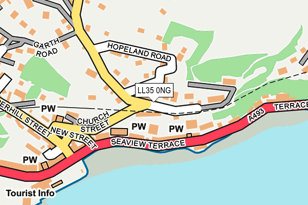
LL35 0NG is in Aberdovey. LL35 0NG is located in the Aberdyfi electoral ward, within the unitary authority of Gwynedd and the Welsh Parliamentary constituency of Dwyfor Meirionnydd. The Local Health Board is Betsi Cadwaladr University and the police force is North Wales. This postcode has been in use since January 1980.


GetTheData
Source: OS OpenMap – Local (Ordnance Survey)
Source: OS VectorMap District (Ordnance Survey)
Licence: Open Government Licence (requires attribution)
| Easting | 261623 |
| Northing | 296084 |
| Latitude | 52.544971 |
| Longitude | -4.042027 |
GetTheData
Source: Open Postcode Geo
Licence: Open Government Licence
| Town/City | Aberdovey |
| Country | Wales |
| Postcode District | LL35 |
➜ See where LL35 is on a map ➜ Where is Aberdovey? | |
GetTheData
Source: Land Registry Price Paid Data
Licence: Open Government Licence
Elevation or altitude of LL35 0NG as distance above sea level:
| Metres | Feet | |
|---|---|---|
| Elevation | 30m | 98ft |
Elevation is measured from the approximate centre of the postcode, to the nearest point on an OS contour line from OS Terrain 50, which has contour spacing of ten vertical metres.
➜ How high above sea level am I? Find the elevation of your current position using your device's GPS.
GetTheData
Source: Open Postcode Elevation
Licence: Open Government Licence
| Ward | Aberdyfi |
| Constituency | Dwyfor Meirionnydd |
GetTheData
Source: ONS Postcode Database
Licence: Open Government Licence
| Cenetaph (Sea View Terrace) | Aberdovey | 87m |
| Cenetaph (Sea View Terrace) | Aberdovey | 106m |
| Railway Station (Terrace Road) | Aberdovey | 429m |
| Railway Station (Terrace Road) | Aberdovey | 453m |
| Neuadd Dyfi (A493) | Aberdovey | 722m |
| Penhelig Station | 0.5km |
| Aberdovey Station | 1km |
| Tywyn Station | 5.7km |
GetTheData
Source: NaPTAN
Licence: Open Government Licence
| Percentage of properties with Next Generation Access | 100.0% |
| Percentage of properties with Superfast Broadband | 100.0% |
| Percentage of properties with Ultrafast Broadband | 0.0% |
| Percentage of properties with Full Fibre Broadband | 0.0% |
Superfast Broadband is between 30Mbps and 300Mbps
Ultrafast Broadband is > 300Mbps
| Percentage of properties unable to receive 2Mbps | 0.0% |
| Percentage of properties unable to receive 5Mbps | 0.0% |
| Percentage of properties unable to receive 10Mbps | 0.0% |
| Percentage of properties unable to receive 30Mbps | 0.0% |
GetTheData
Source: Ofcom
Licence: Ofcom Terms of Use (requires attribution)
GetTheData
Source: ONS Postcode Database
Licence: Open Government Licence


➜ Get more ratings from the Food Standards Agency
GetTheData
Source: Food Standards Agency
Licence: FSA terms & conditions
| Last Collection | |||
|---|---|---|---|
| Location | Mon-Fri | Sat | Distance |
| The Square | 16:30 | 09:00 | 200m |
| Maethlon | 10:30 | 09:30 | 2,674m |
| Ynyslas Bridge | 11:00 | 10:15 | 2,964m |
GetTheData
Source: Dracos
Licence: Creative Commons Attribution-ShareAlike
The below table lists the International Territorial Level (ITL) codes (formerly Nomenclature of Territorial Units for Statistics (NUTS) codes) and Local Administrative Units (LAU) codes for LL35 0NG:
| ITL 1 Code | Name |
|---|---|
| TLL | Wales |
| ITL 2 Code | Name |
| TLL1 | West Wales and The Valleys |
| ITL 3 Code | Name |
| TLL12 | Gwynedd |
| LAU 1 Code | Name |
| W06000002 | Gwynedd |
GetTheData
Source: ONS Postcode Directory
Licence: Open Government Licence
The below table lists the Census Output Area (OA), Lower Layer Super Output Area (LSOA), and Middle Layer Super Output Area (MSOA) for LL35 0NG:
| Code | Name | |
|---|---|---|
| OA | W00000231 | |
| LSOA | W01001933 | Gwynedd 017F |
| MSOA | W02000026 | Gwynedd 017 |
GetTheData
Source: ONS Postcode Directory
Licence: Open Government Licence
| LL35 0NF | Hillside | 28m |
| LL35 0ND | Hillside Park | 72m |
| LL35 0LL | Sea View Terrace | 73m |
| LL35 0NH | 92m | |
| LL35 0LW | 110m | |
| LL35 0EF | Sea View Terrace | 111m |
| LL35 0LN | Bath Place | 128m |
| LL35 0ES | Church Street | 144m |
| LL35 0ET | Gibraltar Terrace | 162m |
| LL35 0EH | New Street | 167m |
GetTheData
Source: Open Postcode Geo; Land Registry Price Paid Data
Licence: Open Government Licence