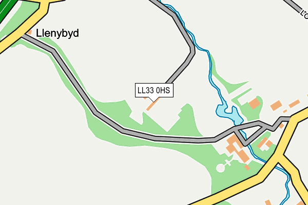
LL33 0HS is in Llanfairfechan. LL33 0HS is located in the Arllechwedd electoral ward, within the unitary authority of Gwynedd and the Welsh Parliamentary constituency of Arfon. The Local Health Board is Betsi Cadwaladr University and the police force is North Wales. This postcode has been in use since January 1980.


GetTheData
Source: OS OpenMap – Local (Ordnance Survey)
Source: OS VectorMap District (Ordnance Survey)
Licence: Open Government Licence (requires attribution)
| Easting | 267017 |
| Northing | 373573 |
| Latitude | 53.242474 |
| Longitude | -3.994252 |
GetTheData
Source: Open Postcode Geo
Licence: Open Government Licence
| Town/City | Llanfairfechan |
| Country | Wales |
| Postcode District | LL33 |
➜ See where LL33 is on a map ➜ Where is Llanfairfechan? | |
GetTheData
Source: Land Registry Price Paid Data
Licence: Open Government Licence
Elevation or altitude of LL33 0HS as distance above sea level:
| Metres | Feet | |
|---|---|---|
| Elevation | 30m | 98ft |
Elevation is measured from the approximate centre of the postcode, to the nearest point on an OS contour line from OS Terrain 50, which has contour spacing of ten vertical metres.
➜ How high above sea level am I? Find the elevation of your current position using your device's GPS.
GetTheData
Source: Open Postcode Elevation
Licence: Open Government Licence
| Ward | Arllechwedd |
| Constituency | Arfon |
GetTheData
Source: ONS Postcode Database
Licence: Open Government Licence
GARDEN COTTAGE, GORDDINOG, LLANFAIRFECHAN, LL33 0HS 2015 17 APR £280,000 |
GetTheData
Source: HM Land Registry Price Paid Data
Licence: Contains HM Land Registry data © Crown copyright and database right 2025. This data is licensed under the Open Government Licence v3.0.
| Gorddinog Turn (Aber Road) | Gorddinog | 282m |
| Gorddinog (Aber Road) | Gorddinog | 294m |
| Rhandir Hedd Cemetery (Aber Road) | Llanfairfechan | 804m |
| Rhandir Hedd Cemetery (Aber Road) | Llanfairfechan | 918m |
| Argoed (Caeffynnon Road) | Llanfairfechan | 1,436m |
| Llanfairfechan Station | 1.8km |
| Penmaenmawr Station | 5.7km |
GetTheData
Source: NaPTAN
Licence: Open Government Licence
| Percentage of properties with Next Generation Access | 100.0% |
| Percentage of properties with Superfast Broadband | 33.3% |
| Percentage of properties with Ultrafast Broadband | 0.0% |
| Percentage of properties with Full Fibre Broadband | 0.0% |
Superfast Broadband is between 30Mbps and 300Mbps
Ultrafast Broadband is > 300Mbps
| Percentage of properties unable to receive 2Mbps | 0.0% |
| Percentage of properties unable to receive 5Mbps | 0.0% |
| Percentage of properties unable to receive 10Mbps | 0.0% |
| Percentage of properties unable to receive 30Mbps | 66.7% |
GetTheData
Source: Ofcom
Licence: Ofcom Terms of Use (requires attribution)
GetTheData
Source: ONS Postcode Database
Licence: Open Government Licence


➜ Get more ratings from the Food Standards Agency
GetTheData
Source: Food Standards Agency
Licence: FSA terms & conditions
| Last Collection | |||
|---|---|---|---|
| Location | Mon-Fri | Sat | Distance |
| Station Road | 16:55 | 10:30 | 1,704m |
| Llanllechyd | 12:15 | 09:30 | 6,823m |
GetTheData
Source: Dracos
Licence: Creative Commons Attribution-ShareAlike
The below table lists the International Territorial Level (ITL) codes (formerly Nomenclature of Territorial Units for Statistics (NUTS) codes) and Local Administrative Units (LAU) codes for LL33 0HS:
| ITL 1 Code | Name |
|---|---|
| TLL | Wales |
| ITL 2 Code | Name |
| TLL1 | West Wales and The Valleys |
| ITL 3 Code | Name |
| TLL12 | Gwynedd |
| LAU 1 Code | Name |
| W06000002 | Gwynedd |
GetTheData
Source: ONS Postcode Directory
Licence: Open Government Licence
The below table lists the Census Output Area (OA), Lower Layer Super Output Area (LSOA), and Middle Layer Super Output Area (MSOA) for LL33 0HS:
| Code | Name | |
|---|---|---|
| OA | W00000254 | |
| LSOA | W01000050 | Gwynedd 003A |
| MSOA | W02000012 | Gwynedd 003 |
GetTheData
Source: ONS Postcode Directory
Licence: Open Government Licence
| LL33 0EG | Gwyllt Road | 389m |
| LL33 0HR | Aber Road | 467m |
| LL33 0EF | Gwyllt Road | 518m |
| LL33 0HY | Tanyclogwyn | 579m |
| LL33 0EH | 663m | |
| LL33 0EE | Gwyllt Road | 737m |
| LL33 0ED | Gwyllt Road | 803m |
| LL33 0HU | 1308m | |
| LL33 0EB | Llanerch Road | 1326m |
| LL33 0UT | Llwyn Gwgan | 1479m |
GetTheData
Source: Open Postcode Geo; Land Registry Price Paid Data
Licence: Open Government Licence