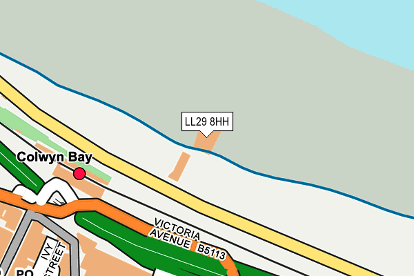
LL29 8HH is located in the Glyn electoral ward, within the unitary authority of Conwy and the Welsh Parliamentary constituency of Clwyd West. The Local Health Board is Betsi Cadwaladr University and the police force is North Wales. This postcode has been in use since January 1980.


GetTheData
Source: OS OpenMap – Local (Ordnance Survey)
Source: OS VectorMap District (Ordnance Survey)
Licence: Open Government Licence (requires attribution)
| Easting | 285281 |
| Northing | 379190 |
| Latitude | 53.297205 |
| Longitude | -3.722735 |
GetTheData
Source: Open Postcode Geo
Licence: Open Government Licence
| Country | Wales |
| Postcode District | LL29 |
➜ See where LL29 is on a map | |
GetTheData
Source: Land Registry Price Paid Data
Licence: Open Government Licence
Elevation or altitude of LL29 8HH as distance above sea level:
| Metres | Feet | |
|---|---|---|
| Elevation | 10m | 33ft |
Elevation is measured from the approximate centre of the postcode, to the nearest point on an OS contour line from OS Terrain 50, which has contour spacing of ten vertical metres.
➜ How high above sea level am I? Find the elevation of your current position using your device's GPS.
GetTheData
Source: Open Postcode Elevation
Licence: Open Government Licence
| Ward | Glyn |
| Constituency | Clwyd West |
GetTheData
Source: ONS Postcode Database
Licence: Open Government Licence
| Railway Station (Victoria Avenue) | Colwyn Bay | 175m |
| Bay View Road | Colwyn Bay | 310m |
| Central Hotel (Rhos Road) | Colwyn Bay | 390m |
| St Paul`s Church (Abergele Road) | Colwyn Bay | 400m |
| Greenfield Road (Abergele Road) | Colwyn Bay | 429m |
| Colwyn Bay Station | 0.2km |
GetTheData
Source: NaPTAN
Licence: Open Government Licence
Estimated total energy consumption in LL29 8HH by fuel type, 2015.
| Consumption (kWh) | 79,189 |
|---|---|
| Meter count | 10 |
| Mean (kWh/meter) | 7,919 |
| Median (kWh/meter) | 5,613 |
GetTheData
Source: Postcode level gas estimates: 2015 (experimental)
Source: Postcode level electricity estimates: 2015 (experimental)
Licence: Open Government Licence
GetTheData
Source: ONS Postcode Database
Licence: Open Government Licence


➜ Get more ratings from the Food Standards Agency
GetTheData
Source: Food Standards Agency
Licence: FSA terms & conditions
| Last Collection | |||
|---|---|---|---|
| Location | Mon-Fri | Sat | Distance |
| Safeway | 17:15 | 11:30 | 238m |
| Station Road | 17:15 | 11:30 | 279m |
| Greenfield Road | 17:15 | 11:30 | 339m |
GetTheData
Source: Dracos
Licence: Creative Commons Attribution-ShareAlike
The below table lists the International Territorial Level (ITL) codes (formerly Nomenclature of Territorial Units for Statistics (NUTS) codes) and Local Administrative Units (LAU) codes for LL29 8HH:
| ITL 1 Code | Name |
|---|---|
| TLL | Wales |
| ITL 2 Code | Name |
| TLL1 | West Wales and The Valleys |
| ITL 3 Code | Name |
| TLL13 | Conwy and Denbighshire |
| LAU 1 Code | Name |
| W06000003 | Conwy |
GetTheData
Source: ONS Postcode Directory
Licence: Open Government Licence
The below table lists the Census Output Area (OA), Lower Layer Super Output Area (LSOA), and Middle Layer Super Output Area (MSOA) for LL29 8HH:
| Code | Name | |
|---|---|---|
| OA | W00000770 | |
| LSOA | W01000144 | Conwy 007C |
| MSOA | W02000033 | Conwy 007 |
GetTheData
Source: ONS Postcode Directory
Licence: Open Government Licence
| LL29 8DG | Sea View Road | 266m |
| LL29 8DY | Victoria Avenue | 271m |
| LL29 8BU | Station Road | 319m |
| LL29 8EA | Pendorlan Avenue | 321m |
| LL29 8DU | Victoria Avenue | 325m |
| LL29 8LA | Princes Drive | 339m |
| LL29 8BP | Station Road | 340m |
| LL29 8DL | Lincoln Terrace | 354m |
| LL29 8DW | Bay View Road | 363m |
| LL29 8EW | Greenfield Road | 375m |
GetTheData
Source: Open Postcode Geo; Land Registry Price Paid Data
Licence: Open Government Licence