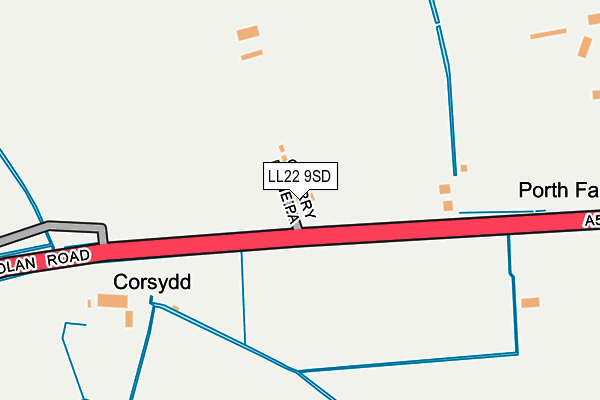
LL22 9SD lies on Rhuddlan Road in St George, Abergele. LL22 9SD is located in the Kinmel Bay electoral ward, within the unitary authority of Conwy and the Welsh Parliamentary constituency of Clwyd West. The Local Health Board is Betsi Cadwaladr University and the police force is North Wales. This postcode has been in use since January 1980.


GetTheData
Source: OS OpenMap – Local (Ordnance Survey)
Source: OS VectorMap District (Ordnance Survey)
Licence: Open Government Licence (requires attribution)
| Easting | 298993 |
| Northing | 377613 |
| Latitude | 53.285829 |
| Longitude | -3.516578 |
GetTheData
Source: Open Postcode Geo
Licence: Open Government Licence
| Street | Rhuddlan Road |
| Locality | St George |
| Town/City | Abergele |
| Country | Wales |
| Postcode District | LL22 |
➜ See where LL22 is on a map | |
GetTheData
Source: Land Registry Price Paid Data
Licence: Open Government Licence
Elevation or altitude of LL22 9SD as distance above sea level:
| Metres | Feet | |
|---|---|---|
| Elevation | 10m | 33ft |
Elevation is measured from the approximate centre of the postcode, to the nearest point on an OS contour line from OS Terrain 50, which has contour spacing of ten vertical metres.
➜ How high above sea level am I? Find the elevation of your current position using your device's GPS.
GetTheData
Source: Open Postcode Elevation
Licence: Open Government Licence
| Ward | Kinmel Bay |
| Constituency | Clwyd West |
GetTheData
Source: ONS Postcode Database
Licence: Open Government Licence
| Tir Llwyd Industrial Estate | Kinmel Bay | 992m |
| Glan-y-morfa (Ronald's Way) | Bodelwyddan | 1,151m |
| Denbigh Circle (St Asaph Avenue) | Towyn | 1,389m |
| Parc Hyde (Denbigh Circle) | Kinmel Bay | 1,522m |
| Pentecostal Church (Gors Road) | Towyn | 1,802m |
| Rhyl Station | 4.1km |
| Abergele & Pensarn Station | 4.5km |
GetTheData
Source: NaPTAN
Licence: Open Government Licence
| Percentage of properties with Next Generation Access | 0.0% |
| Percentage of properties with Superfast Broadband | 0.0% |
| Percentage of properties with Ultrafast Broadband | 0.0% |
| Percentage of properties with Full Fibre Broadband | 0.0% |
Superfast Broadband is between 30Mbps and 300Mbps
Ultrafast Broadband is > 300Mbps
| Percentage of properties unable to receive 2Mbps | 0.0% |
| Percentage of properties unable to receive 5Mbps | 100.0% |
| Percentage of properties unable to receive 10Mbps | 100.0% |
| Percentage of properties unable to receive 30Mbps | 100.0% |
GetTheData
Source: Ofcom
Licence: Ofcom Terms of Use (requires attribution)
GetTheData
Source: ONS Postcode Database
Licence: Open Government Licence


➜ Get more ratings from the Food Standards Agency
GetTheData
Source: Food Standards Agency
Licence: FSA terms & conditions
| Last Collection | |||
|---|---|---|---|
| Location | Mon-Fri | Sat | Distance |
| St Margarets Drive | 17:15 | 11:00 | 3,481m |
| Glas Coed Gate | 11:00 | 11:00 | 3,690m |
| Maes Y Dre | 16:45 | 11:00 | 3,994m |
GetTheData
Source: Dracos
Licence: Creative Commons Attribution-ShareAlike
The below table lists the International Territorial Level (ITL) codes (formerly Nomenclature of Territorial Units for Statistics (NUTS) codes) and Local Administrative Units (LAU) codes for LL22 9SD:
| ITL 1 Code | Name |
|---|---|
| TLL | Wales |
| ITL 2 Code | Name |
| TLL1 | West Wales and The Valleys |
| ITL 3 Code | Name |
| TLL13 | Conwy and Denbighshire |
| LAU 1 Code | Name |
| W06000003 | Conwy |
GetTheData
Source: ONS Postcode Directory
Licence: Open Government Licence
The below table lists the Census Output Area (OA), Lower Layer Super Output Area (LSOA), and Middle Layer Super Output Area (MSOA) for LL22 9SD:
| Code | Name | |
|---|---|---|
| OA | W00000804 | |
| LSOA | W01000150 | Conwy 005B |
| MSOA | W02000031 | Conwy 005 |
GetTheData
Source: ONS Postcode Directory
Licence: Open Government Licence
| LL22 9SB | Borth Cross Roads | 357m |
| LL18 5JA | Tir Llwyd Industrial Estate | 994m |
| LL18 5HB | St Asaph Avenue | 1289m |
| LL18 5HR | Gwellyn Avenue | 1325m |
| LL18 5JZ | Tir Llwyd Enterprise Park | 1328m |
| LL18 5SW | Terfyn | 1382m |
| LL18 5JX | Tudor Court | 1419m |
| LL22 9SF | 1426m | |
| LL18 5HP | Holywell Crescent | 1469m |
| LL18 5HT | Coed Avenue | 1495m |
GetTheData
Source: Open Postcode Geo; Land Registry Price Paid Data
Licence: Open Government Licence