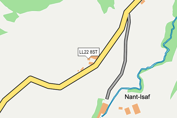
LL22 8ST is located in the Betws-yn-Rhos electoral ward, within the unitary authority of Conwy and the Welsh Parliamentary constituency of Clwyd West. The Local Health Board is Betsi Cadwaladr University and the police force is North Wales. This postcode has been in use since January 1980.


GetTheData
Source: OS OpenMap – Local (Ordnance Survey)
Source: OS VectorMap District (Ordnance Survey)
Licence: Open Government Licence (requires attribution)
| Easting | 292412 |
| Northing | 369674 |
| Latitude | 53.213215 |
| Longitude | -3.612571 |
GetTheData
Source: Open Postcode Geo
Licence: Open Government Licence
| Country | Wales |
| Postcode District | LL22 |
➜ See where LL22 is on a map | |
GetTheData
Source: Land Registry Price Paid Data
Licence: Open Government Licence
Elevation or altitude of LL22 8ST as distance above sea level:
| Metres | Feet | |
|---|---|---|
| Elevation | 180m | 591ft |
Elevation is measured from the approximate centre of the postcode, to the nearest point on an OS contour line from OS Terrain 50, which has contour spacing of ten vertical metres.
➜ How high above sea level am I? Find the elevation of your current position using your device's GPS.
GetTheData
Source: Open Postcode Elevation
Licence: Open Government Licence
| Ward | Betws-yn-rhos |
| Constituency | Clwyd West |
GetTheData
Source: ONS Postcode Database
Licence: Open Government Licence
| Post Office (Swan Square) | Llanfair Talhaiarn | 641m |
| Post Office (Swan Square) | Llanfair Talhaiarn | 645m |
| Coed Mawr Farm (A548) | Llanfair Talhaiarn | 680m |
| Llanfair Talhaiarn Bridge (A548) | Llanfair Talhaiarn | 687m |
| Coed Mawr Farm (A548) | Llanfair Talhaiarn | 689m |
GetTheData
Source: NaPTAN
Licence: Open Government Licence
| Percentage of properties with Next Generation Access | 100.0% |
| Percentage of properties with Superfast Broadband | 83.3% |
| Percentage of properties with Ultrafast Broadband | 0.0% |
| Percentage of properties with Full Fibre Broadband | 0.0% |
Superfast Broadband is between 30Mbps and 300Mbps
Ultrafast Broadband is > 300Mbps
| Percentage of properties unable to receive 2Mbps | 0.0% |
| Percentage of properties unable to receive 5Mbps | 0.0% |
| Percentage of properties unable to receive 10Mbps | 0.0% |
| Percentage of properties unable to receive 30Mbps | 16.7% |
GetTheData
Source: Ofcom
Licence: Ofcom Terms of Use (requires attribution)
GetTheData
Source: ONS Postcode Database
Licence: Open Government Licence


➜ Get more ratings from the Food Standards Agency
GetTheData
Source: Food Standards Agency
Licence: FSA terms & conditions
| Last Collection | |||
|---|---|---|---|
| Location | Mon-Fri | Sat | Distance |
| Penrefail | 15:30 | 11:00 | 4,416m |
| Council House | 16:45 | 11:00 | 4,427m |
| Dolwen Mill | 11:00 | 10:15 | 6,132m |
GetTheData
Source: Dracos
Licence: Creative Commons Attribution-ShareAlike
The below table lists the International Territorial Level (ITL) codes (formerly Nomenclature of Territorial Units for Statistics (NUTS) codes) and Local Administrative Units (LAU) codes for LL22 8ST:
| ITL 1 Code | Name |
|---|---|
| TLL | Wales |
| ITL 2 Code | Name |
| TLL1 | West Wales and The Valleys |
| ITL 3 Code | Name |
| TLL13 | Conwy and Denbighshire |
| LAU 1 Code | Name |
| W06000003 | Conwy |
GetTheData
Source: ONS Postcode Directory
Licence: Open Government Licence
The below table lists the Census Output Area (OA), Lower Layer Super Output Area (LSOA), and Middle Layer Super Output Area (MSOA) for LL22 8ST:
| Code | Name | |
|---|---|---|
| OA | W00000647 | |
| LSOA | W01000122 | Conwy 014A |
| MSOA | W02000040 | Conwy 014 |
GetTheData
Source: ONS Postcode Directory
Licence: Open Government Licence
| LL22 8SR | Ffordd Groes | 479m |
| LL22 8SD | Church Street | 512m |
| LL22 8SP | 519m | |
| LL22 8SS | 550m | |
| LL22 8SB | Water Street | 590m |
| LL22 8SE | Morris Street | 604m |
| LL22 8RT | School Lane | 627m |
| LL22 8RU | Swan Square | 633m |
| LL22 8SN | Denbigh Road | 635m |
| LL22 8RY | Swan Square | 654m |
GetTheData
Source: Open Postcode Geo; Land Registry Price Paid Data
Licence: Open Government Licence