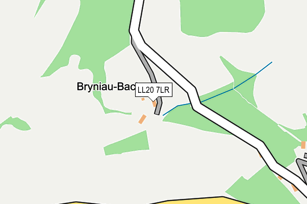
LL20 7LR lies on Vivod in Llangollen. LL20 7LR is located in the Llangollen electoral ward, within the unitary authority of Denbighshire and the Welsh Parliamentary constituency of Clwyd South. The Local Health Board is Betsi Cadwaladr University and the police force is North Wales. This postcode has been in use since January 1980.


GetTheData
Source: OS OpenMap – Local (Ordnance Survey)
Source: OS VectorMap District (Ordnance Survey)
Licence: Open Government Licence (requires attribution)
| Easting | 320353 |
| Northing | 342564 |
| Latitude | 52.974502 |
| Longitude | -3.187544 |
GetTheData
Source: Open Postcode Geo
Licence: Open Government Licence
| Street | Vivod |
| Town/City | Llangollen |
| Country | Wales |
| Postcode District | LL20 |
➜ See where LL20 is on a map ➜ Where is Llangollen? | |
GetTheData
Source: Land Registry Price Paid Data
Licence: Open Government Licence
Elevation or altitude of LL20 7LR as distance above sea level:
| Metres | Feet | |
|---|---|---|
| Elevation | 210m | 689ft |
Elevation is measured from the approximate centre of the postcode, to the nearest point on an OS contour line from OS Terrain 50, which has contour spacing of ten vertical metres.
➜ How high above sea level am I? Find the elevation of your current position using your device's GPS.
GetTheData
Source: Open Postcode Elevation
Licence: Open Government Licence
| Ward | Llangollen |
| Constituency | Clwyd South |
GetTheData
Source: ONS Postcode Database
Licence: Open Government Licence
PEN LLWYBR, VIVOD, LLANGOLLEN, LL20 7LR 2015 15 DEC £300,000 |
PEN LLWYBR, VIVOD, LLANGOLLEN, LL20 7LR 2002 13 AUG £195,000 |
BRYNIAU MAWR, VIVOD, LLANGOLLEN, LL20 7LR 1999 25 JUN £200,000 |
GetTheData
Source: HM Land Registry Price Paid Data
Licence: Contains HM Land Registry data © Crown copyright and database right 2025. This data is licensed under the Open Government Licence v3.0.
| Wild Pheasant Hotel (Berwyn Road) | Llangollen | 531m |
| Wild Pheasant Hotel (Berwyn Road) | Llangollen | 546m |
| Ystrad Hall (A5) | Berwyn | 646m |
| Eisteddfod Pavilion (Abbey Road) | Geufron | 651m |
| Ystrad Hall (A5) | Berwyn | 665m |
| Berwyn (Llangollen Railway) | Berwyn | 788m |
| Llangollen (Llangollen Railway) | Llangollen | 1,141m |
GetTheData
Source: NaPTAN
Licence: Open Government Licence
| Percentage of properties with Next Generation Access | 100.0% |
| Percentage of properties with Superfast Broadband | 0.0% |
| Percentage of properties with Ultrafast Broadband | 0.0% |
| Percentage of properties with Full Fibre Broadband | 0.0% |
Superfast Broadband is between 30Mbps and 300Mbps
Ultrafast Broadband is > 300Mbps
| Percentage of properties unable to receive 2Mbps | 0.0% |
| Percentage of properties unable to receive 5Mbps | 0.0% |
| Percentage of properties unable to receive 10Mbps | 0.0% |
| Percentage of properties unable to receive 30Mbps | 100.0% |
GetTheData
Source: Ofcom
Licence: Ofcom Terms of Use (requires attribution)
GetTheData
Source: ONS Postcode Database
Licence: Open Government Licence


➜ Get more ratings from the Food Standards Agency
GetTheData
Source: Food Standards Agency
Licence: FSA terms & conditions
| Last Collection | |||
|---|---|---|---|
| Location | Mon-Fri | Sat | Distance |
| Tower Bridge | 10:30 | 10:30 | 728m |
| Abbey Road | 10:30 | 10:30 | 864m |
| Pentrefelin | 09:30 | 09:30 | 1,107m |
GetTheData
Source: Dracos
Licence: Creative Commons Attribution-ShareAlike
The below table lists the International Territorial Level (ITL) codes (formerly Nomenclature of Territorial Units for Statistics (NUTS) codes) and Local Administrative Units (LAU) codes for LL20 7LR:
| ITL 1 Code | Name |
|---|---|
| TLL | Wales |
| ITL 2 Code | Name |
| TLL1 | West Wales and The Valleys |
| ITL 3 Code | Name |
| TLL13 | Conwy and Denbighshire |
| LAU 1 Code | Name |
| W06000004 | Denbighshire |
GetTheData
Source: ONS Postcode Directory
Licence: Open Government Licence
The below table lists the Census Output Area (OA), Lower Layer Super Output Area (LSOA), and Middle Layer Super Output Area (MSOA) for LL20 7LR:
| Code | Name | |
|---|---|---|
| OA | W00001119 | |
| LSOA | W01000208 | Denbighshire 016C |
| MSOA | W02000057 | Denbighshire 016 |
GetTheData
Source: ONS Postcode Directory
Licence: Open Government Licence
| LL20 8AG | Cilmedw Way | 425m |
| LL20 8AA | Geraint | 465m |
| LL20 8AH | Berwyn Road | 488m |
| LL20 7LP | Vivod | 513m |
| LL20 8AZ | Afon Glas | 543m |
| LL20 8AD | Berwyn Street | 585m |
| LL20 8AF | Park Avenue | 626m |
| LL20 8SS | Abbey Road | 642m |
| LL20 8AB | Rose Cottages | 673m |
| LL20 8AN | Bryn Goleu | 708m |
GetTheData
Source: Open Postcode Geo; Land Registry Price Paid Data
Licence: Open Government Licence