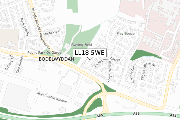
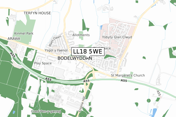
LL18 5WE lies on Clos Deganwy in Bodelwyddan, Rhyl. LL18 5WE is located in the Bodelwyddan electoral ward, within the unitary authority of Denbighshire and the Welsh Parliamentary constituency of Vale of Clwyd. The Local Health Board is Betsi Cadwaladr University and the police force is North Wales. This postcode has been in use since December 1995.


GetTheData
Source: OS Open Zoomstack (Ordnance Survey)
Licence: Open Government Licence (requires attribution)
Attribution: Contains OS data © Crown copyright and database right 2025
Source: Open Postcode Geo
Licence: Open Government Licence (requires attribution)
Attribution: Contains OS data © Crown copyright and database right 2025; Contains Royal Mail data © Royal Mail copyright and database right 2025; Source: Office for National Statistics licensed under the Open Government Licence v.3.0
| Easting | 299854 |
| Northing | 375704 |
| Latitude | 53.268839 |
| Longitude | -3.503066 |
GetTheData
Source: Open Postcode Geo
Licence: Open Government Licence
| Street | Clos Deganwy |
| Locality | Bodelwyddan |
| Town/City | Rhyl |
| Country | Wales |
| Postcode District | LL18 |
➜ See where LL18 is on a map | |
GetTheData
Source: Land Registry Price Paid Data
Licence: Open Government Licence
Elevation or altitude of LL18 5WE as distance above sea level:
| Metres | Feet | |
|---|---|---|
| Elevation | 20m | 66ft |
Elevation is measured from the approximate centre of the postcode, to the nearest point on an OS contour line from OS Terrain 50, which has contour spacing of ten vertical metres.
➜ How high above sea level am I? Find the elevation of your current position using your device's GPS.
GetTheData
Source: Open Postcode Elevation
Licence: Open Government Licence
| Ward | Bodelwyddan |
| Constituency | Vale Of Clwyd |
GetTheData
Source: ONS Postcode Database
Licence: Open Government Licence
| Post Office (Unclassified) | Bodelwyddan | 232m |
| Victoria Garage (Grenville Row) | Bodelwyddan | 246m |
| Lowther Arms (Unclassified) | Bodelwyddan | 387m |
| Lowther Arms (St Asaph Road) | Bodelwyddan | 407m |
| Vicarage Close (Unnamed Road) | Bodelwyddan | 450m |
GetTheData
Source: NaPTAN
Licence: Open Government Licence
| Percentage of properties with Next Generation Access | 100.0% |
| Percentage of properties with Superfast Broadband | 100.0% |
| Percentage of properties with Ultrafast Broadband | 0.0% |
| Percentage of properties with Full Fibre Broadband | 0.0% |
Superfast Broadband is between 30Mbps and 300Mbps
Ultrafast Broadband is > 300Mbps
| Median download speed | 53.7Mbps |
| Average download speed | 53.8Mbps |
| Maximum download speed | 75.98Mbps |
| Median upload speed | 12.0Mbps |
| Average upload speed | 13.3Mbps |
| Maximum upload speed | 20.00Mbps |
| Percentage of properties unable to receive 2Mbps | 0.0% |
| Percentage of properties unable to receive 5Mbps | 0.0% |
| Percentage of properties unable to receive 10Mbps | 0.0% |
| Percentage of properties unable to receive 30Mbps | 0.0% |
GetTheData
Source: Ofcom
Licence: Ofcom Terms of Use (requires attribution)
Estimated total energy consumption in LL18 5WE by fuel type, 2015.
| Consumption (kWh) | 183,894 |
|---|---|
| Meter count | 14 |
| Mean (kWh/meter) | 13,135 |
| Median (kWh/meter) | 13,933 |
| Consumption (kWh) | 54,056 |
|---|---|
| Meter count | 14 |
| Mean (kWh/meter) | 3,861 |
| Median (kWh/meter) | 3,721 |
GetTheData
Source: Postcode level gas estimates: 2015 (experimental)
Source: Postcode level electricity estimates: 2015 (experimental)
Licence: Open Government Licence
GetTheData
Source: ONS Postcode Database
Licence: Open Government Licence


➜ Get more ratings from the Food Standards Agency
GetTheData
Source: Food Standards Agency
Licence: FSA terms & conditions
| Last Collection | |||
|---|---|---|---|
| Location | Mon-Fri | Sat | Distance |
| Glas Coed Gate | 11:00 | 11:00 | 1,739m |
| St Asaph Business Park | 18:30 | 2,474m | |
| St Asaph Business Park | 18:30 | 09:00 | 2,524m |
GetTheData
Source: Dracos
Licence: Creative Commons Attribution-ShareAlike
The below table lists the International Territorial Level (ITL) codes (formerly Nomenclature of Territorial Units for Statistics (NUTS) codes) and Local Administrative Units (LAU) codes for LL18 5WE:
| ITL 1 Code | Name |
|---|---|
| TLL | Wales |
| ITL 2 Code | Name |
| TLL1 | West Wales and The Valleys |
| ITL 3 Code | Name |
| TLL13 | Conwy and Denbighshire |
| LAU 1 Code | Name |
| W06000004 | Denbighshire |
GetTheData
Source: ONS Postcode Directory
Licence: Open Government Licence
The below table lists the Census Output Area (OA), Lower Layer Super Output Area (LSOA), and Middle Layer Super Output Area (MSOA) for LL18 5WE:
| Code | Name | |
|---|---|---|
| OA | W00001018 | |
| LSOA | W01000191 | Denbighshire 009A |
| MSOA | W02000050 | Denbighshire 009 |
GetTheData
Source: ONS Postcode Directory
Licence: Open Government Licence
| LL18 5WH | Clos Dinbych | 95m |
| LL18 5WF | Llwyn Rhuthun | 96m |
| LL18 5WJ | Clos Dinas Bran | 126m |
| LL18 5WT | Ffordd Parc Castell | 133m |
| LL18 5WG | Llwyn Harlech | 152m |
| LL18 5WD | Ffordd Parc Castell | 186m |
| LL18 5WL | Rhodfa Criccieth | 191m |
| LL18 5TJ | Swn Y Dail | 192m |
| LL18 5TD | St Margarets Row | 194m |
| LL18 5WR | Clos Beaumaris | 209m |
GetTheData
Source: Open Postcode Geo; Land Registry Price Paid Data
Licence: Open Government Licence