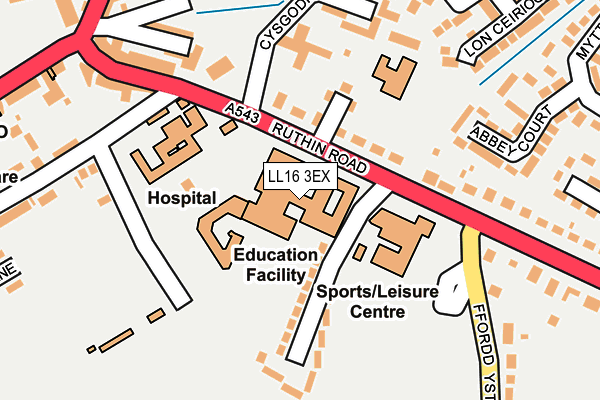
LL16 3EX is located in the Denbigh Lower electoral ward, within the unitary authority of Denbighshire and the Welsh Parliamentary constituency of Vale of Clwyd. The Local Health Board is Betsi Cadwaladr University and the police force is North Wales. This postcode has been in use since December 1994.


GetTheData
Source: OS OpenMap – Local (Ordnance Survey)
Source: OS VectorMap District (Ordnance Survey)
Licence: Open Government Licence (requires attribution)
| Easting | 306010 |
| Northing | 366302 |
| Latitude | 53.185479 |
| Longitude | -3.408018 |
GetTheData
Source: Open Postcode Geo
Licence: Open Government Licence
| Country | Wales |
| Postcode District | LL16 |
➜ See where LL16 is on a map ➜ Where is Denbigh? | |
GetTheData
Source: Land Registry Price Paid Data
Licence: Open Government Licence
Elevation or altitude of LL16 3EX as distance above sea level:
| Metres | Feet | |
|---|---|---|
| Elevation | 50m | 164ft |
Elevation is measured from the approximate centre of the postcode, to the nearest point on an OS contour line from OS Terrain 50, which has contour spacing of ten vertical metres.
➜ How high above sea level am I? Find the elevation of your current position using your device's GPS.
GetTheData
Source: Open Postcode Elevation
Licence: Open Government Licence
| Ward | Denbigh Lower |
| Constituency | Vale Of Clwyd |
GetTheData
Source: ONS Postcode Database
Licence: Open Government Licence
| High School (Ruthin Road) | Denbigh | 51m |
| High School (Ruthin Road) | Denbigh | 76m |
| Plas Pigot (Ruthin Road) | Fron | 147m |
| High School Bus Park (Ruthin Road) | Brook House | 171m |
| Railway Inn (Ruthin Road) | Fron | 218m |
GetTheData
Source: NaPTAN
Licence: Open Government Licence
GetTheData
Source: ONS Postcode Database
Licence: Open Government Licence


➜ Get more ratings from the Food Standards Agency
GetTheData
Source: Food Standards Agency
Licence: FSA terms & conditions
| Last Collection | |||
|---|---|---|---|
| Location | Mon-Fri | Sat | Distance |
| Ruthin Road | 16:35 | 10:15 | 55m |
| Fron | 16:55 | 10:45 | 392m |
| Vale Street | 17:20 | 10:00 | 652m |
GetTheData
Source: Dracos
Licence: Creative Commons Attribution-ShareAlike
The below table lists the International Territorial Level (ITL) codes (formerly Nomenclature of Territorial Units for Statistics (NUTS) codes) and Local Administrative Units (LAU) codes for LL16 3EX:
| ITL 1 Code | Name |
|---|---|
| TLL | Wales |
| ITL 2 Code | Name |
| TLL1 | West Wales and The Valleys |
| ITL 3 Code | Name |
| TLL13 | Conwy and Denbighshire |
| LAU 1 Code | Name |
| W06000004 | Denbighshire |
GetTheData
Source: ONS Postcode Directory
Licence: Open Government Licence
The below table lists the Census Output Area (OA), Lower Layer Super Output Area (LSOA), and Middle Layer Super Output Area (MSOA) for LL16 3EX:
| Code | Name | |
|---|---|---|
| OA | W00001049 | |
| LSOA | W01000197 | Denbighshire 012C |
| MSOA | W02000053 | Denbighshire 012 |
GetTheData
Source: ONS Postcode Directory
Licence: Open Government Licence
| LL16 3HD | Ruthin Road | 119m |
| LL16 3HB | Clwyd Avenue | 125m |
| LL16 3ER | Ruthin Road | 180m |
| LL16 3EL | Ruthin Road | 206m |
| LL16 3DH | Garden Terrace | 209m |
| LL16 3EH | Ruthin Road | 214m |
| LL16 3EU | Ruthin Road | 224m |
| LL16 3HU | Abbey Court | 238m |
| LL16 3DF | Vale Road | 258m |
| LL16 3JG | Tan Y Bryniau | 262m |
GetTheData
Source: Open Postcode Geo; Land Registry Price Paid Data
Licence: Open Government Licence