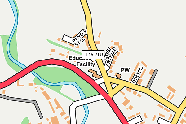
LL15 2TU is located in the Llandyrnog electoral ward, within the unitary authority of Denbighshire and the Welsh Parliamentary constituency of Vale of Clwyd. The Local Health Board is Betsi Cadwaladr University and the police force is North Wales. This postcode has been in use since January 1980.


GetTheData
Source: OS OpenMap – Local (Ordnance Survey)
Source: OS VectorMap District (Ordnance Survey)
Licence: Open Government Licence (requires attribution)
| Easting | 310876 |
| Northing | 360512 |
| Latitude | 53.134301 |
| Longitude | -3.333607 |
GetTheData
Source: Open Postcode Geo
Licence: Open Government Licence
| Country | Wales |
| Postcode District | LL15 |
➜ See where LL15 is on a map ➜ Where is Rhewl? | |
GetTheData
Source: Land Registry Price Paid Data
Licence: Open Government Licence
Elevation or altitude of LL15 2TU as distance above sea level:
| Metres | Feet | |
|---|---|---|
| Elevation | 50m | 164ft |
Elevation is measured from the approximate centre of the postcode, to the nearest point on an OS contour line from OS Terrain 50, which has contour spacing of ten vertical metres.
➜ How high above sea level am I? Find the elevation of your current position using your device's GPS.
GetTheData
Source: Open Postcode Elevation
Licence: Open Government Licence
| Ward | Llandyrnog |
| Constituency | Vale Of Clwyd |
GetTheData
Source: ONS Postcode Database
Licence: Open Government Licence
| Drovers Arms (A525) | Ruthin | 129m |
| Drovers Arms (A525) | Ruthin | 134m |
| Maes Derw (A525) | Rhos | 407m |
| Maes Derw (A525) | Rhos | 414m |
| Bryn Clwyd (A525) | Llanfwrog | 875m |
GetTheData
Source: NaPTAN
Licence: Open Government Licence
| Percentage of properties with Next Generation Access | 100.0% |
| Percentage of properties with Superfast Broadband | 100.0% |
| Percentage of properties with Ultrafast Broadband | 100.0% |
| Percentage of properties with Full Fibre Broadband | 100.0% |
Superfast Broadband is between 30Mbps and 300Mbps
Ultrafast Broadband is > 300Mbps
| Percentage of properties unable to receive 2Mbps | 0.0% |
| Percentage of properties unable to receive 5Mbps | 0.0% |
| Percentage of properties unable to receive 10Mbps | 0.0% |
| Percentage of properties unable to receive 30Mbps | 0.0% |
GetTheData
Source: Ofcom
Licence: Ofcom Terms of Use (requires attribution)
Estimated total energy consumption in LL15 2TU by fuel type, 2015.
| Consumption (kWh) | 176,481 |
|---|---|
| Meter count | 11 |
| Mean (kWh/meter) | 16,044 |
| Median (kWh/meter) | 15,679 |
GetTheData
Source: Postcode level gas estimates: 2015 (experimental)
Source: Postcode level electricity estimates: 2015 (experimental)
Licence: Open Government Licence
GetTheData
Source: ONS Postcode Database
Licence: Open Government Licence


➜ Get more ratings from the Food Standards Agency
GetTheData
Source: Food Standards Agency
Licence: FSA terms & conditions
| Last Collection | |||
|---|---|---|---|
| Location | Mon-Fri | Sat | Distance |
| Rhewl Post Office | 16:00 | 10:00 | 59m |
| Llanfwrog Post Office | 17:00 | 10:45 | 2,301m |
| Lon Parcwr | 17:15 | 10:00 | 2,433m |
GetTheData
Source: Dracos
Licence: Creative Commons Attribution-ShareAlike
The below table lists the International Territorial Level (ITL) codes (formerly Nomenclature of Territorial Units for Statistics (NUTS) codes) and Local Administrative Units (LAU) codes for LL15 2TU:
| ITL 1 Code | Name |
|---|---|
| TLL | Wales |
| ITL 2 Code | Name |
| TLL1 | West Wales and The Valleys |
| ITL 3 Code | Name |
| TLL13 | Conwy and Denbighshire |
| LAU 1 Code | Name |
| W06000004 | Denbighshire |
GetTheData
Source: ONS Postcode Directory
Licence: Open Government Licence
The below table lists the Census Output Area (OA), Lower Layer Super Output Area (LSOA), and Middle Layer Super Output Area (MSOA) for LL15 2TU:
| Code | Name | |
|---|---|---|
| OA | W00001101 | |
| LSOA | W01000206 | Denbighshire 013C |
| MSOA | W02000054 | Denbighshire 013 |
GetTheData
Source: ONS Postcode Directory
Licence: Open Government Licence
| LL15 2TY | 70m | |
| LL15 2UF | Denbigh Road | 78m |
| LL15 2UB | 185m | |
| LL15 1TH | 188m | |
| LL15 2TT | Cilgwyn | 251m |
| LL15 2UD | 279m | |
| LL15 1TG | Bro Clwyd | 285m |
| LL15 1TN | 351m | |
| LL15 1TF | 363m | |
| LL15 1BA | Bro Clywedog | 380m |
GetTheData
Source: Open Postcode Geo; Land Registry Price Paid Data
Licence: Open Government Licence