LL13 8TP maps, stats, and open data
LL13 8TP is located in the Queensway electoral ward, within the unitary authority of Wrexham and the Welsh Parliamentary constituency of Wrexham. The Local Health Board is Betsi Cadwaladr University and the police force is North Wales. This postcode has been in use since January 1980.
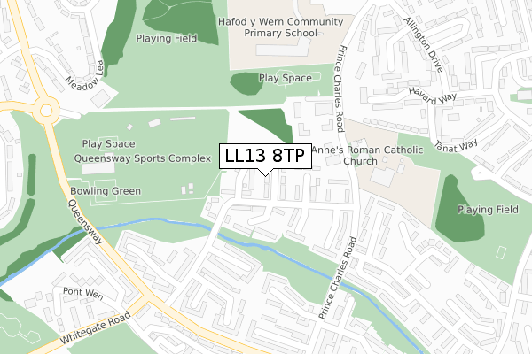
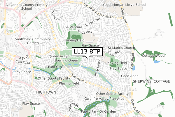
LL13 8TP maps


Licence: Open Government Licence (requires attribution)
Attribution: Contains OS data © Crown copyright and database right 2025
Source: Open Postcode Geo
Licence: Open Government Licence (requires attribution)
Attribution: Contains OS data © Crown copyright and database right 2025; Contains Royal Mail data © Royal Mail copyright and database right 2025; Source: Office for National Statistics licensed under the Open Government Licence v.3.0
LL13 8TP geodata
| Easting | 334791 |
| Northing | 350067 |
| Latitude | 53.043877 |
| Longitude | -2.974089 |
Where is LL13 8TP?
| Country | Wales |
| Postcode District | LL13 |
LL13 8TP Elevation
Elevation or altitude of LL13 8TP as distance above sea level:
| Metres | Feet | |
|---|---|---|
| Elevation | 60m | 197ft |
Elevation is measured from the approximate centre of the postcode, to the nearest point on an OS contour line from OS Terrain 50, which has contour spacing of ten vertical metres.
➜ How high above sea level am I? Find the elevation of your current position using your device's GPS.
Politics
| Ward | Queensway |
|---|---|
| Constituency | Wrexham |
Transport
Nearest bus stops to LL13 8TP
| Gwenfro (Prince Charles Road) | The Dunks | 187m |
| Gwenfro (Prince Charles Road) | The Dunks | 197m |
| Y Wern | The Dunks | 288m |
| Y Wern | The Dunks | 289m |
| Queensway West (Queensway) | The Dunks | 309m |
Nearest railway stations to LL13 8TP
| Wrexham Central Station | 1.7km |
| Wrexham General Station | 2km |
| Gwersyllt Station | 4.3km |
Broadband
Broadband access in LL13 8TP (2020 data)
| Percentage of properties with Next Generation Access | 100.0% |
| Percentage of properties with Superfast Broadband | 100.0% |
| Percentage of properties with Ultrafast Broadband | 100.0% |
| Percentage of properties with Full Fibre Broadband | 100.0% |
Superfast Broadband is between 30Mbps and 300Mbps
Ultrafast Broadband is > 300Mbps
Broadband speed in LL13 8TP (2019 data)
Download
| Median download speed | 45.5Mbps |
| Average download speed | 78.2Mbps |
| Maximum download speed | 350.00Mbps |
Upload
| Median upload speed | 9.9Mbps |
| Average upload speed | 9.3Mbps |
| Maximum upload speed | 18.03Mbps |
Broadband limitations in LL13 8TP (2020 data)
| Percentage of properties unable to receive 2Mbps | 0.0% |
| Percentage of properties unable to receive 5Mbps | 0.0% |
| Percentage of properties unable to receive 10Mbps | 0.0% |
| Percentage of properties unable to receive 30Mbps | 0.0% |
LL13 8TP gas and electricity consumption
Estimated total energy consumption in LL13 8TP by fuel type, 2015.
Gas
| Consumption (kWh) | 297,535 |
|---|---|
| Meter count | 43 |
| Mean (kWh/meter) | 6,919 |
| Median (kWh/meter) | 5,853 |
Electricity
| Consumption (kWh) | 173,577 |
|---|---|
| Meter count | 39 |
| Mean (kWh/meter) | 4,451 |
| Median (kWh/meter) | 3,703 |
- Consumption: The estimated total energy consumption, in kWh, across all meters in LL13 8TP, for 2015.
- Meter count: The total number of meters in LL13 8TP.
- Mean: The mean average consumption per meter, in kWh.
- Median: The median average consumption per meter, in kWh.
Source: Postcode level electricity estimates: 2015 (experimental)
Licence: Open Government Licence
Deprivation
99.2% of Welsh postcodes are less deprived than LL13 8TP:Food Standards Agency
Three nearest food hygiene ratings to LL13 8TP (metres)


➜ Get more ratings from the Food Standards Agency
Nearest post box to LL13 8TP
| Last Collection | |||
|---|---|---|---|
| Location | Mon-Fri | Sat | Distance |
| Fenwick Drive | 16:00 | 12:00 | 874m |
| Queens Park Post Office | 16:30 | 11:30 | 904m |
| High Street | 18:30 | 12:30 | 1,232m |
LL13 8TP ITL and LL13 8TP LAU
The below table lists the International Territorial Level (ITL) codes (formerly Nomenclature of Territorial Units for Statistics (NUTS) codes) and Local Administrative Units (LAU) codes for LL13 8TP:
| ITL 1 Code | Name |
|---|---|
| TLL | Wales |
| ITL 2 Code | Name |
| TLL2 | East Wales |
| ITL 3 Code | Name |
| TLL23 | Flintshire and Wrexham |
| LAU 1 Code | Name |
| W06000006 | Wrexham |
LL13 8TP census areas
The below table lists the Census Output Area (OA), Lower Layer Super Output Area (LSOA), and Middle Layer Super Output Area (MSOA) for LL13 8TP:
| Code | Name | |
|---|---|---|
| OA | W00002203 | |
| LSOA | W01000413 | Wrexham 010C |
| MSOA | W02000087 | Wrexham 010 |
Nearest postcodes to LL13 8TP
| LL13 8TR | Gwenfro | 98m |
| LL13 8UA | Y Wern | 250m |
| LL13 8TL | Tanybryn | 256m |
| LL13 8UD | Y Wern | 258m |
| LL13 9LP | Havard Way | 293m |
| LL13 8TT | Minafon | 310m |
| LL13 9LU | Burnham Gardens | 315m |
| LL13 9LW | Tanat Way | 317m |
| LL13 8TY | Y Wern | 320m |
| LL13 8UN | Queensway | 331m |