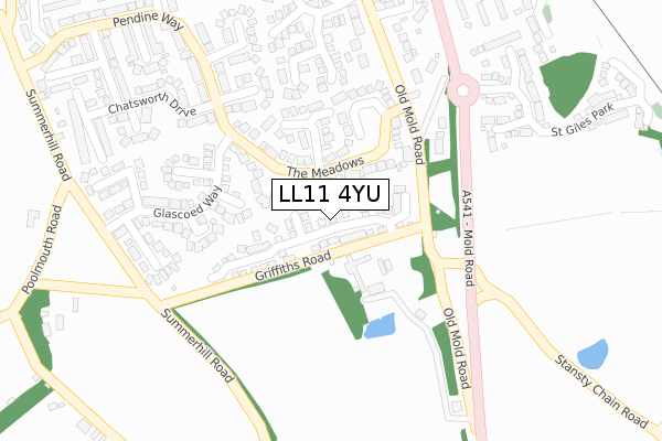
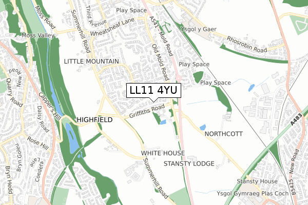
LL11 4YU is located in the Gwersyllt West electoral ward, within the unitary authority of Wrexham and the Welsh Parliamentary constituency of Wrexham. The Local Health Board is Betsi Cadwaladr University and the police force is North Wales. This postcode has been in use since October 2018.


GetTheData
Source: OS Open Zoomstack (Ordnance Survey)
Licence: Open Government Licence (requires attribution)
Attribution: Contains OS data © Crown copyright and database right 2024
Source: Open Postcode Geo
Licence: Open Government Licence (requires attribution)
Attribution: Contains OS data © Crown copyright and database right 2024; Contains Royal Mail data © Royal Mail copyright and database right 2024; Source: Office for National Statistics licensed under the Open Government Licence v.3.0
| Easting | 331848 |
| Northing | 352471 |
| Latitude | 53.065131 |
| Longitude | -3.018489 |
GetTheData
Source: Open Postcode Geo
Licence: Open Government Licence
| Country | Wales |
| Postcode District | LL11 |
| ➜ LL11 open data dashboard ➜ See where LL11 is on a map ➜ Where is Gwersyllt? | |
GetTheData
Source: Land Registry Price Paid Data
Licence: Open Government Licence
| Ward | Gwersyllt West |
| Constituency | Wrexham |
GetTheData
Source: ONS Postcode Database
Licence: Open Government Licence
15, MAES GWYRDD, GWERSYLLT, WREXHAM, LL11 4YU 2021 30 MAR £322,000 |
27, MAES GWYRDD, GWERSYLLT, WREXHAM, LL11 4YU 2020 22 DEC £260,000 |
33, MAES GWYRDD, GWERSYLLT, WREXHAM, LL11 4YU 2020 4 DEC £255,000 |
68, MAES GWYRDD, GWERSYLLT, WREXHAM, LL11 4YU 2020 30 OCT £250,000 |
25, MAES GWYRDD, GWERSYLLT, WREXHAM, LL11 4YU 2020 2 OCT £224,000 |
62, MAES GWYRDD, GWERSYLLT, WREXHAM, LL11 4YU 2020 25 SEP £273,000 |
29, MAES GWYRDD, GWERSYLLT, WREXHAM, LL11 4YU 2020 28 AUG £235,000 |
31, MAES GWYRDD, GWERSYLLT, WREXHAM, LL11 4YU 2020 27 MAR £235,000 |
35, MAES GWYRDD, GWERSYLLT, WREXHAM, LL11 4YU 2020 20 MAR £294,000 |
74, MAES GWYRDD, GWERSYLLT, WREXHAM, LL11 4YU 2020 20 MAR £315,000 |
GetTheData
Source: HM Land Registry Price Paid Data
Licence: Contains HM Land Registry data © Crown copyright and database right 2024. This data is licensed under the Open Government Licence v3.0.
| June 2022 | Violence and sexual offences | On or near Highfield Road | 428m |
| June 2022 | Violence and sexual offences | On or near Bickerton Drive | 495m |
| May 2022 | Anti-social behaviour | On or near Arenig Close | 176m |
| ➜ Get more crime data in our Crime section | |||
GetTheData
Source: data.police.uk
Licence: Open Government Licence
| Heatherdale Close (The Meadows) | Gwersyllt | 93m |
| Heatherdale Close (The Meadows) | Gwersyllt | 100m |
| Toll Bar Cottage (Mold Road) | Pool Mouth | 172m |
| Toll Bar Cottage (Mold Road) | Pool Mouth | 182m |
| Pendine Shops (Pendine Way) | Gwersyllt | 217m |
| Gwersyllt Station | 0.8km |
| Wrexham General Station | 2km |
| Wrexham Central Station | 2.5km |
GetTheData
Source: NaPTAN
Licence: Open Government Licence
| Percentage of properties with Next Generation Access | 100.0% |
| Percentage of properties with Superfast Broadband | 100.0% |
| Percentage of properties with Ultrafast Broadband | 100.0% |
| Percentage of properties with Full Fibre Broadband | 100.0% |
Superfast Broadband is between 30Mbps and 300Mbps
Ultrafast Broadband is > 300Mbps
| Percentage of properties unable to receive 2Mbps | 0.0% |
| Percentage of properties unable to receive 5Mbps | 0.0% |
| Percentage of properties unable to receive 10Mbps | 0.0% |
| Percentage of properties unable to receive 30Mbps | 0.0% |
GetTheData
Source: Ofcom
Licence: Ofcom Terms of Use (requires attribution)
GetTheData
Source: ONS Postcode Database
Licence: Open Government Licence


➜ Get more ratings from the Food Standards Agency
GetTheData
Source: Food Standards Agency
Licence: FSA terms & conditions
| Last Collection | |||
|---|---|---|---|
| Location | Mon-Fri | Sat | Distance |
| Gwynfryn Bwlchgwyn | 11:00 | 10:15 | 242m |
| Pendine Way | 09:30 | 08:45 | 493m |
| Gwersyllt Post Office | 17:00 | 10:30 | 808m |
GetTheData
Source: Dracos
Licence: Creative Commons Attribution-ShareAlike
| School | Phase of Education | Distance |
|---|---|---|
| Noddfa Dodds Lane, Wrexham, LL11 4NT | Not applicable | 780m |
| Ysgol Bryn Alyn Church Street, Gwersyllt, Wrexham, LL11 4HB | Not applicable | 1.2km |
| Ysgol Plas Coch Ffordd Stansty, Plas Coch, Wrexham, LL11 2BU | Not applicable | 1.2km |
GetTheData
Source: Edubase
Licence: Open Government Licence
The below table lists the International Territorial Level (ITL) codes (formerly Nomenclature of Territorial Units for Statistics (NUTS) codes) and Local Administrative Units (LAU) codes for LL11 4YU:
| ITL 1 Code | Name |
|---|---|
| TLL | Wales |
| ITL 2 Code | Name |
| TLL2 | East Wales |
| ITL 3 Code | Name |
| TLL23 | Flintshire and Wrexham |
| LAU 1 Code | Name |
| W06000006 | Wrexham |
GetTheData
Source: ONS Postcode Directory
Licence: Open Government Licence
The below table lists the Census Output Area (OA), Lower Layer Super Output Area (LSOA), and Middle Layer Super Output Area (MSOA) for LL11 4YU:
| Code | Name | |
|---|---|---|
| OA | W00002030 | |
| LSOA | W01000380 | Wrexham 004D |
| MSOA | W02000081 | Wrexham 004 |
GetTheData
Source: ONS Postcode Directory
Licence: Open Government Licence
| LL11 4TJ | The Meadows | 126m |
| LL11 4SX | The Meadows | 127m |
| LL11 4YQ | Celyn Close | 136m |
| LL11 4YG | Stansty Park | 139m |
| LL11 4SZ | Heatherdale Close | 148m |
| LL11 4YT | Arenig Close | 159m |
| LL11 4YJ | Terrig Way | 201m |
| LL11 4XG | Malvern Drive | 205m |
| LL11 4YP | Glascoed Way | 212m |
| LL11 4TQ | Ferndale Rise | 216m |
GetTheData
Source: Open Postcode Geo; Land Registry Price Paid Data
Licence: Open Government Licence