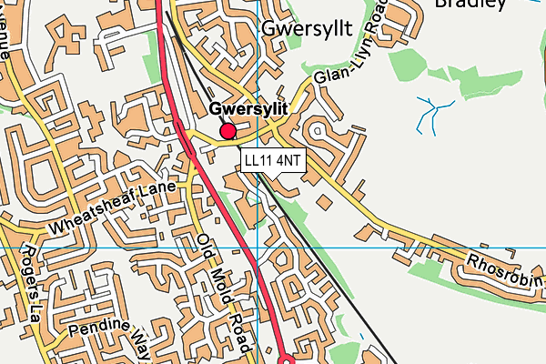
Noddfa is located in Wrexham and falls under the local authority of Wrexham. The type of establishment is welsh establishment.
| Address | Noddfa Dodds Lane Wrexham LL11 4NT |
GetTheData
Source: Get Information About Schools
Licence: Open Government Licence
| Phase of Education | Not applicable |
| Type of Establishment | Welsh establishment |
| Official Sixth Form | Not applicable |
| Diocese | Not applicable |
| Special Classes | Not applicable |
GetTheData
Source: Get Information About Schools
Licence: Open Government Licence
| Street Address | Dodds Lane |
| Town | Wrexham |
| Postcode | LL11 4NT |
| ➜ More LL11 4NT open data | |
GetTheData
Source: Get Information About Schools
Licence: Open Government Licence

GetTheData
Source: OS VectorMap District (Ordnance Survey)
Licence: Open Government Licence (requires attribution)
| Ofsted Special Measures | Not applicable |
GetTheData
Source: Get Information About Schools
Licence: Open Government Licence
| Establishment Name | Noddfa |
| Establishment Number | 1105 |
| Unique Reference Number | 402464 |
| Local Authority | Wrexham |
| Local Authority Code | 665 |
| Previous Local Authority Code | 999 |
| Government Statistical Service Local Authority Code | W06000006 |
| Government Office Region | Wales (pseudo) |
| District | Wrexham |
| District Code | W06000006 |
| Ward | Gwersyllt South |
| Parliamentary Constituency | Wrexham |
| Urban/Rural Description | (England/Wales) Urban city and town |
| Middle Super Output Area | Wrexham 003 |
| Lower Super Output Area | Wrexham 003B |
GetTheData
Source: Get Information About Schools
Licence: Open Government Licence
| Establishment Status | Open |
| Last Changed Date | 13th February 2023 |
| Open Date | 1st September 2022 |
GetTheData
Source: Get Information About Schools
Licence: Open Government Licence
| Teenage Mothers | Not applicable |
| Special Educational Needs (SEN) Provision in Primary Care Unit | Not applicable |
| Pupil Referral Unit (PRU) Provides for Educational and Behavioural Difficulties (EBD) | Not applicable |
GetTheData
Source: Get Information About Schools
Licence: Open Government Licence
| Section 41 Approved | Not approved |
GetTheData
Source: Get Information About Schools
Licence: Open Government Licence
| Trust flag | Not applicable |
| School Sponsor flag | Not applicable |
GetTheData
Source: Get Information About Schools
Licence: Open Government Licence
| Federation flag | Not applicable |
GetTheData
Source: Get Information About Schools
Licence: Open Government Licence
GetTheData
Source: Get Information About Schools
Licence: Open Government Licence
| Easting | 332149 |
| Northing | 353191 |
| Latitude | 53.07163 |
| Longitude | -3.01415 |
GetTheData
Source: Get Information About Schools
Licence: Open Government Licence
| School | Phase of Education | Distance |
|---|---|---|
| Ysgol Bryn Alyn Church Street, Gwersyllt, Wrexham, LL11 4HB | Not applicable | 768m |
| Ysgol Heulfan Sunny View, Gwersylit, Wrexham, LL11 4HS | Not applicable | 999m |
| Wat's Dyke C.P. School Garden Village, Wrexham, LL11 2TE | Not applicable | 1.5km |
| Ysgol Plas Coch Ffordd Stansty, Plas Coch, Wrexham, LL11 2BU | Not applicable | 1.6km |
| Brynteg County School Maesteg, Brynteg, Wrexham, LL11 6NB | Not applicable | 1.7km |
| Ysgol Penrhyn New Broughton Primary School Lane, New Broughton, Wrexham, LL11 6SF | Not applicable | 1.9km |
| Black Lane C.P. School Long Lane, Pentre Broughton, Wrexham, LL11 6BT | Not applicable | 2km |
| Rhosddu Primary School Price's Lane, Rhosddu, Wrexham, LL11 2NB | Not applicable | 2.1km |
| Tanyfron C.P. School Tanyfron Road, Tanyfron, Wrexham, LL11 5SA | Not applicable | 2.6km |
| St Mary's Aided Primary School Ael Y Bryn, Brymbo, Wrexham, LL11 5DA | Not applicable | 2.8km |
GetTheData
Source: Get Information About Schools
Licence: Open Government Licence