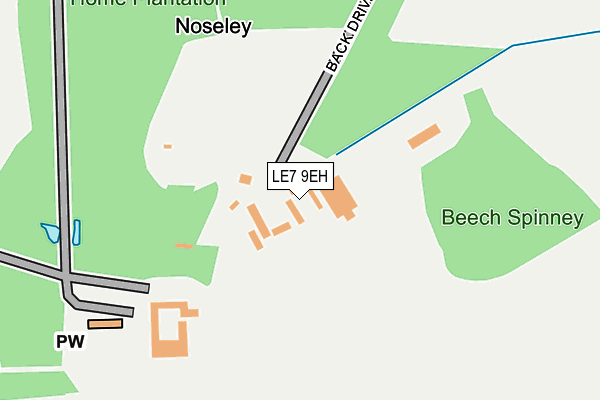
LE7 9EH is located in the Nevill electoral ward, within the local authority district of Harborough and the English Parliamentary constituency of Rutland and Melton. The Sub Integrated Care Board (ICB) Location is NHS Leicester, Leicestershire and Rutland ICB - 03W and the police force is Leicestershire. This postcode has been in use since January 1980.


GetTheData
Source: OS OpenMap – Local (Ordnance Survey)
Source: OS VectorMap District (Ordnance Survey)
Licence: Open Government Licence (requires attribution)
| Easting | 473967 |
| Northing | 298625 |
| Latitude | 52.580434 |
| Longitude | -0.909821 |
GetTheData
Source: Open Postcode Geo
Licence: Open Government Licence
| Country | England |
| Postcode District | LE7 |
➜ See where LE7 is on a map ➜ Where is Noseley? | |
GetTheData
Source: Land Registry Price Paid Data
Licence: Open Government Licence
Elevation or altitude of LE7 9EH as distance above sea level:
| Metres | Feet | |
|---|---|---|
| Elevation | 130m | 427ft |
Elevation is measured from the approximate centre of the postcode, to the nearest point on an OS contour line from OS Terrain 50, which has contour spacing of ten vertical metres.
➜ How high above sea level am I? Find the elevation of your current position using your device's GPS.
GetTheData
Source: Open Postcode Elevation
Licence: Open Government Licence
| Ward | Nevill |
| Constituency | Rutland And Melton |
GetTheData
Source: ONS Postcode Database
Licence: Open Government Licence
| Percentage of properties with Next Generation Access | 100.0% |
| Percentage of properties with Superfast Broadband | 0.0% |
| Percentage of properties with Ultrafast Broadband | 0.0% |
| Percentage of properties with Full Fibre Broadband | 0.0% |
Superfast Broadband is between 30Mbps and 300Mbps
Ultrafast Broadband is > 300Mbps
| Median download speed | 6.0Mbps |
| Average download speed | 12.4Mbps |
| Maximum download speed | 25.64Mbps |
| Median upload speed | 1.2Mbps |
| Average upload speed | 2.5Mbps |
| Maximum upload speed | 5.55Mbps |
| Percentage of properties unable to receive 2Mbps | 0.0% |
| Percentage of properties unable to receive 5Mbps | 15.4% |
| Percentage of properties unable to receive 10Mbps | 23.1% |
| Percentage of properties unable to receive 30Mbps | 100.0% |
GetTheData
Source: Ofcom
Licence: Ofcom Terms of Use (requires attribution)
Estimated total energy consumption in LE7 9EH by fuel type, 2015.
| Consumption (kWh) | 61,258 |
|---|---|
| Meter count | 12 |
| Mean (kWh/meter) | 5,105 |
| Median (kWh/meter) | 3,423 |
GetTheData
Source: Postcode level gas estimates: 2015 (experimental)
Source: Postcode level electricity estimates: 2015 (experimental)
Licence: Open Government Licence
GetTheData
Source: ONS Postcode Database
Licence: Open Government Licence
| Last Collection | |||
|---|---|---|---|
| Location | Mon-Fri | Sat | Distance |
| Three Gates | 15:45 | 08:00 | 2,188m |
| Gaulby Road | 16:30 | 09:00 | 4,295m |
| Church Street | 17:10 | 11:00 | 4,561m |
GetTheData
Source: Dracos
Licence: Creative Commons Attribution-ShareAlike
The below table lists the International Territorial Level (ITL) codes (formerly Nomenclature of Territorial Units for Statistics (NUTS) codes) and Local Administrative Units (LAU) codes for LE7 9EH:
| ITL 1 Code | Name |
|---|---|
| TLF | East Midlands (England) |
| ITL 2 Code | Name |
| TLF2 | Leicestershire, Rutland and Northamptonshire |
| ITL 3 Code | Name |
| TLF22 | Leicestershire CC and Rutland |
| LAU 1 Code | Name |
| E07000131 | Harborough |
GetTheData
Source: ONS Postcode Directory
Licence: Open Government Licence
The below table lists the Census Output Area (OA), Lower Layer Super Output Area (LSOA), and Middle Layer Super Output Area (MSOA) for LE7 9EH:
| Code | Name | |
|---|---|---|
| OA | E00130749 | |
| LSOA | E01025770 | Harborough 002A |
| MSOA | E02005368 | Harborough 002 |
GetTheData
Source: ONS Postcode Directory
Licence: Open Government Licence
| LE7 9EX | Church Lane | 1034m |
| LE7 9EE | 1090m | |
| LE7 9EU | Tugby Road | 1167m |
| LE7 9EN | Rolleston Road | 1993m |
| LE7 9EW | Skeffington Road | 2041m |
| LE7 9EQ | Kibworth Road | 2288m |
| LE8 0PL | Melton Road | 2618m |
| LE7 9EL | Harborough Road | 2733m |
| LE16 7SS | Goadby Road | 2880m |
| LE7 9ER | Three Gates Lane | 2920m |
GetTheData
Source: Open Postcode Geo; Land Registry Price Paid Data
Licence: Open Government Licence